Old Maps of Steamboat Springs, Colorado
Explore 31 old maps of Steamboat Springs, spanning from 1911 to today. These high-resolution historic maps reveal how streets, neighborhoods, landmarks, and natural features evolved over time — perfect for genealogy, metal detecting, research, and local history exploration.
What you can do with these maps:
- See how Steamboat Springs changed over time: Compare historical maps to modern-day views to trace roads, homesites, rail lines & more.
- View detailed metadata: Each map includes creators, publishers, year, scale, and archive source.
- Overlay maps with satellite & LiDAR: Visualize the past alongside modern tools to explore terrain & human change.
- Trusted historical sources: Maps sourced from the USGS, Library of Congress, and other archives.
- Access maps your way: View online, download high-res files, or order prints for personal or research use.
Start exploring old maps of Steamboat Springs to uncover forgotten places, hidden landmarks, and the deep history beneath your feet.
Steamboat Springs, CO maps
(31)- 1911 Map of Hahns Peak, 1954 Print
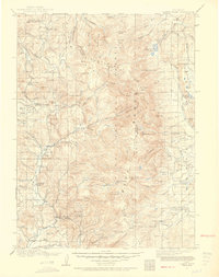 1911 Hahns Peak1954 Print · USGSThe northern Park Range and the Continental Divide appear in great detail just after the first decade of the twentieth century. Researchers can locate remote schools and ranches like Moon Hill School, the Elkhorn Mine, and the settlement of Pearl.2 unique versions available
 - 1913 Map of Hahns Peak
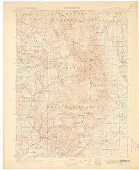 1913 Hahns Peak1913 Print · USGSRoutt County was a landscape of high-country mining and isolated homesteads in the early 1900s. Researchers can trace the era's rural infrastructure through old schoolhouses like Moon Hill School, the Elkhorn Mine, and settlements such as Columbine.2 unique versions available
 - 1954 Map of Craig, 1973 Print
 1954 Craig1973 Print · USGSNorthwest Colorado and the high mountain parks are captured in the mid-fifties, showing the region's ranching, mining, and timber centers. Genealogists and historians can trace rail corridors like the Denver and Rio Grande Western and old towns such as Axial, Milner, and Coalmont.3 unique versions available
 - 1957 Map of Craig
 1957 Craig1957 Print · USGSNorthwest Colorado in the mid-fifties is a landscape of mountain ranching and rail-dependent river towns. Researchers can trace historic coal mining at the Sudduth Mine, follow the Denver and Rio Grande Western tracks, and locate vanished settlements like Pearl.
 - 1958 Map of Craig
 1958 Craig1958 Print · USGSNorthwest Colorado and the High Rockies are captured here in the mid-fifties, showing a landscape of burgeoning water projects and mountain ranching. Genealogists and historians can trace old homesteads and mountain outposts from Grand Lake to Meeker, alongside industrial landmarks like Uranium Mines and the Denver and Rio Grande Western railroad.
 - 1960 Map of Craig
 1960 Craig1960 Print · USGSNorthwest Colorado in the 1950s is a landscape of mountain summits and industrial growth at the headwaters of the West. Genealogists and historians can trace rail-town development along the Denver and Salt Lake line, while locating Uranium Mines and settlements like Craig, Meeker, and Steamboat Springs.
 - 1962 Map of Craig
 1962 Craig1962 Print · USGSNorthwest Colorado in the early sixties is a land of high-elevation ranching and remote river valleys. Genealogists and historians can trace the Denver and Rio Grande Western rail lines and locate early settlements like Hahns Peak, Meeker, and Juniper Springs.
 - 1962 Map of Rocky Peak, 1964 Print
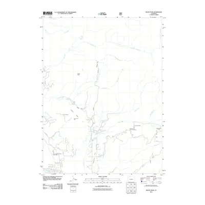
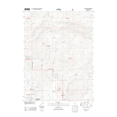
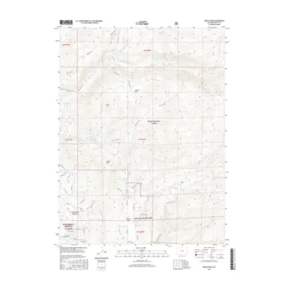
 1962 Rocky Peak1964 Print · USGSThe Routt County backcountry comes alive in this early 1960s survey of the mountain drainages north of the Yampa valley. Researchers can trace the early footprint of Strawberry Park and find local landmarks like the Steamboat Springs Airport and the Dry Lake Campground.3 unique versions available
 - 1962 Map of Mad Creek, 1964 Print
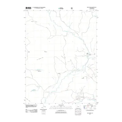
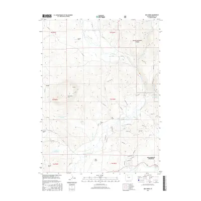
 1962 Mad Creek1964 Print · USGSRoutt County mountain valleys and high peaks are captured here in the early sixties, showing the intersection of ranching life and heavy rail. Genealogists and hikers can trace the Elk Mountain Cem, the settlement at Mystic, and old trails into the Routt National Forest.3 unique versions available
 - 1964 Map of Craig
 1964 Craig1964 Print · USGSNorthwestern Colorado's high country is captured here during the mid-sixties, from the Yampa River valley to the high peaks of the Park Range. Local researchers can trace the Denver and Rio Grande Western rail line and locate Uranium Mines near Lay.
 - 1965 Map of Craig
 1965 Craig1965 Print · USGSNorthwest Colorado in the mid-sixties is defined by its massive river basins and high mountain ranges flanking the Continental Divide. Trace the routes of the Denver and Rio Grande Western through old settlements like McCoy and Kremmling.
 - 1969 Map of Steamboat Springs, 1972 Print
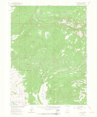
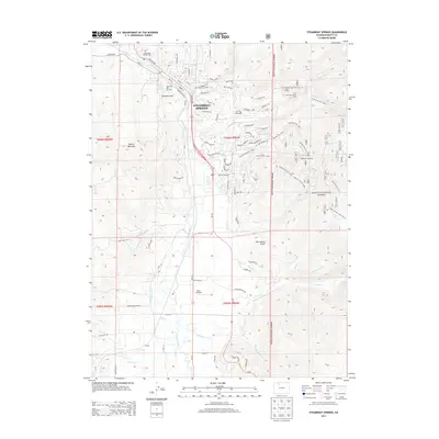
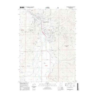
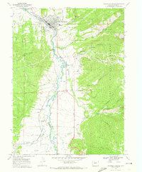 1969 Steamboat Springs1972 Print · USGSSteamboat Springs is shown in the late 1960s as it evolved into a premier mountain destination. Trace early ski runs at Steamboat Ski Area or find local landmarks like Heart Spring and the Denver and Rio Grande Western rail line.2 unique versions available
 - 1980 Map of Steamboat Springs, 1982 Print
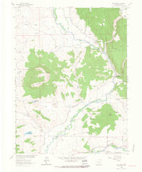
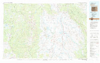
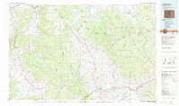 1980 Steamboat Springs1982 Print · USGSNorthwest Colorado's ranching and rail corridors come to life in the early eighties as mountain recreation and resource management began to reshape the region. Researchers can trace the Denver and Rio Grande Western line through Oak Creek or locate local landmarks like Old Homestead and Egeria Park.
 - 1981 Map of Walden, 1982 Print
 1981 Walden1982 Print · USGSThe North Park basin in the early eighties was a high-country crossroads of ranching and industry. Researchers can trace the Union Pacific rail corridor and locate historical mining operations like the Sudduth Mine or the remote settlement of Coalmont.
 - 2000 Map of Rocky Peak, 2004 Print
 2000 Rocky Peak2004 Print · USGSRoutt County at the start of the twenty-first century reveals a landscape defined by the Routt National Forest and the upper reaches of the Yampa River. Map collectors can trace the Cabin Creek Trail into the Mount Zirkel Wilderness or locate the Steamboat Springs Airport in the valley.
 - 2000 Map of Mad Creek, 2004 Print
 2000 Mad Creek2004 Print · USGSRoutt County at the turn of the millennium shows a landscape defined by the confluence of the Elk River valley and high forest terrain. Researchers can locate the Elk Mountain Cemetery and trace the complex water systems of the Keller Ditch and Trull Creek.
 - 2011 Map of Steamboat Springs, 2011 Print
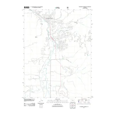 2011 Steamboat Springs2011 Print · USGSCovers Steamboat Springs, including Routt County, United States, and other nearby areas
 - 2011 Map of Mad Creek, 2011 Print
 2011 Mad Creek2011 Print · USGSCovers Steamboat Springs, including Mad Creek, Mystic, and other nearby areas
 - 2011 Map of Rocky Peak, 2011 Print
 2011 Rocky Peak2011 Print · USGSCovers Steamboat Springs, including Strawberry Park Hot Springs, Routt County, and other nearby areas
 - 2013 Map of Steamboat Springs, 2013 Print
 2013 Steamboat Springs2013 Print · USGSCovers Steamboat Springs, including Routt County, United States, and other nearby areas
 - 2013 Map of Mad Creek, 2013 Print
 2013 Mad Creek2013 Print · USGSCovers Steamboat Springs, including Mad Creek, Mystic, and other nearby areas
 - 2013 Map of Rocky Peak, 2013 Print
 2013 Rocky Peak2013 Print · USGSCovers Steamboat Springs, including Strawberry Park Hot Springs, Routt County, and other nearby areas
 - 2016 Map of Steamboat Springs, 2016 Print
 2016 Steamboat Springs2016 Print · USGSCovers Steamboat Springs, including Routt County, United States, and other nearby areas
 - 2016 Map of Rocky Peak, 2016 Print
 2016 Rocky Peak2016 Print · USGSCovers Steamboat Springs, including Strawberry Park Hot Springs, Routt County, and other nearby areas
 - 2016 Map of Mad Creek, 2016 Print
 2016 Mad Creek2016 Print · USGSCovers Steamboat Springs, including Mad Creek, Mystic, and other nearby areas
Showing maps 1-25 of 31
Top cities near Steamboat Springs
Frequently asked questions
- What are the different types of historical maps available for Steamboat Springs?
- What is the oldest map of Steamboat Springs?
- Where can I purchase historical maps of Steamboat Springs for my home or office?
- Where can I download high-res historical maps of Steamboat Springs?
- Are there historical topographic maps available for Steamboat Springs?
- Is there historical aerial imagery available for Steamboat Springs?
- Where are historical maps of Steamboat Springs sourced from?