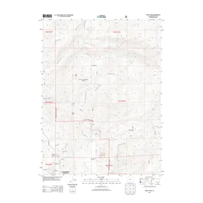
2013 Map of Rocky Peak
USGS Topo · Published 2013About this map
Steamboat Springs anchors the southern edge of this landscape, where the Yampa River and Lincoln Ave define the valley floor. The map highlights a complex network of water management and recreation infrastructure, from the Hot Springs Highline Ditch and Woodchuck Ditch to the geothermal waters of Routt Hot Springs. These features, alongside the Steamboat Springs Airport/Bob Adams Field, illustrate the town's growth as a mountain hub within the Routt National Forest. To the north, the terrain rises toward Rocky Peak and Copper Ridge, accessed by an extensive system of wilderness routes including the Elk Park Trail and Bear Creek Trail. The proximity of Strawberry Park and Summit Park to these protected lands shows the integration of residential development and wilderness that characterizes this portion of Routt County.
Find a feature on this map
45 named features on this map. Tap any name to fly to it.
Don’t see what you’re looking for? This feature index may not catch every label — zoom into the map to look around manually.
Map Details
Editions of this 2013 Rocky Peak Map
This is the sole edition of this map. No revisions or reprints were ever made.
Other maps of this area

1911 · Hahns Peak
USGS Topo · 1:125,000

1913 · Hahns Peak
USGS Topo · 1:125,000

1954 · Craig
USGS Topo · 1:250,000

1955 · Buffalo Pass
USGS Topo · 1:24,000

1955 · Mount Ethel
USGS Topo · 1:24,000

1955 · Mount Ethel
USGS Topo · 1:62,500

1956 · Storm Mountain
USGS Topo · 1:24,000

1956 · Rabbit Ears Peak
USGS Topo · 1:62,500

1957 · Craig
USGS Topo · 1:250,000

1958 · Craig
USGS Topo · 1:250,000