2020s Maps of Steamboat Springs, Colorado
Explore 3 historic maps of Steamboat Springs from the 2020s. These maps offer a rare glimpse into what life looked like during the 2020s — showing old roads, neighborhoods, homes, and landmarks that have changed or disappeared over time.
Whether you're researching your family's past, planning a metal detecting trip, or studying how Steamboat Springs's landscape evolved across the 2020s, these high-resolution maps are a powerful tool for exploring the history of this region.
- Focus on a specific era: All maps on this page are from the 2020s, giving you a focused view of this time period.
- See what’s changed: Compare century-old streets, trails, and buildings to today's modern landscape using overlays and satellite layers.
- Research with precision: Use these maps for genealogy, historical research, land use analysis, or educational projects.
- View, download, or print: Maps are fully viewable online in high resolution, and can be downloaded or printed for your own records.
Start exploring Steamboat Springs's history through authentic maps from the 2020s. This is your window into the past.
Steamboat Springs, CO maps
(3)- 2022 Map of Rocky Peak, 2022 Print
 2022 Rocky Peak2022 Print · USGSThe northern reaches of Steamboat Springs and the surrounding national forest are captured here in the early 2020s. Researchers can trace the development of Strawberry Park and the rugged drainage of the Yampa River near Rocky Peak.
 - 2022 Map of Steamboat Springs, 2022 Print
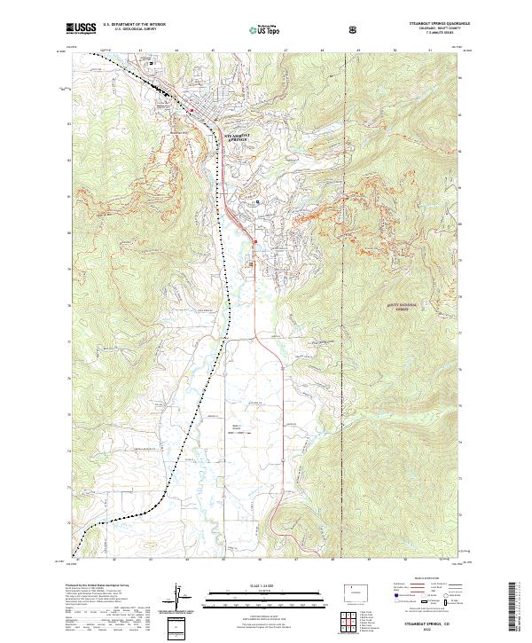 2022 Steamboat Springs2022 Print · USGSSteamboat Springs and the Yampa River valley are captured in the early 2020s, showing the intersection of mountain recreation and ranching heritage. Local historians can trace family plots at the Steamboat Springs Cem or locate early irrigation infrastructure like Baxter Ditch and Suttle Ditch.
 - 2022 Map of Mad Creek, 2022 Print
 2022 Mad Creek2022 Print · USGSSteamboat Springs and the Elk River valley are captured in this recent survey of Routt County. Trace local landmarks like the Elk Mountain Cem, Eagle Soaring Airport, and the prominent profile of The Sleeping Giant.
End of results
Showing maps 1-3 of 3
Top cities near Steamboat Springs
Frequently asked questions
- What are the different types of historical maps available for Steamboat Springs?
- What is the oldest map of Steamboat Springs?
- Where can I purchase historical maps of Steamboat Springs for my home or office?
- Where can I download high-res historical maps of Steamboat Springs?
- Are there historical topographic maps available for Steamboat Springs?
- Is there historical aerial imagery available for Steamboat Springs?
- Where are historical maps of Steamboat Springs sourced from?