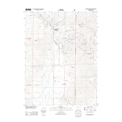
2013 Map of Steamboat Springs
USGS Topo · Published 2013About this map
Steamboat Springs serves as the focal point of this 2013 survey, where the Yampa River creates a natural corridor through the valley floor. The map highlights the extensive integration of recreational land use and rugged terrain, particularly through the presence of the Howelsen Hill Ski Area and the larger Steamboat Ski Area. These areas are complemented by an intricate network of local trails like Thunderhead Trail and Fish Creek Trail. To the south, the small settlement of Sidney and the Mesa 1 Airport illustrate the transition from the city center to more open ranching and agricultural lands. Unique hydrological features such as Sulphur Cave Spring and Heart Spring are documented near the town core, while Routt National Forest dominates the eastern and southern high ground, shielding the headwaters of Priest Creek and Walton Creek.
Find a feature on this map
80 named features on this map. Tap any name to fly to it.
Don’t see what you’re looking for? This feature index may not catch every label — zoom into the map to look around manually.
Map Details
Editions of this 2013 Steamboat Springs Map
This is the sole edition of this map. No revisions or reprints were ever made.
Other maps of this area

1911 · Hahns Peak
USGS Topo · 1:125,000

1913 · Hahns Peak
USGS Topo · 1:125,000

1954 · Craig
USGS Topo · 1:250,000

1955 · Buffalo Pass
USGS Topo · 1:24,000

1955 · Mount Ethel
USGS Topo · 1:62,500

1956 · Storm Mountain
USGS Topo · 1:24,000

1956 · Walton Peak
USGS Topo · 1:24,000

1956 · Rabbit Ears Peak
USGS Topo · 1:62,500

1957 · Craig
USGS Topo · 1:250,000

1958 · Craig
USGS Topo · 1:250,000