Old Maps of Coventry, Connecticut for Genealogy
Trace your family roots with 33 historic maps of Coventry. These high-res maps reveal old neighborhoods, homesites, landmarks, and streets — helping you uncover where your ancestors lived and how the area evolved over time.
- Explore historic neighborhoods: Identify where your relatives may have lived in the 1800s or 1900s.
- Compare maps over time: Trace the changes in streets, buildings, and landmarks for multi-generational research.
- Perfect for genealogy & ancestry research: Used by family historians and researchers to map out lineage and migration.
These maps are an incredible resource for exploring your personal connection to Coventry's past.
Coventry, CT maps
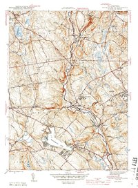
(33)- 1892 Map of Tolland
 1892 Tolland1892 Print · USGSTolland and Coventry are shown here in the 1890s during a period of industrial growth along the region's river valleys. Genealogists and historians can trace the early rail networks and industrial centers like Rockville, Stafford Springs, and Talcottville.7 unique versions available
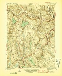
 - 1892 Map of Gilead
 1892 Gilead1892 Print · USGSEastern Connecticut was a landscape of rail-connected hamlets and water-powered industries in the years before the turn of the century. Genealogists and historians can trace the paths of the Lyman Viaduct, find early settlements like Turnerville, and locate family landmarks near Colchester.7 unique versions available
 - 1921 Map of Tolland
 1921 Tolland1921 Print · USGSTolland County at the start of the twenties reveals a complex network of electric rail lines and industrial waterpower. Genealogists can locate family homes and centers of trade like Stafford Springs, Talcottville, and the Conn. Epileptic Colony.
 - 1944 Map of South Coventry
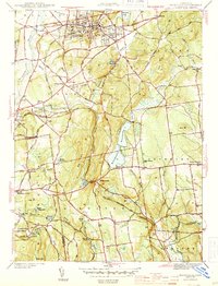
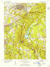
 1944 South Coventry1944 Print · USGSTolland County at the close of the Second World War shows a landscape defined by the Willimantic River valley and the growing University of Connecticut. Genealogists and historians can trace the Central Vermont rail line through Mansfield Depot or locate family roots near the Nathan Hale Birthplace and Eagleville.3 unique versions available
 - 1944 Map of Columbia
 1944 Columbia1944 Print · USGSTolland County at the height of the Second World War shows a rural landscape defined by its rail-and-river network and local school districts. Genealogists and historians can trace family-named sites like St Peters Cem, Chestnut Hill Sch, and the rail junction at Amston.3 unique versions available
 - 1944 Map of Rockville
 1944 Rockville1944 Print · USGSTolland County during the mid-forties shows a landscape of busy mill towns and high ridge farms connected by the New York New Haven and Hartford Railroad. Genealogists can trace family landmarks and rural schoolhouses like Silver St Sch, Maple St Sch, and the Old Vernon Cem.4 unique versions available
 - 1947 Map of Hartford, 1955 Print
 1947 Hartford1955 Print · USGSSouthern New England and the Hudson Valley are shown in detail during the post-war expansion era. Genealogists and researchers can trace local landmarks from the State Capitol and Yale University to the Stratford Lighthouse and Woodlawn Cem.2 unique versions available
 - 1948 Map of Hartford
 1948 Hartford1948 Print · USGSSouthern New England is captured here in the late 1940s, showcasing a landscape of thriving industrial cities and developing parkways. Genealogists and historians can trace the rail networks of the New York New Haven and Hartford RR or locate coastal defense sites like Fort Terry and Camp Shanks.2 unique versions available
 - 1953 Map of South Coventry, 1955 Print
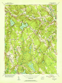
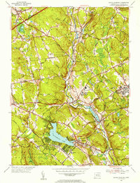 1953 South Coventry1955 Print · USGSTolland County in the early fifties shows a landscape of developing university grounds and historic rural villages. Genealogists can trace family landmarks like the Nathan Hale Birthplace or follow the Central Vermont Railway past Mansfield Depot and Eagleville Lake.5 unique versions available
 - 1953 Map of Rockville, 1955 Print
 1953 Rockville1955 Print · USGSTolland and Hartford Counties show a blend of industrial centers and rural farmsteads in the early fifties as the highway system begins to expand. Researchers can locate family landmarks like the Old Vernon Cem, the County Home, and the Grant Hill Sch among the rolling ridges.3 unique versions available
 - 1953 Map of Columbia, 1955 Print
 1953 Columbia1955 Print · USGSTolland County and its surrounding highlands appear here in the mid-1950s, a period when rural schoolhouses and family cemeteries still anchored the community. Genealogists can locate family landmarks like Utley Hill Cem, Porter Sch, and the rail stops along the New York and New Haven and Hartford Railroad.6 unique versions available
 - 1961 Map of Hartford
 1961 Hartford1961 Print · USGSSouthern New England and the Hudson Valley are shown here in the mid-fifties, capturing a landscape of booming coastal cities and interior hill towns. Researchers can trace the legacy of the New York New Haven and Hartford rail corridor and find strategic sites like Camp Shanks and Fort Michie.
 - 1962 Map of Hartford, 1971 Print
 1962 Hartford1971 Print · USGSSouthern New England and the Hudson Valley are shown in the early sixties, as suburban growth reached into the foothills. Trace the path of the New York New Haven & Hartford RR and find landmarks like Camp Nathan Hale and Gillette Castle State Park.3 unique versions available
 - 1965 Map of Hartford
 1965 Hartford1965 Print · USGSSouthern New England and the Hudson Valley are shown here during the mid-sixties expansion of the Interstate era. Trace the path of the New York New Haven & Hartford RR or locate historic landmarks like West Point Military Reservation and the Merritt Parkway.2 unique versions available
 - 1967 Map of Rockville, 1969 Print
 1967 Rockville1969 Print · USGSTolland and Hartford Counties are captured during a period of transition in the late sixties as suburban development meets historic mill towns. Researchers can trace ancestral roots at St Bernards Cem or follow the old rail lines through Bolton Notch and past Paper Mill Pond.5 unique versions available
 - 1983 Map of Coventry, 1984 Print
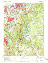
 1983 Coventry1984 Print · USGSCoventry and Tolland are captured in the early 1980s, showcasing a landscape of academic expansion and deep-rooted New England history. Genealogists and locals can trace the Nathan Hale Birthplace, Workmans Circle Cem, and the old rail corridor of the Central Vermont.2 unique versions available
 - 1986 Map of Hartford
 1986 Hartford1986 Print · USGSCentral Connecticut and the surrounding highlands were undergoing significant suburban growth and industrial transition during the mid-eighties. Researchers can trace the layout of regional landmarks including Bradley International Airport, the University of Connecticut, and the historic State Capitol.
 - 1994 Map of Hartford, 1995 Print
 1994 Hartford1995 Print · USGSGreater Hartford and the Connecticut River Valley are captured here in the mid-nineties, showing the dense intersection of industry and academia. Trace the urban footprint of the State Capitol and Trinity College or locate the sprawling grounds of the University of Connecticut.2 unique versions available
 - 2012 Map of Columbia, 2012 Print
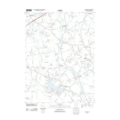
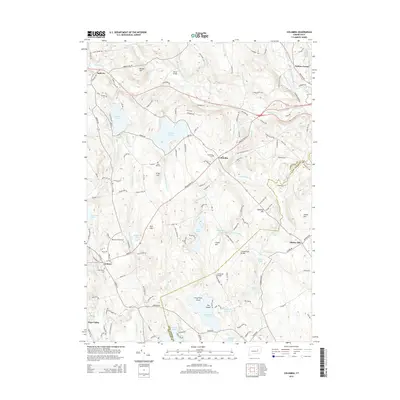
 2012 Columbia2012 Print · USGSCovers Coventry, including Mansfield, Windham, and other nearby areas
 - 2012 Map of Rockville, 2012 Print
 2012 Rockville2012 Print · USGSCovers Coventry, including Manchester, Vernon, and other nearby areas
 - 2012 Map of Coventry, 2012 Print
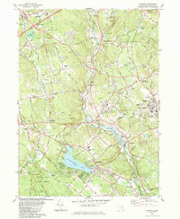
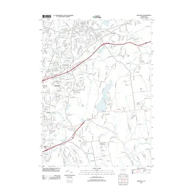
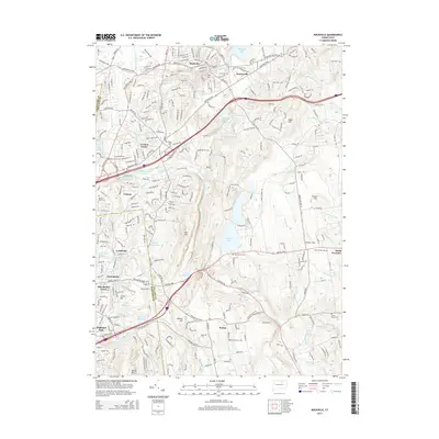
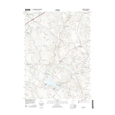
 2012 Coventry2012 Print · USGSCovers Coventry, including Mansfield, Tolland, and other nearby areas
 - 2015 Map of Columbia, 2015 Print
 2015 Columbia2015 Print · USGSCovers Coventry, including Mansfield, Windham, and other nearby areas
 - 2015 Map of Rockville, 2015 Print
 2015 Rockville2015 Print · USGSCovers Coventry, including Manchester, Vernon, and other nearby areas
 - 2015 Map of Coventry, 2015 Print
 2015 Coventry2015 Print · USGSCovers Coventry, including Mansfield, Tolland, and other nearby areas
 - 2018 Map of Coventry, 2018 Print
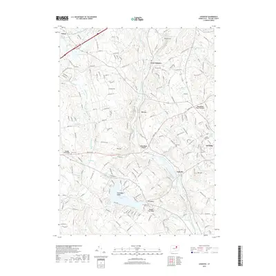 2018 Coventry2018 Print · USGSCovers Coventry, including Mansfield, Tolland, and other nearby areas
Showing maps 1-25 of 33
Top cities near Coventry
- Manchester historical maps
- Middletown historical maps
- Enfield historical maps
- Norwich historical maps
- Glastonbury historical maps
- Vernon historical maps
See more
Top neighborhoods of Coventry
Frequently asked questions
- What are the different types of historical maps available for Coventry?
- What is the oldest map of Coventry?
- Where can I purchase historical maps of Coventry for my home or office?
- Where can I download high-res historical maps of Coventry?
- Are there historical topographic maps available for Coventry?
- Is there historical aerial imagery available for Coventry?
- Where are historical maps of Coventry sourced from?