1950s Maps of West Hartford, Connecticut
Explore 5 historic maps of West Hartford from the 1950s. These maps offer a rare glimpse into what life looked like during the 1950s — showing old roads, neighborhoods, homes, and landmarks that have changed or disappeared over time.
Whether you're researching your family's past, planning a metal detecting trip, or studying how West Hartford's landscape evolved across the 1950s, these high-resolution maps are a powerful tool for exploring the history of this region.
- Focus on a specific era: All maps on this page are from the 1950s, giving you a focused view of this time period.
- See what’s changed: Compare century-old streets, trails, and buildings to today's modern landscape using overlays and satellite layers.
- Research with precision: Use these maps for genealogy, historical research, land use analysis, or educational projects.
- View, download, or print: Maps are fully viewable online in high resolution, and can be downloaded or printed for your own records.
Start exploring West Hartford's history through authentic maps from the 1950s. This is your window into the past.
West Hartford, CT maps
(5)- 1951 Map of Avon
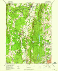
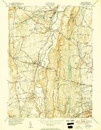 1951 Avon1951 Print · USGSMid-century Hartford County reveals a landscape of ridge-top landmarks and valley settlements along the Farmington River. Trace the grounds of the Avon Old Farms School, locate the Heublein Tower, and find family history at Cider Brook Cemetery.2 unique versions available
 - 1952 Map of Hartford North, 1954 Print
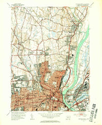 1952 Hartford North1954 Print · USGSGreater Hartford is depicted in the early fifties as the city expanded across the river into the surrounding suburbs. Genealogists can trace family footprints through numerous urban cemeteries like Mt St Benedict Cemetery and historic institutions including Trinity College and St Thomas Seminary.3 unique versions available
 - 1952 Map of Hartford South, 1954 Print
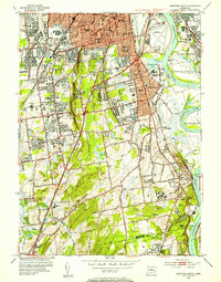 1952 Hartford South1954 Print · USGSGreater Hartford and the Connecticut River valley are shown during a period of rapid suburban growth in the early fifties. Genealogists and historians can locate family landmarks like the Cedar Hill Cemetery, Trinity College, and the State Veterans Home.4 unique versions available
 - 1953 Map of New Britain, 1954 Print
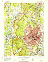 1953 New Britain1954 Print · USGSNew Britain and Plainville are shown at a peak of post-war expansion, where dense urban blocks meet the trap rock ridges of central Connecticut. Researchers can trace historic institutions like the State Teachers College, local industry near Farmington Sta, and the old Copper Mine.4 unique versions available
 - 1957 Map of Avon, 1958 Print
 1957 Avon1958 Print · USGSMid-century Hartford County is shown here as suburban expansion begins to meet established valley institutions and state forests. Genealogists and researchers can trace local landmarks like Avon Old Farms, St Ann Cem, and the historic Powder Mill.6 unique versions available
End of results
Showing maps 1-5 of 5
Top cities near West Hartford
- Hartford historical maps
- Waterbury historical maps
- New Britain historical maps
- Meriden historical maps
- Bristol historical maps
- Manchester historical maps
See more
Top neighborhoods of West Hartford
- Elmwood historical maps
- Foote Corners historical maps
- Whitings Corner historical maps
- Fernridge Place historical maps
- Hartford Golf Club Historic District historical maps
- Prospect Avenue Historic District historical maps
See more
Frequently asked questions
- What are the different types of historical maps available for West Hartford?
- What is the oldest map of West Hartford?
- Where can I purchase historical maps of West Hartford for my home or office?
- Where can I download high-res historical maps of West Hartford?
- Are there historical topographic maps available for West Hartford?
- Is there historical aerial imagery available for West Hartford?
- Where are historical maps of West Hartford sourced from?