Old Maps of Lake Chaffee, Ashford for Hiking & Exploration
Hike through history with 18 historic maps of Lake Chaffee. Explore old trails, ghost towns, and forgotten backroads — perfect for outdoor adventurers and local explorers.
- Rediscover forgotten places: Map out old mining camps, roads, and footpaths that no longer exist on modern maps.
- Layer with modern tools: Combine with LiDAR or satellite views to plan hikes through historical terrain.
- Made for exploration: Popular among hikers, overlanders, and local history lovers.
Use these maps to find adventure and explore the hidden past of Lake Chaffee.
Lake Chaffee, Ashford maps
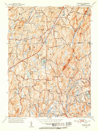
(18)- 1892 Map of Woodstock
 1892 Woodstock1892 Print · USGSNortheastern Connecticut at the close of the nineteenth century was a landscape of river-powered mill villages and independent farmsteads. Genealogists and historians can trace the paths between Mansfield Center, Phoenixville, and the New York and New England Railroad stops.6 unique versions available
 - 1921 Map of Woodstock
 1921 Woodstock1921 Print · USGSWindham County villages and highland ridges are captured here during the early twentieth century, showing a landscape of small mill towns and glacial ponds. Researchers can trace the path of the New York New Haven and Hartford Railroad or locate family roots in Atwoodville, Phoenixville, or Mansfield Hollow.
 - 1945 Map of Westford
 1945 Westford1945 Print · USGSThe borderlands of Windham and Tolland Counties are shown here during the mid-forties, a landscape of quiet hill towns and state forests. Genealogists and historians can trace local roots at the Swamp Burying Ground, Westford Hill Ch, and the old Red Sch.2 unique versions available
 - 1947 Map of Hartford, 1955 Print
 1947 Hartford1955 Print · USGSSouthern New England and the Hudson Valley are shown in detail during the post-war expansion era. Genealogists and researchers can trace local landmarks from the State Capitol and Yale University to the Stratford Lighthouse and Woodlawn Cem.2 unique versions available
 - 1948 Map of Hartford
 1948 Hartford1948 Print · USGSSouthern New England is captured here in the late 1940s, showcasing a landscape of thriving industrial cities and developing parkways. Genealogists and historians can trace the rail networks of the New York New Haven and Hartford RR or locate coastal defense sites like Fort Terry and Camp Shanks.2 unique versions available
 - 1952 Map of Westford, 1953 Print
 1952 Westford1953 Print · USGSIn the hills of Tolland and Windham counties in the early fifties, rural life centered on crossroads like Union and Westford. Genealogists can trace family footprints at Swamp Burying Ground, Moose Meadow Sch, and Westford Village.5 unique versions available
 - 1961 Map of Hartford
 1961 Hartford1961 Print · USGSSouthern New England and the Hudson Valley are shown here in the mid-fifties, capturing a landscape of booming coastal cities and interior hill towns. Researchers can trace the legacy of the New York New Haven and Hartford rail corridor and find strategic sites like Camp Shanks and Fort Michie.
 - 1962 Map of Hartford, 1971 Print
 1962 Hartford1971 Print · USGSSouthern New England and the Hudson Valley are shown in the early sixties, as suburban growth reached into the foothills. Trace the path of the New York New Haven & Hartford RR and find landmarks like Camp Nathan Hale and Gillette Castle State Park.3 unique versions available
 - 1965 Map of Hartford
 1965 Hartford1965 Print · USGSSouthern New England and the Hudson Valley are shown here during the mid-sixties expansion of the Interstate era. Trace the path of the New York New Haven & Hartford RR or locate historic landmarks like West Point Military Reservation and the Merritt Parkway.2 unique versions available
 - 1983 Map of Westford, 1984 Print
 1983 Westford1984 Print · USGSNortheastern Connecticut's wooded uplands and rural hamlets are captured here in the early eighties. Researchers can locate ancestral sites like the Swamp Burying Ground, Moose Meadow Cem, and Westford Hill.
 - 1986 Map of Hartford
 1986 Hartford1986 Print · USGSCentral Connecticut and the surrounding highlands were undergoing significant suburban growth and industrial transition during the mid-eighties. Researchers can trace the layout of regional landmarks including Bradley International Airport, the University of Connecticut, and the historic State Capitol.
 - 1994 Map of Hartford, 1995 Print
 1994 Hartford1995 Print · USGSGreater Hartford and the Connecticut River Valley are captured here in the mid-nineties, showing the dense intersection of industry and academia. Trace the urban footprint of the State Capitol and Trinity College or locate the sprawling grounds of the University of Connecticut.2 unique versions available
 - 2012 Map of Westford, 2012 Print
 2012 Westford2012 Print · USGSCovers Lake Chaffee, including Stafford, Willington, and other nearby areas
 - 2015 Map of Westford, 2015 Print
 2015 Westford2015 Print · USGSCovers Lake Chaffee, including Stafford, Willington, and other nearby areas
 - 2018 Map of Westford, 2018 Print
 2018 Westford2018 Print · USGSCovers Lake Chaffee, including Stafford, Willington, and other nearby areas
 - 2021 Map of Westford, 2021 Print
 2021 Westford2021 Print · USGSCovers Lake Chaffee, including Stafford, Willington, and other nearby areas
 - 2023 Map of Westford, 2023 Print
 2023 Westford2023 Print · USGSCovers Lake Chaffee, including Stafford, Willington, and other nearby areas
 - 2024 Map of Westford, 2024 Print
 2024 Westford2024 Print · USGSThe rural uplands of Union and Westford are documented here in recent detail, showing a landscape shaped by narrow hollows and high ridges. Local historians can trace cemetery locations like Swamp Cem or follow the route of the Nipmuck Trl past landmarks such as Lead Mine Hill.
End of results
Showing maps 1-18 of 18
Top cities near Lake Chaffee
- Vernon historical maps
- Mansfield historical maps
- Windham historical maps
- Ludlow historical maps
- Southbridge historical maps
- Storrs historical maps
See more
Frequently asked questions
- What are the different types of historical maps available for Lake Chaffee?
- What is the oldest map of Lake Chaffee?
- Where can I purchase historical maps of Lake Chaffee for my home or office?
- Where can I download high-res historical maps of Lake Chaffee?
- Are there historical topographic maps available for Lake Chaffee?
- Is there historical aerial imagery available for Lake Chaffee?
- Where are historical maps of Lake Chaffee sourced from?