1950s Maps of Goshen, Connecticut
Explore 8 historic maps of Goshen from the 1950s. These maps offer a rare glimpse into what life looked like during the 1950s — showing old roads, neighborhoods, homes, and landmarks that have changed or disappeared over time.
Whether you're researching your family's past, planning a metal detecting trip, or studying how Goshen's landscape evolved across the 1950s, these high-resolution maps are a powerful tool for exploring the history of this region.
- Focus on a specific era: All maps on this page are from the 1950s, giving you a focused view of this time period.
- See what’s changed: Compare century-old streets, trails, and buildings to today's modern landscape using overlays and satellite layers.
- Research with precision: Use these maps for genealogy, historical research, land use analysis, or educational projects.
- View, download, or print: Maps are fully viewable online in high resolution, and can be downloaded or printed for your own records.
Start exploring Goshen's history through authentic maps from the 1950s. This is your window into the past.
Goshen, CT maps
(8)- 1950 Map of Cornwall
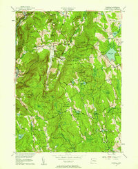
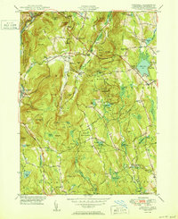 1950 Cornwall1950 Print · USGSLitchfield County's upland terrain is captured here in the mid-twentieth century, centered on the historic villages and forested ridges of Cornwall and Goshen. Researchers can locate numerous family burial grounds like Allen Cem and Cornwall Cem, or trace the path of the Appalachian Trail as it crossed Dudleytown Hill.2 unique versions available
 - 1950 Map of South Canaan
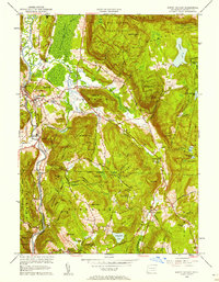
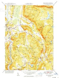 1950 South Canaan1950 Print · USGSLitchfield County highland life in the late 1940s is centered here on the rugged ridges of the Housatonic State Forest and the Housatonic River valley. Genealogists and hikers can trace the Appalachian Trail past family landmarks like Under Mountain Cem and Cornwall Hollow.3 unique versions available
 - 1951 Map of West Torrington
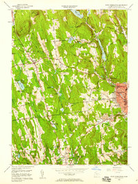
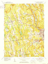 1951 West Torrington1951 Print · USGSLitchfield County in the early fifties shows a landscape of historic hilltop farms and growing educational institutions. Trace local history at the John Browns Birthplace (Ruins) or find family roots in the Old Middle Street Cem and Newfield Cem.2 unique versions available
 - 1951 Map of Norfolk
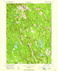
 1951 Norfolk1951 Print · USGSThe Litchfield County foothills in the early fifties show a quiet landscape of mountain parks and scattered farmsteads. Researchers can trace old family burial grounds like Grantville Cem and find vanished rural nodes like the Winchester Center PO.2 unique versions available
 - 1956 Map of Norfolk, 1958 Print
 1956 Norfolk1958 Print · USGSLitchfield County's upland terrain is captured here in the mid-fifties, showing the rural character of Norfolk and Winchester. Genealogists can trace family names through sites like Winchester Center PO, Grantville Cem, and South Norfolk.4 unique versions available
 - 1956 Map of Cornwall, 1958 Print
 1956 Cornwall1958 Print · USGSMid-century Litchfield County is captured here during a time when small hamlets and state forests defined the Housatonic Valley. Genealogists and hikers can trace family-named sites like Kellogg Corners and the original path of the Appalachian Trail near Dudleytown Hill.5 unique versions available
 - 1956 Map of South Canaan, 1958 Print
 1956 South Canaan1958 Print · USGSLitchfield County's upland forests and river valleys are captured here in the mid-1950s, showing a landscape defined by timber and transit. Researchers can trace the Appalachian Trail, locate the Yale University Forestry School, and find rural burials at Root Cem.6 unique versions available
 - 1956 Map of West Torrington, 1958 Print
 1956 West Torrington1958 Print · USGSThe Litchfield Hills in the mid-fifties show a unique mix of industrial river valleys and remote upland institutions. Genealogists can trace family plots at Old Middle Street Cem and explore landmark ruins like John Browns Birthplace.5 unique versions available
End of results
Showing maps 1-8 of 8
Top cities near Goshen
- Torrington historical maps
- Watertown historical maps
- Wolcott historical maps
- Plymouth historical maps
- Burlington historical maps
- Litchfield historical maps
See more
Top neighborhoods of Goshen
- Tyler Lake Heights historical maps
- West Goshen historical maps
- North Goshen historical maps
- Kelly Corner historical maps
Frequently asked questions
- What are the different types of historical maps available for Goshen?
- What is the oldest map of Goshen?
- Where can I purchase historical maps of Goshen for my home or office?
- Where can I download high-res historical maps of Goshen?
- Are there historical topographic maps available for Goshen?
- Is there historical aerial imagery available for Goshen?
- Where are historical maps of Goshen sourced from?