Old Maps of Goshen, Connecticut for Academic Research
Study the evolution of Goshen with 25 high-resolution historic maps. Whether you're teaching, researching, or modeling changes in land use, these maps provide essential visual documentation of urban, environmental, and geographic change.
- Analyze long-term change: Track patterns in development, transportation, and natural features.
- Ideal for environmental or urban studies: Support academic projects with primary historical map data.
- Use in the classroom or lab: Educators and researchers rely on these maps to bring historical context to life.
These maps are a powerful tool for teaching, research, and visualizing how Goshen has changed over the decades.
Goshen, CT maps
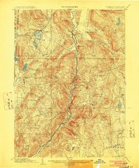
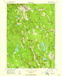
(25)- 1892 Map of Winsted
 1892 Winsted1892 Print · USGSLitchfield County's industrial valleys and upland villages are captured here in the late nineteenth century, during the peak of the region's railroad era. Researchers can trace historic property locations and rail spurs in Winsted, Torrington, and along the shores of Highland Lake.10 unique versions available
 - 1892 Map of Cornwall
 1892 Cornwall1892 Print · USGSLitchfield County in the 1890s reveals a landscape of river-powered industry and rail-connected villages. Researchers can trace ancestral roots and old transport routes through Ore Hill, Lime Rock, and the stops along the Housatonic Railroad.
 - 1893 Map of Cornwall
 1893 Cornwall1893 Print · USGSLitchfield County's iron-mining and rail-corridor history comes into focus in the 1890s as the Housatonic Railroad follows the river valley. Genealogists and historians can trace old property lines and rural centers like Ore Hill, Lime Rock, and Amenia Union.3 unique versions available
 - 1903 Map of Cornwall
 1903 Cornwall1903 Print · USGSNorthwestern Connecticut at the dawn of the twentieth century shows a landscape of iron-mining hamlets and river-valley rail lines. Genealogists and historians can trace the foundations of Ore Hill, the streets of Salisbury, and the path of the Central New England RR.9 unique versions available
 - 1904 Map of Litchfield
 1904 Litchfield1904 Print · USGSThe Litchfield Hills at the turn of the century are shown here as a landscape of iron heritage and river-powered industry. Genealogists and historians can locate old industrial sites like Kent Furnace, ancestral homes near Sharon Valley, and early rail stops at Limerock Sta..3 unique versions available
 - 1947 Map of Hartford, 1955 Print
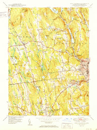
 1947 Hartford1955 Print · USGSSouthern New England and the Hudson Valley are shown in detail during the post-war expansion era. Genealogists and researchers can trace local landmarks from the State Capitol and Yale University to the Stratford Lighthouse and Woodlawn Cem.2 unique versions available
 - 1948 Map of Hartford
 1948 Hartford1948 Print · USGSSouthern New England is captured here in the late 1940s, showcasing a landscape of thriving industrial cities and developing parkways. Genealogists and historians can trace the rail networks of the New York New Haven and Hartford RR or locate coastal defense sites like Fort Terry and Camp Shanks.2 unique versions available
 - 1950 Map of Cornwall
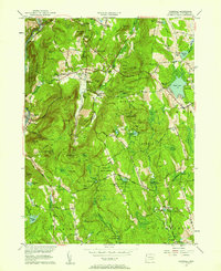
 1950 Cornwall1950 Print · USGSLitchfield County's upland terrain is captured here in the mid-twentieth century, centered on the historic villages and forested ridges of Cornwall and Goshen. Researchers can locate numerous family burial grounds like Allen Cem and Cornwall Cem, or trace the path of the Appalachian Trail as it crossed Dudleytown Hill.2 unique versions available
 - 1950 Map of South Canaan
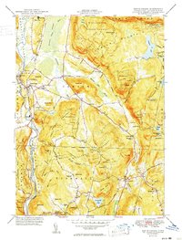 1950 South Canaan1950 Print · USGSLitchfield County highland life in the late 1940s is centered here on the rugged ridges of the Housatonic State Forest and the Housatonic River valley. Genealogists and hikers can trace the Appalachian Trail past family landmarks like Under Mountain Cem and Cornwall Hollow.3 unique versions available
 - 1951 Map of West Torrington
 1951 West Torrington1951 Print · USGSLitchfield County in the early fifties shows a landscape of historic hilltop farms and growing educational institutions. Trace local history at the John Browns Birthplace (Ruins) or find family roots in the Old Middle Street Cem and Newfield Cem.2 unique versions available
 - 1951 Map of Norfolk
 1951 Norfolk1951 Print · USGSThe Litchfield County foothills in the early fifties show a quiet landscape of mountain parks and scattered farmsteads. Researchers can trace old family burial grounds like Grantville Cem and find vanished rural nodes like the Winchester Center PO.2 unique versions available
 - 1956 Map of Norfolk, 1958 Print
 1956 Norfolk1958 Print · USGSLitchfield County's upland terrain is captured here in the mid-fifties, showing the rural character of Norfolk and Winchester. Genealogists can trace family names through sites like Winchester Center PO, Grantville Cem, and South Norfolk.4 unique versions available
 - 1956 Map of Cornwall, 1958 Print
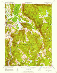
 1956 Cornwall1958 Print · USGSMid-century Litchfield County is captured here during a time when small hamlets and state forests defined the Housatonic Valley. Genealogists and hikers can trace family-named sites like Kellogg Corners and the original path of the Appalachian Trail near Dudleytown Hill.5 unique versions available
 - 1956 Map of South Canaan, 1958 Print
 1956 South Canaan1958 Print · USGSLitchfield County's upland forests and river valleys are captured here in the mid-1950s, showing a landscape defined by timber and transit. Researchers can trace the Appalachian Trail, locate the Yale University Forestry School, and find rural burials at Root Cem.6 unique versions available
 - 1956 Map of West Torrington, 1958 Print
 1956 West Torrington1958 Print · USGSThe Litchfield Hills in the mid-fifties show a unique mix of industrial river valleys and remote upland institutions. Genealogists can trace family plots at Old Middle Street Cem and explore landmark ruins like John Browns Birthplace.5 unique versions available
 - 1961 Map of Hartford
 1961 Hartford1961 Print · USGSSouthern New England and the Hudson Valley are shown here in the mid-fifties, capturing a landscape of booming coastal cities and interior hill towns. Researchers can trace the legacy of the New York New Haven and Hartford rail corridor and find strategic sites like Camp Shanks and Fort Michie.
 - 1962 Map of Hartford, 1971 Print
 1962 Hartford1971 Print · USGSSouthern New England and the Hudson Valley are shown in the early sixties, as suburban growth reached into the foothills. Trace the path of the New York New Haven & Hartford RR and find landmarks like Camp Nathan Hale and Gillette Castle State Park.3 unique versions available
 - 1965 Map of Hartford
 1965 Hartford1965 Print · USGSSouthern New England and the Hudson Valley are shown here during the mid-sixties expansion of the Interstate era. Trace the path of the New York New Haven & Hartford RR or locate historic landmarks like West Point Military Reservation and the Merritt Parkway.2 unique versions available
 - 1965 Map of Norfolk, 1971 Print
 1965 Norfolk1971 Print · USGSLitchfield County's uplands are seen here in the mid-1960s, showing a transition from traditional rural hamlets to a landscape of state forests and summer camps. Genealogists can locate family sites near Winchester Center PO, Kelly Corner, and the Hall Meadow Cem.
 - 1985 Map of Waterbury, 1986 Print
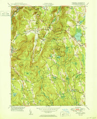
 1985 Waterbury1986 Print · USGSThe Western Connecticut highlands and the Hudson Valley are captured in the mid-1980s, showing a landscape of deep forests and industrial river towns. Genealogists can trace family connections from Waterbury up through Litchfield and Torrington, while exploring the vast Barkhamsted Reservoir and Candlewood Lake basins.
 - 1993 Map of Waterbury
 1993 Waterbury1993 Print · USGSWestern Connecticut and the Hudson Valley appear in the early nineties as a landscape of established industrial cities and deep forest preserves. Researchers can trace the rail corridors of the Metro-North Railroad or locate family sites near the Taft School and Riverside Cemetery.
 - 2024 Map of Norfolk, 2024 Print
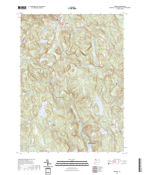 2024 Norfolk2024 Print · USGSThe Northwest Hills of Litchfield County are shown in great detail here, centering on the upland village of Norfolk and its surrounding peaks. Researchers can locate numerous historic burial sites like Center Cem and trace old routes through Grantville and Winchester Center.
 - 2024 Map of South Canaan, 2024 Print
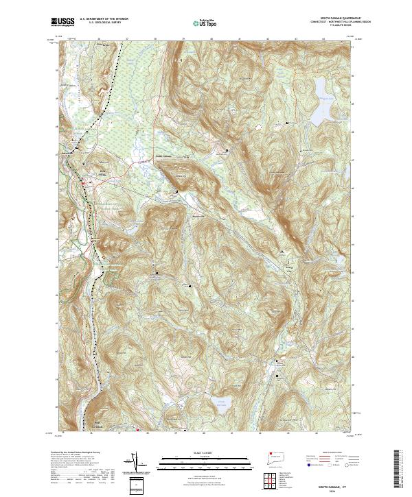 2024 South Canaan2024 Print · USGSLitchfield County's interior hills and the Housatonic riverfront are captured here in the early twenty-first century. Genealogists and local historians can locate numerous burial sites like Sand Hill Cem and Lower City Cem, or trace the path of the Appalachian National Scenic Trail.
 - 2024 Map of West Torrington, 2024 Print
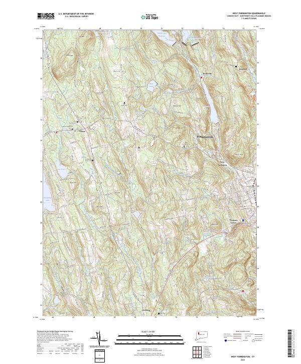 2024 West Torrington2024 Print · USGSThe Northwest Hills of Connecticut are captured here in the early twenty-first century as they balance woodland terrain with residential growth. Genealogists and local researchers can locate established sites like Saint Thomas Cem and the Litchfield County Court House.
 - 2024 Map of Cornwall, 2024 Print
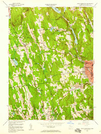
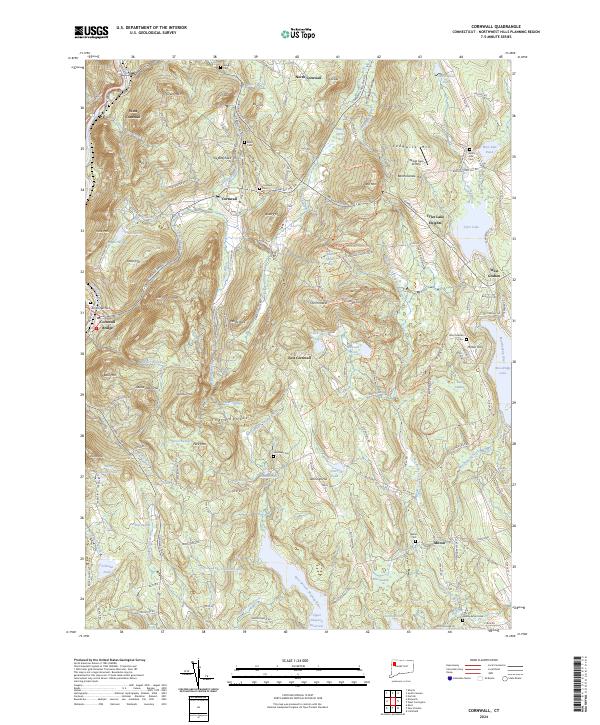 2024 Cornwall2024 Print · USGSThe Litchfield Hills come into sharp focus in this recent survey of the Cornwall area, showcasing the enduring rural character of Northwest Connecticut. Genealogists can locate family landmarks like Wright Cem, Allen Cem, and the old sites near Dudleytown Hill or Milton Hill.
End of results
Showing maps 1-25 of 25
Top cities near Goshen
- Torrington historical maps
- Watertown historical maps
- Wolcott historical maps
- Plymouth historical maps
- Burlington historical maps
- Litchfield historical maps
See more
Top neighborhoods of Goshen
- Kelly Corner historical maps
- North Goshen historical maps
- Tyler Lake Heights historical maps
- West Goshen historical maps
Frequently asked questions
- What are the different types of historical maps available for Goshen?
- What is the oldest map of Goshen?
- Where can I purchase historical maps of Goshen for my home or office?
- Where can I download high-res historical maps of Goshen?
- Are there historical topographic maps available for Goshen?
- Is there historical aerial imagery available for Goshen?
- Where are historical maps of Goshen sourced from?