Old Maps of Hartland, Connecticut for Metal Detecting
Plan your next treasure hunt with 85 historic maps of Hartland. Find old homesites, ghost towns, trails, and gathering spots that may be lost to time — perfect for identifying promising metal detecting locations.
- Locate forgotten sites: Uncover places like long-lost settlements, abandoned rail lines, or gathering spots.
- Plan better hunts: Use map overlays combined with LiDAR or satellite views to narrow in on historically rich areas.
- Made for detectorists: Thousands of hobbyists use these maps to discover relics, coins, and hidden history.
Use these historic maps to boost your research and find new opportunities beneath the surface of Hartland.
Hartland, CT maps
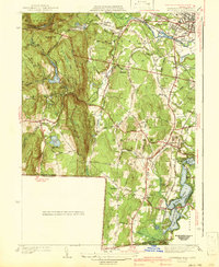
(85)- 1887 Map of Granville
 1887 Granville1887 Print · USGSHampden County's river valleys and rugged uplands are captured here in the late nineteenth century as industry and railroads transformed the terrain. Trace family-named landmarks and infrastructure like Ore Hill, the Borden Br. Res., and the Boston and Albany Railroad.
 - 1888 Map of Sandisfield
 1888 Sandisfield1888 Print · USGSThe Berkshires at the end of the nineteenth century reveal a landscape of mountain villages and river-powered industry. Genealogists can trace family roots through the early roads of Sandisfield, New Marlborough, and the banks of the Farmington River.
 - 1889 Map of Granville
 1889 Granville1889 Print · USGSThe hill towns of Hampden County are shown here in the late nineteenth century, capturing a period of upland farming and early industrial rail. Researchers can trace the Boston and Albany Railroad through the Westfield River valley or locate family sites in North Blandford and East Granville.
 - 1892 Map of Winsted
 1892 Winsted1892 Print · USGSLitchfield County's industrial valleys and upland villages are captured here in the late nineteenth century, during the peak of the region's railroad era. Researchers can trace historic property locations and rail spurs in Winsted, Torrington, and along the shores of Highland Lake.10 unique versions available
 - 1892 Map of Granby
 1892 Granby1892 Print · USGSThe Farmington River valley during the 1890s reveals a landscape of industrial hubs and steep ridges connected by a dense rail network. Researchers can trace historic landmarks like Satan's Kingdom and the routes of the Central New England and Western Railroad.8 unique versions available
 - 1893 Map of Granville
 1893 Granville1893 Print · USGSHampden County and the northern Connecticut border are captured here in the late nineteenth century as the regional rail network matured. Genealogists and local historians can trace the early homesteads and hamlets of Blandford, Granville, and West Parish, while locating landmarks like Ore Hill and Salmon Falls.
 - 1893 Map of Sandisfield
 1893 Sandisfield1893 Print · USGSThe Berkshires and northern Litchfield County are captured here in the late nineteenth century during a period of established river-valley industry. Genealogists and historians can trace the early layout of Sandisfield, New Boston, and Colebrook River along the Farmington River corridor.
 - 1895 Map of Granville
 1895 Granville1895 Print · USGSWestern Massachusetts and northern Connecticut hill towns are captured in the 1890s, revealing a landscape of remote mountain hamlets and early river railroads. Genealogists can trace family holdings near East Granville, North Blandford, and the distinct peaks of Liberty Hill or Winchell Mtn.8 unique versions available
 - 1896 Map of Holyoke
 1896 Holyoke1896 Print · USGSThe Pioneer Valley and the eastern Berkshire foothills thrive in the 1890s as a complex network of industrial towns and upland farming communities. Historians can trace early infrastructure through the Bisbee Mill, the Agricultural College, and the prominent Ox Bow on the Connecticut River.
 - 1897 Map of Sandisfield
 1897 Sandisfield1897 Print · USGSThe Berkshires and Litchfield Hills are captured here in the late nineteenth century before modern development reshaped the highlands. Genealogists can trace early homesteads and hamlets along the Farmington River, including New Boston, Montville, and South Sandisfield.7 unique versions available
 - 1897 Map of Holyoke
 1897 Holyoke1897 Print · USGSThe Pioneer Valley and surrounding highlands thrive in the 1890s, caught here at the height of the region's industrial and agricultural development. Genealogists and historians can trace family roots through dozens of hill towns and river settlements, from Agricultural College in Amherst to the mills of Holyoke and the remote tracks of the Athol Br. R. R..
 - 1899 Map of Housatonic
 1899 Housatonic1899 Print · USGSThe Berkshire hills at the close of the nineteenth century reveal a landscape of industrial hamlets and Shaker settlements. Trace the rail-and-river economy through Lenox Furnace, locate the historic Shaker Village, and find landmarks like Laura Tower.
 - 1900 Map of Housatonic
 1900 Housatonic1900 Print · USGSThe Berkshires and the Housatonic Valley are captured here at a moment of industrial and social transition during the late Victorian era. Genealogists and historians can trace the early rail networks of the Boston and Albany R.R. through old settlements like Shaker Village and Lenox Furnace.5 unique versions available
 - 1901 Map of Holyoke
 1901 Holyoke1901 Print · USGSThe Pioneer Valley and surrounding highlands thrive at the turn of the century, showing a landscape defined by mill towns and early rail networks. Genealogists and historians can trace old homesteads and local landmarks like Bisbee Mill, South Ferry, and the Agricultural College.4 unique versions available
 - 1904 Map of Litchfield
 1904 Litchfield1904 Print · USGSThe Litchfield Hills at the turn of the century are shown here as a landscape of iron heritage and river-powered industry. Genealogists and historians can locate old industrial sites like Kent Furnace, ancestral homes near Sharon Valley, and early rail stops at Limerock Sta..3 unique versions available
 - 1906 Map of Farmington
 1906 Farmington1906 Print · USGSCentral Connecticut at the turn of the century is a landscape of river-powered industry and rail-connected towns. Researchers can trace historic river crossings like Bissell Ferry and explore early village centers including Collinsville, Satans Kingdom, and Pine Meadow.2 unique versions available
 - 1907 Map of Sandisfield, 1910 Print
 1907 Sandisfield1910 Print · USGSThe Massachusetts-Connecticut borderlands appear here at the turn of the century, showing a network of river-valley hamlets and upland farms. Genealogists can trace family roots through old settlements like Sandisfield, New Boston, and Montville along the Clam River.3 unique versions available
 - 1937 Map of Southwick
 1937 Southwick1937 Print · USGSHampden County's borderlands are captured in the late 1930s, showing the early infrastructure and rural character of this Massachusetts-Connecticut corridor. Local historians can trace old transit lines like the New York and New Haven Road and identify ancestral sites at Granville Cem or the Northeast Cem.
 - 1942 Map of Southwick
 1942 Southwick1942 Print · USGSSouthwick and the surrounding hill towns are shown here just before the mid-century, where the rail line still hugged the edge of the Congamond Lakes. Researchers can trace old family sites and local industry, from the Southwick Ch to a small Tannery and the West Parish Filters.2 unique versions available
 - 1943 Map of Holyoke
 1943 Holyoke1943 Print · USGSThe Pioneer Valley and the eastern Berkshires are captured here in the early 1940s, showing a robust network of river-side industry and hill-country forests. Researchers can locate vanished landmarks and institutional grounds like Northampton State Hospital, Barnes Airport, and the Nat Gd Rifle Range.
 - 1943 Map of Housatonic
 1943 Housatonic1943 Print · USGSThe Berkshires and the Housatonic Valley are captured during the war years, showing a landscape of traditional Shaker settlements and growing industrial centers. Trace the routes of the NY NH & H RR and explore sites like Shaker Village, Richmond Furnace, and Rockdale Mills.
 - 1946 Map of West Granville
 1946 West Granville1946 Print · USGSThe Massachusetts-Connecticut borderlands are captured here in the mid-1940s as the regional landscape was being reshaped by large-scale water projects. Genealogists and local historians can trace family-named roads and landmarks like Tolland Cem, Hartland Sch, and the Booth Hill Fire Tower.2 unique versions available
 - 1947 Map of Southwick
 1947 Southwick1947 Print · USGSHampden County and the northern Connecticut border are captured in the late 1940s, a time when rail travel still defined local transit. Researchers can trace the New Haven and Hartford RR through Southwick Depot or locate family roots at Pine Hill Cem and the Southwick Ch.3 unique versions available
 - 1947 Map of Hartford, 1955 Print
 1947 Hartford1955 Print · USGSSouthern New England and the Hudson Valley are shown in detail during the post-war expansion era. Genealogists and researchers can trace local landmarks from the State Capitol and Yale University to the Stratford Lighthouse and Woodlawn Cem.2 unique versions available
 - 1948 Map of Southwick
 1948 Southwick1948 Print · USGSThe borderlands between Hampden and Hartford counties come alive in this late 1940s survey of the Congamond area. Genealogists can trace family footprints near Pine Hill Cem or the Southwick Depot, while exploring the rural roads connecting Mundale and Gillett Corner.
Showing maps 1-25 of 85
Top cities near Hartland
- West Hartford historical maps
- Westfield historical maps
- Torrington historical maps
- Windsor historical maps
- Simsbury historical maps
- Bloomfield historical maps
See more
Top neighborhoods of Hartland
Frequently asked questions
- What are the different types of historical maps available for Hartland?
- What is the oldest map of Hartland?
- Where can I purchase historical maps of Hartland for my home or office?
- Where can I download high-res historical maps of Hartland?
- Are there historical topographic maps available for Hartland?
- Is there historical aerial imagery available for Hartland?
- Where are historical maps of Hartland sourced from?