1950s Maps of Hartland, Connecticut
Explore 11 historic maps of Hartland from the 1950s. These maps offer a rare glimpse into what life looked like during the 1950s — showing old roads, neighborhoods, homes, and landmarks that have changed or disappeared over time.
Whether you're researching your family's past, planning a metal detecting trip, or studying how Hartland's landscape evolved across the 1950s, these high-resolution maps are a powerful tool for exploring the history of this region.
- Focus on a specific era: All maps on this page are from the 1950s, giving you a focused view of this time period.
- See what’s changed: Compare century-old streets, trails, and buildings to today's modern landscape using overlays and satellite layers.
- Research with precision: Use these maps for genealogy, historical research, land use analysis, or educational projects.
- View, download, or print: Maps are fully viewable online in high resolution, and can be downloaded or printed for your own records.
Start exploring Hartland's history through authentic maps from the 1950s. This is your window into the past.
Hartland, CT maps
(11)- 1951 Map of Winsted
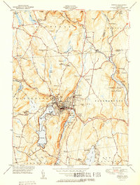 1951 Winsted1951 Print · USGSLitchfield County's industrial valleys and summer camps are captured here in the early fifties. Genealogists and historians can trace the New York New Haven and Hartford rail corridor or locate The Little Red Schoolhouse and Barkhamsted Lighthouse.2 unique versions available
 - 1951 Map of New Hartford
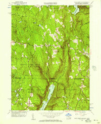
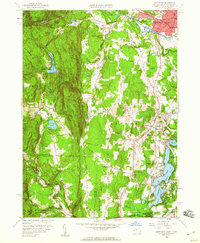
 1951 New Hartford1951 Print · USGSLitchfield and Hartford Counties appear here in the early fifties, centered on the massive Barkhamsted Reservoir and Saville Dam. Researchers can locate historic sites like the Washington Hill Ch, the Riverside Cem, and the Indian Council Cave.2 unique versions available
 - 1954 Map of Tolland
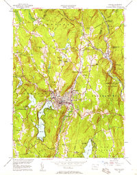
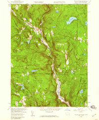
 1954 Tolland1954 Print · USGSThe Massachusetts-Connecticut borderlands appear here in the early fifties, defined by the winding Farmington River West Branch and high forest reserves. Researchers can trace historic road networks like Blandford Road and locate rural settlements such as Roosterville, McClayville, and Montville.
 - 1955 Map of West Granville, 1957 Print
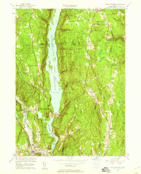
 1955 West Granville1957 Print · USGSThe Massachusetts and Connecticut borderlands appear here in the mid-1950s, characterized by vast state forests and major reservoir projects. Genealogists can trace family names and local landmarks like Tolland Cem, Hartland Sch, and the West Granville village center.2 unique versions available
 - 1956 Map of Winsted, 1958 Print
 1956 Winsted1958 Print · USGSMid-century Litchfield County is centered here on the industrial hub of Winsted and the recreation-rich Highland Lake. Genealogists and historians can locate The Little Red Schoolhouse, the Old North Road Burying Ground, and the nascent Hogsback Dam.7 unique versions available
 - 1956 Map of New Hartford, 1959 Print
 1956 New Hartford1959 Print · USGSMid-century Litchfield and Hartford counties are defined here by the massive reservoir systems and sprawling state forests. Researchers can trace rural life and infrastructure through the Saville Dam, the local Drive-in Theater, and the Barkhamsted Cem.6 unique versions available
 - 1956 Map of Albany, 1968 Print
 1956 Albany1968 Print · USGSThe industrial heart of the Northeast is revealed in the mid-1950s, from the Hudson Valley to the Connecticut River. Researchers can trace the legacy of the Quabbin Reservoir, locate Westover Air Force Base, or follow the Rutland RR through the Green Mountains.2 unique versions available
 - 1957 Map of Albany
 1957 Albany1957 Print · USGSThe Tri-State region and Connecticut River Valley are captured here during a period of significant postwar growth and infrastructure expansion. Genealogists and historians can trace the rail-and-river economy through landmarks like the Boston and Maine railroad, Quabbin Reservoir, and Westover Air Force Base.
 - 1958 Map of Tolland Center, 1959 Print
 1958 Tolland Center1959 Print · USGSThe borderlands of Massachusetts and Connecticut appear here in the late fifties, showcasing a landscape of state forests and river-cut valleys. Genealogists and hikers can trace old roads to Tolland Center, Roberts Cem, and the waters of Doolittle Lake.5 unique versions available
 - 1958 Map of Southwick, 1960 Print
 1958 Southwick1960 Print · USGSThe Massachusetts-Connecticut border at the end of the fifties reveals a landscape of wooded ridges and active lakeside communities. Genealogists and locals can trace family roots through Mundale, Gillett Corner, and the Congamond Lakes near Babbs Beach.2 unique versions available
 - 1959 Map of Albany
 1959 Albany1959 Print · USGSThe Hudson and Connecticut River valleys are captured here during the late fifties, showing the region's dense rail networks and massive water projects. Researchers can trace the New York State Thruway or locate local landmarks like Mt Greylock and the Quabbin Reservoir.
End of results
Showing maps 1-11 of 11
Top cities near Hartland
- West Hartford historical maps
- Westfield historical maps
- Torrington historical maps
- Windsor historical maps
- Simsbury historical maps
- Bloomfield historical maps
See more
Top neighborhoods of Hartland
Frequently asked questions
- What are the different types of historical maps available for Hartland?
- What is the oldest map of Hartland?
- Where can I purchase historical maps of Hartland for my home or office?
- Where can I download high-res historical maps of Hartland?
- Are there historical topographic maps available for Hartland?
- Is there historical aerial imagery available for Hartland?
- Where are historical maps of Hartland sourced from?