Old Maps of Cowgills Corner, Delaware for Academic Research
Study the evolution of Cowgills Corner with 19 high-resolution historic maps. Whether you're teaching, researching, or modeling changes in land use, these maps provide essential visual documentation of urban, environmental, and geographic change.
- Analyze long-term change: Track patterns in development, transportation, and natural features.
- Ideal for environmental or urban studies: Support academic projects with primary historical map data.
- Use in the classroom or lab: Educators and researchers rely on these maps to bring historical context to life.
These maps are a powerful tool for teaching, research, and visualizing how Cowgills Corner has changed over the decades.
Cowgills Corner, DE maps
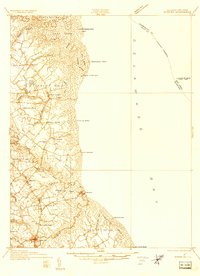
(19)- 1899 Map of Vineland
 1899 Vineland1899 Print · USGSCumberland and Salem counties come alive in the late nineteenth century, showcasing a thriving coastal economy of rail lines and river ports. Genealogists and researchers can trace family lands near Maskells Mill, the oyster docks of Bivalve, or the rural junction at New England Cross Roads.3 unique versions available
 - 1919 Map of Vineland, 1921 Print
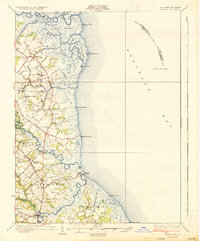
 1919 Vineland1921 Print · USGSCumberland County’s coastal oyster ports and inland industrial centers are captured here during a period of peak maritime activity. Genealogists and historians can trace rail lines like the Central R. R. of New Jersey or locate vanished sites like Whitehall Ldg. and Sheppards Mill.
 - 1934 Map of Bowers
 1934 Bowers1934 Print · USGSCoastal Kent County in the mid-1930s is a landscape of tidal marshes and tight-knit farming communities tied to the bay. Researchers can trace ancestral roots at Barratts Chapel, find rural schoolhouses like St Jones Sch, and locate old river settlements like Barkers Landing.
 - 1936 Map of Bowers
 1936 Bowers1936 Print · USGSCoastal Kent County appears in the mid-1930s as a landscape of tidal marshes, small farming districts, and vital river landings. Genealogists can trace family footprints through sites like Barretts Chapel, Barkers Landing, and rural schools like Cowgill Sch.4 unique versions available
 - 1946 Map of Wilmington, 1948 Print
 1946 Wilmington1948 Print · USGSThe Delaware Valley and Jersey Shore emerge in this mid-century portrait of a region defined by river commerce and seaside growth. Genealogists and historians can trace the rail networks of the Pennsylvania Railroad, locate early airfields like Dover Airpark, and find river defenses at Fort Delaware.2 unique versions available
 - 1949 Map of Little Creek
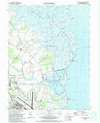
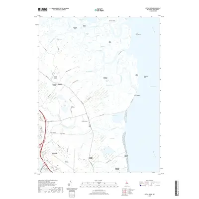
 1949 Little Creek1949 Print · USGSThe Delaware coast in the late 1940s shows a landscape of tidal marshes and growing military aviation. Researchers can locate the Friends Meetinghouse, the Moors Cem, and the specialized Dover Army Air Base Strafing Range near the Mahon River.3 unique versions available
 - 1955 Map of Wilmington
 1955 Wilmington1955 Print · USGSThe Delaware Valley and Jersey Shore are seen here during the mid-fifties era of rapid suburban expansion and highway development. You can trace the path of the New Jersey Turnpike, locate the Fort Dix Military Reservation, or explore the rail networks of the Pennsylvania Railroad.
 - 1956 Map of Little Creek, 1958 Print
 1956 Little Creek1958 Print · USGSThe Kent County coast in the mid-1950s shows a landscape of tidal marshes and military expansion. Genealogists can trace family sites at the Friends Meetinghouse or Moors Cem while exploring the docks at Dona Landing.5 unique versions available
 - 1957 Map of Wilmington
 1957 Wilmington1957 Print · USGSThe mid-Atlantic coastal plain comes alive in the mid-fifties as the New Jersey Turnpike and Garden State Parkway redefine travel. Researchers can trace the rail-to-road transition and find landmarks like Ship John Shoal Light and the Fort Dix Military Reservation.2 unique versions available
 - 1959 Map of Wilmington
 1959 Wilmington1959 Print · USGSThe Delaware Valley and Jersey Shore are seen here in the late fifties, during a period of massive suburban and highway expansion. Researchers can trace mid-century infrastructure like the N J Turnpike or locate coastal landmarks from Barnegat Bay to the Maurice River.3 unique versions available
 - 1966 Map of Wilmington, 1968 Print
 1966 Wilmington1968 Print · USGSThe Delaware Valley and Jersey Shore are seen here in the mid-1960s, documenting a landscape of dense industrial cities and emerging coastal resorts. Researchers can trace the sprawling rail networks of the Pennsylvania Railroad or locate landmarks like Fort Dix Military Reservation and Elk Neck State Park.4 unique versions available
 - 1972 Map of Wilmington, 1976 Print
 1972 Wilmington1976 Print · USGSThe Delaware Valley and Jersey Shore are seen here in the 1970s, showcasing the region's dense transport networks and vast state forests. Trace early coastal development near Atlantic City or locate rural landmarks like Mount Holly and Dover Air Force Base.2 unique versions available
 - 1984 Map of Dover, 1985 Print
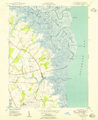
 1984 Dover1985 Print · USGSThe Delaware Bay coastline and its surrounding communities are captured here in the mid-1980s. Genealogists and historians can trace the growth of Dover, locate rural landmarks like St Augustine, or study the rail networks of CONRAIL and the Dover Air Force Base.
 - 1993 Map of Little Creek
 1993 Little Creek1993 Print · USGSThe Delaware coastline near Little Creek comes to life in the early nineties as the vast marshlands meet the expanding outskirts of Dover. Researchers can trace family sites at Friends Meetinghouse Cem, explore the reaches of Port Mahon, or locate the historic Leipsic River Range Light.
 - 2011 Map of Little Creek, 2011 Print
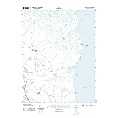 2011 Little Creek2011 Print · USGSCovers Cowgills Corner, including Dover, Little Creek, and other nearby areas
 - 2014 Map of Little Creek, 2014 Print
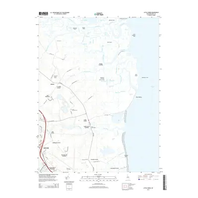 2014 Little Creek2014 Print · USGSCovers Cowgills Corner, including Dover, Little Creek, and other nearby areas
 - 2016 Map of Little Creek, 2016 Print
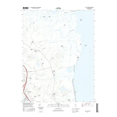 2016 Little Creek2016 Print · USGSCovers Cowgills Corner, including Dover, Little Creek, and other nearby areas
 - 2019 Map of Little Creek, 2019 Print
 2019 Little Creek2019 Print · USGSCovers Cowgills Corner, including Dover, Little Creek, and other nearby areas
 - 2023 Map of Little Creek, 2023 Print
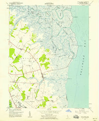
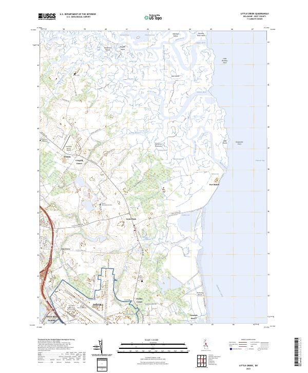 2023 Little Creek2023 Print · USGSThe Kent County coast comes into focus in this contemporary survey of the salt marshes and military installations east of Dover. Researchers can trace the legacy of local families at Moors Cem and Little Creek Cem or explore the maritime edge at Port Mahon.
End of results
Showing maps 1-19 of 19
Top cities near Cowgills Corner
- Dover historical maps
- Smyrna historical maps
- Middletown historical maps
- Fairfield Township historical maps
- Hopewell Township historical maps
- Highland Acres historical maps
See more
Frequently asked questions
- What are the different types of historical maps available for Cowgills Corner?
- What is the oldest map of Cowgills Corner?
- Where can I purchase historical maps of Cowgills Corner for my home or office?
- Where can I download high-res historical maps of Cowgills Corner?
- Are there historical topographic maps available for Cowgills Corner?
- Is there historical aerial imagery available for Cowgills Corner?
- Where are historical maps of Cowgills Corner sourced from?