Old Maps of Milford, Delaware
Explore 26 old maps of Milford, spanning from 1918 to today. These high-resolution historic maps reveal how streets, neighborhoods, landmarks, and natural features evolved over time — perfect for genealogy, metal detecting, research, and local history exploration.
What you can do with these maps:
- See how Milford changed over time: Compare historical maps to modern-day views to trace roads, homesites, rail lines & more.
- View detailed metadata: Each map includes creators, publishers, year, scale, and archive source.
- Overlay maps with satellite & LiDAR: Visualize the past alongside modern tools to explore terrain & human change.
- Trusted historical sources: Maps sourced from the USGS, Library of Congress, and other archives.
- Access maps your way: View online, download high-res files, or order prints for personal or research use.
Start exploring old maps of Milford to uncover forgotten places, hidden landmarks, and the deep history beneath your feet.
Milford, DE maps
(26)- 1918 Map of Cedar Creek
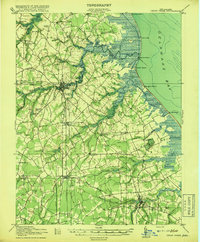 1918 Cedar Creek1918 Print · USGSDelaware's bay coast during the Great War era reveals a landscape of tidal marshes and remote beach landings. Researchers can trace rural Sussex County life through sites like Old Baptist Ch, Mispillion River LH, and the P. B. and W. RR.2 unique versions available
 - 1919 Map of Cedar Creek
 1919 Cedar Creek1919 Print · USGSSussex County's coastal necks and rail towns are captured here at the end of the Great War. Genealogists can trace family schoolhouses like Cave Neck School and Slaughter Neck School or locate old water-powered sites such as Marshall Mill Pond.
 - 1938 Map of Cedar Creek
 1938 Cedar Creek1938 Print · USGSCoastal Sussex County in the late 1930s shows a landscape of tidal necks and millponds connected by the P B AND W RR. Genealogists can trace family footprints across dozens of local school sites like Wesleys School and the Old Baptist Church.2 unique versions available
 - 1944 Map of Cedar Creek
 1944 Cedar Creek1944 Print · USGSCoastal Sussex County is documented here during the mid-forties, showing the vital rail and maritime connections of the Delaware Bay shore. Researchers can trace family roots through numerous rural landmarks like Sour Apple Tree Sch, Slaughter Beach, and the Old Baptist Church.
 - 1946 Map of Salisbury, 1948 Print
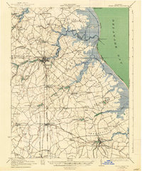
 1946 Salisbury1948 Print · USGSThe Delmarva Peninsula in the late nineteen-forties shows a landscape defined by its deep river arteries and emerging coastal defenses. Genealogists and historians can trace rail-connected towns like Federalsburg or locate maritime landmarks such as the Ocean City Seaplane Base and Fort Miles Military Reservation.4 unique versions available
 - 1947 Map of Salisbury, 1948 Print
 1947 Salisbury1948 Print · USGSThe Delmarva Peninsula in the late forties reveals a coastal landscape of maritime defense and growing seaside towns. Trace the post-war footprint of Salisbury, the strategic Fort Miles Military Reservation, and the Ocean City Seaplane Base.
 - 1948 Map of Salisbury, 1951 Print
 1948 Salisbury1951 Print · USGSThe Delmarva Peninsula in the late 1940s is shown here as a busy network of rail-towns and coastal outposts. Researchers can trace the legacy of the Pennsylvania Railroad through inland hubs like Georgetown or the maritime reaches of Crisfield and Cape May.
 - 1949 Map of Mispillion River
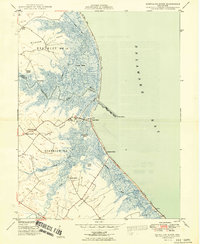 1949 Mispillion River1949 Print · USGSThe Delaware coast near the mouth of the Mispillion River was a landscape of tidal marshes and isolated necks during the late nineteen-forties. Genealogists and historians can trace old landings like Maloneys Landing and community landmarks such as Cedar Neck Ch and Fort Saulsbury.2 unique versions available
 - 1954 Map of Milford, 1955 Print
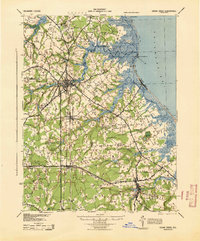
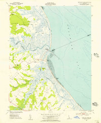
 1954 Milford1955 Print · USGSThe coastal plain of Delaware's Kent and Sussex counties is captured in the mid-fifties, centered on the hub of Milford. Genealogists and historians can trace the evolution of the MISPILLION RIVER waterfront, family landmarks like Abbotts Pond, and the old I O O F Cemetery.3 unique versions available
 - 1955 Map of Mispillion River, 1956 Print
 1955 Mispillion River1956 Print · USGSCoastal Sussex County in the mid-fifties is captured here as a network of salt marshes, river landings, and maritime outposts. Genealogists can trace family landmarks like Cedar Neck Ch and Fort Saulsbury, or locate early sites like Majorleys Landing.3 unique versions available
 - 1957 Map of Salisbury
 1957 Salisbury1957 Print · USGSThe Delmarva Peninsula in the mid-1950s reveals a landscape of coastal defenses and rail-driven commerce. Researchers can trace the Pennsylvania railroad lines or locate historic landmarks like the Fenwick Island Lighthouse and St Martin church.
 - 1961 Map of Salisbury
 1961 Salisbury1961 Print · USGSThe Delmarva Peninsula comes into focus in the early sixties, showing the vital road and rail networks connecting the Chesapeake to the Atlantic. Genealogists and historians can trace family-named landings and coastal landmarks from Crisfield to the Brandywine Shoal Lighthouse.
 - 1965 Map of Salisbury
 1965 Salisbury1965 Print · USGSThe Delmarva Peninsula in the mid-1960s is depicted here as a landscape of coastal defenses and maritime hubs. Genealogists and local historians can trace the foundations of bayside towns like Crisfield and the tactical positioning of the Fort Miles Military Reservation and Cape May Naval Air Station.
 - 1984 Map of Seaford, 1986 Print
 1984 Seaford1986 Print · USGSCoastal Delaware and the Maryland borderlands are captured here in the mid-eighties as modern tourism and traditional agriculture coexist. Researchers can trace the rail-and-river routes through Seaford, explore inland millponds like Chipman Pond, or study the shoreline at Cape Henlopen.2 unique versions available
 - 1993 Map of Milford
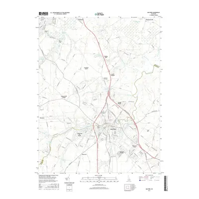
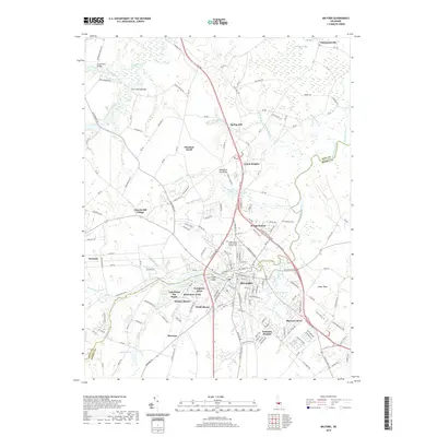
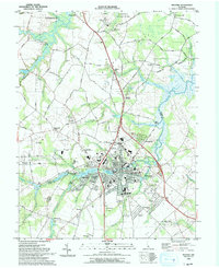 1993 Milford1993 Print · USGSMilford and the Kent-Sussex county line appear here in the early nineties, showing a landscape defined by tidewater rivers and growing residential tracts. Trace local landmarks like the historic Abbotts Mill, the Banneker School, and the waters of Silver Lake.
 - 1993 Map of Mispillion River
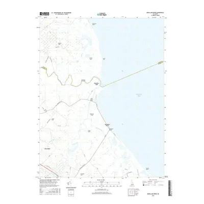
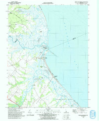 1993 Mispillion River1993 Print · USGSCoastal Sussex County is captured here in the early nineties, where the river meets the bay at the historic Mispillion Light. Researchers can trace local heritage through maritime sites like Fort Saulsbury and old river landings including Revills Landing and Davis Landing.
 - 2011 Map of Mispillion River, 2011 Print
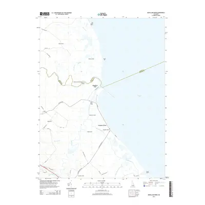
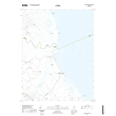
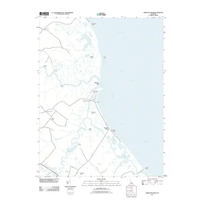 2011 Mispillion River2011 Print · USGSCovers Milford, including Slaughter Beach, Mispillion Light, and other nearby areas
 - 2011 Map of Milford, 2011 Print
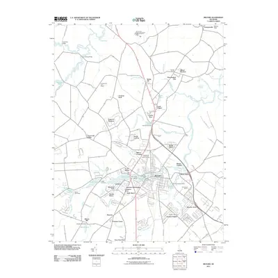 2011 Milford2011 Print · USGSCovers Milford, including Houston, Hall Estates, and other nearby areas
 - 2014 Map of Milford, 2014 Print
 2014 Milford2014 Print · USGSCovers Milford, including Houston, Hall Estates, and other nearby areas
 - 2014 Map of Mispillion River, 2014 Print
 2014 Mispillion River2014 Print · USGSCovers Milford, including Slaughter Beach, Mispillion Light, and other nearby areas
 - 2016 Map of Milford, 2016 Print
 2016 Milford2016 Print · USGSCovers Milford, including Houston, Hall Estates, and other nearby areas
 - 2016 Map of Mispillion River, 2016 Print
 2016 Mispillion River2016 Print · USGSCovers Milford, including Slaughter Beach, Mispillion Light, and other nearby areas
 - 2019 Map of Milford, 2019 Print
 2019 Milford2019 Print · USGSCovers Milford, including Houston, Hall Estates, and other nearby areas
 - 2019 Map of Mispillion River, 2019 Print
 2019 Mispillion River2019 Print · USGSCovers Milford, including Slaughter Beach, Mispillion Light, and other nearby areas
 - 2023 Map of Milford, 2023 Print
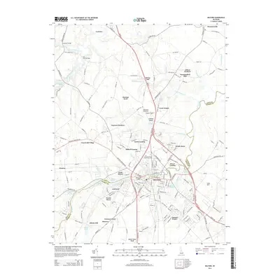
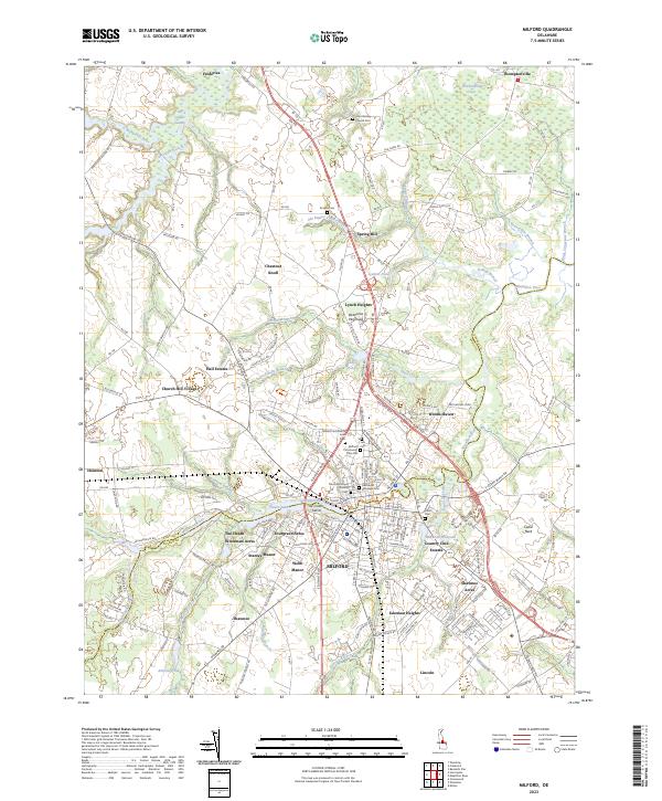 2023 Milford2023 Print · USGSThe Kent and Sussex county line meets at the Mispillion River in this 2023 survey of the Milford area. Genealogists can trace family heritage through the Old Community Cem, John Wesley Church, and Lynch Heights.
Showing maps 1-25 of 26
Top cities near Milford
- Dover historical maps
- Georgetown historical maps
- Highland Acres historical maps
- Harrington historical maps
- Lewes historical maps
- Dover Base historical maps
See more
Top neighborhoods of Milford
Frequently asked questions
- What are the different types of historical maps available for Milford?
- What is the oldest map of Milford?
- Where can I purchase historical maps of Milford for my home or office?
- Where can I download high-res historical maps of Milford?
- Are there historical topographic maps available for Milford?
- Is there historical aerial imagery available for Milford?
- Where are historical maps of Milford sourced from?