Old Maps of Alachua County, Florida for Hiking & Exploration
Hike through history with 176 historic maps of Alachua County. Explore old trails, ghost towns, and forgotten backroads — perfect for outdoor adventurers and local explorers.
- Rediscover forgotten places: Map out old mining camps, roads, and footpaths that no longer exist on modern maps.
- Layer with modern tools: Combine with LiDAR or satellite views to plan hikes through historical terrain.
- Made for exploration: Popular among hikers, overlanders, and local history lovers.
Use these maps to find adventure and explore the hidden past of Alachua County.
Alachua County, FL maps
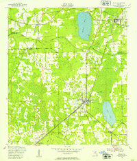
(176)- 1890 Map of Arredondo, 1955 Print
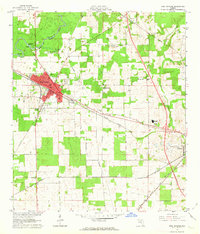
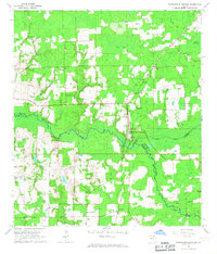
 1890 Arredondo1955 Print · USGSAlachua County at the end of the nineteenth century shows a landscape where iron rails were rapidly connecting old prairie settlements. Genealogists and historians can trace the early rail stops at Arredondo, locate the distinctive Devils Mill Hopper, and see the early layout of Gainesville.2 unique versions available
 - 1892 Map of Arredondo
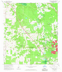
 1892 Arredondo1892 Print · USGSAlachua County is captured here in the late nineteenth century as a hub of early Florida rail commerce. Genealogists and historians can trace the foundations of Gainesville and smaller rural communities such as Arredondo, Stewartville, and Micanopy.
 - 1893 Map of Citra, 1960 Print
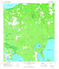
 1893 Citra1960 Print · USGSMarion County in the late nineteenth century was a hub of industrial mining and railroad expansion. Genealogists and historians can trace the early phosphate boom at the French Phosphate Mines or locate old rail stops in Citra, McIntosh, and Anthony.
 - 1894 Map of Arredondo
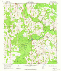
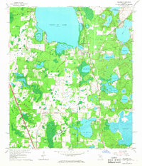
 1894 Arredondo1894 Print · USGSAlachua County at the close of the nineteenth century is defined by its new rail junctions and expansive, shifting wet prairies. Researchers can trace the early footprints of Gainesville or locate vanished sites near Arredondo, Kanapaha, and the banks of Levy Lake.6 unique versions available
 - 1895 Map of Williston
 1895 Williston1895 Print · USGSNorth Central Florida in the mid-1890s reveals a landscape shaped by phosphate mining and the arrival of the iron horse. Genealogists and historians can trace early rail hubs like Williston and Montbrook, alongside industrial sites like Standard Mine and Phosphate.6 unique versions available
 - 1895 Map of Citra
 1895 Citra1895 Print · USGSNorthern Marion County and southern Alachua County are shown here in the 1890s, when phosphate mining and citrus transport drove the local economy. Trace the old rail lines and explore the sites of the French Phosphate Mines, Citra, and McIntosh.6 unique versions available
 - 1938 Map of Hawthorn
 1938 Hawthorn1938 Print · USGSAlachua County in the late thirties is a landscape of intersecting railroads and sprawling lakeside settlements. Genealogists and historians can trace the foundations of Hawthorn, locate remote burial sites like Riley Cem, and explore the rail junctions at Micanopy Junction.
 - 1941 Map of Starke, 1942 Print
 1941 Starke1942 Print · USGSNorth Florida at the start of the 1940s reveals a region rapidly transforming with the mobilization for war. Genealogists and historians can trace old rail lines like the Seaboard Air Line and find communities like Sampson City or the expansive Camp Blanding Military Reservation.
 - 1943 Map of Hawthorn, 1963 Print
 1943 Hawthorn1963 Print · USGSAlachua County during the early war years reveals a landscape defined by its great lakes and a dual-railroad economy. Researchers can trace the routes of the Seaboard Air Line, locate rural landmarks like Ochwilla Church, or find family roots at Providence Cem and Drummond Cem.
 - 1948 Map of Starke
 1948 Starke1948 Print · USGSThe Florida lake country south of Starke is captured here shortly after the war, showing a landscape defined by citrus-era rail lines and massive military training grounds. Genealogists can trace family roots through settlements like Sampson City, Waldo, and the lakeside community of Keystone Heights.
 - 1949 Map of Waldo, 1953 Print
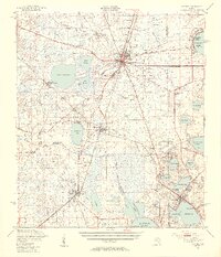
 1949 Waldo1953 Print · USGSAlachua and Bradford Counties are captured at a post-war peak of rail activity during the late 1940s. Genealogists and rail historians can trace the intersection of the Seaboard Air Line and Southern railroads through Waldo and Hampton.3 unique versions available
 - 1949 Map of Keystone Heights, 1953 Print
 1949 Keystone Heights1953 Print · USGSFlorida's lake country is captured here in the years following World War II, showing the growth of Keystone Heights and its neighboring waters. Genealogists and researchers can trace the locations of the Brooklyn Sch, the Cem at Theressa, and the early layout of Tibbits Park Palms.4 unique versions available
 - 1949 Map of Starke, 1955 Print
 1949 Starke1955 Print · USGSNorth Florida at the mid-century reveals a landscape of lakeside settlements and vital rail junctions centered on Starke. Genealogists and historians can trace family roots through rural landmarks like Rising Sch, New Hope Ch, and the station at Sampson City Sta.2 unique versions available
 - 1954 Map of Gainesville, 1965 Print
 1954 Gainesville1965 Print · USGSMid-century North Central Florida comes into focus as a landscape of timber, rails, and river towns along the Gulf. Trace family roots in established centers like Gainesville or follow the path of the Suwannee River to the coastal docks of Cedar Key.3 unique versions available
 - 1955 Map of Bronson NE, 1956 Print
 1955 Bronson NE1956 Print · USGSLevy County's rural landscape in the mid-fifties reveals a network of sinkhole ponds and early industrial sites. Local historians can trace the Seaboard Air Line and Old Railroad Grade near Merediths or locate the Smith Cem.3 unique versions available
 - 1958 Map of Gainesville
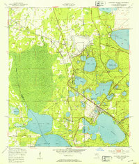
 1958 Gainesville1958 Print · USGSNorth Central Florida’s rail and river networks are frozen in time just before the interstate era. Genealogists and historians can trace the paths of the Atlantic Coast Line through Gainesville or locate coastal settlements like Steinhatchee and Cedar Key.
 - 1959 Map of Gainesville
 1959 Gainesville1959 Print · USGSNorth Florida in the mid-fifties is seen here from the Gulf coast to the inland lakes, showing the rail-and-river network before modern highways dominated. Researchers can trace the paths of the Seaboard Air Line through towns like Chiefland and Micanopy, or explore the coastal inlets of Waccasassa Bay.
 - 1962 Map of High Springs, 1963 Print
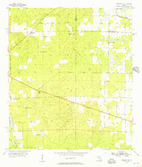
 1962 High Springs1963 Print · USGSHigh Springs and its surrounding rail corridors are captured here in the early sixties, as the region's transportation and agricultural networks were fully matured. Genealogists and local historians can trace rural family landmarks like Traxier Ch, Asberry Cem, and the springs along the Santa Fe River.5 unique versions available
 - 1962 Map of Mikesville, 1964 Print
 1962 Mikesville1964 Print · USGSColumbia County in the early sixties was a landscape of quiet crossroads and riverside parks. Researchers can trace family roots through numerous local landmarks like Mikesville Ch, Bland, and the unique Sky Road Inn Airfield.3 unique versions available
 - 1966 Map of Micanopy
 1966 Micanopy1966 Print · USGSFlorida's interior wetlands and historical land grants are captured here during the mid-1960s, just as the Gainesville suburbs began to push south. Researchers can trace the legacy of old Spanish grants and locate local landmarks like Oak Ridge Cem, the settlement of Tacoma, and Hale Airport.3 unique versions available
 - 1966 Map of Orange Heights
 1966 Orange Heights1966 Print · USGSAlachua County's interior wetlands and Spanish land grant legacy are on full display in the mid-sixties. Genealogists and local historians can trace family roots through the Copeland Settlement, Windsor, and the Orange Heights Cem.4 unique versions available
 - 1966 Map of Worthington Springs, 1967 Print
 1966 Worthington Springs1967 Print · USGSNorth central Florida’s river-crossing communities are documented here in the mid-1960s, showing a landscape of small hamlets and riverside industry. Genealogists can trace family landmarks at Bethany Cem or Fort Call Cem and follow the old Atlantic Coast Line rail route through Worthington Springs.
 - 1966 Map of Gainesville West, 1967 Print
 1966 Gainesville West1967 Print · USGSGainesville and Alachua County are captured during a period of rapid westward suburbanization in the mid-sixties. Researchers can trace the development of neighborhoods like Buckingham West alongside older landmarks such as Warren Cave and Terwilliger Sch.6 unique versions available
 - 1966 Map of Rochelle, 1967 Print
 1966 Rochelle1967 Print · USGSAlachua County is captured in the mid-1960s as a landscape of rail-linked settlements and ancient land grants. Researchers can trace family history at St Pauls Cem or locate the old Seaboard Coast Line junction at Micanopy Junction.3 unique versions available
 - 1966 Map of Melrose, 1967 Print
 1966 Melrose1967 Print · USGSThe northern Florida lake country comes alive in the 1960s, showing a landscape defined by the convergence of four county lines at Melrose. Genealogists and historians can trace rail-side communities like Campville and find local landmarks such as St Johns Ch and Nelson Cem.3 unique versions available
Showing maps 1-25 of 176
Top cities of Alachua County
- Gainesville historical maps
- Alachua historical maps
- High Springs historical maps
- Newberry historical maps
- Hawthorne historical maps
- Archer historical maps
See more
Frequently asked questions
- What are the different types of historical maps available for Alachua County?
- What is the oldest map of Alachua County?
- Where can I purchase historical maps of Alachua County for my home or office?
- Where can I download high-res historical maps of Alachua County?
- Are there historical topographic maps available for Alachua County?
- Is there historical aerial imagery available for Alachua County?
- Where are historical maps of Alachua County sourced from?