1960s Maps of Alachua County, Florida
Explore 23 historic maps of Alachua County from the 1960s. These maps offer a rare glimpse into what life looked like during the 1960s — showing old roads, neighborhoods, homes, and landmarks that have changed or disappeared over time.
Whether you're researching your family's past, planning a metal detecting trip, or studying how Alachua County's landscape evolved across the 1960s, these high-resolution maps are a powerful tool for exploring the history of this region.
- Focus on a specific era: All maps on this page are from the 1960s, giving you a focused view of this time period.
- See what’s changed: Compare century-old streets, trails, and buildings to today's modern landscape using overlays and satellite layers.
- Research with precision: Use these maps for genealogy, historical research, land use analysis, or educational projects.
- View, download, or print: Maps are fully viewable online in high resolution, and can be downloaded or printed for your own records.
Start exploring Alachua County's history through authentic maps from the 1960s. This is your window into the past.
Alachua County, FL maps
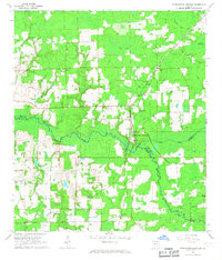
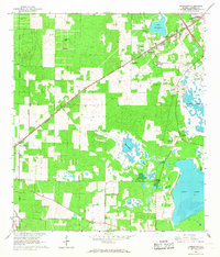
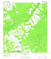
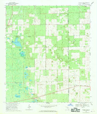
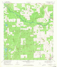
(23)- 1962 Map of High Springs, 1963 Print
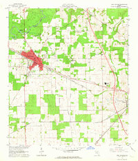 1962 High Springs1963 Print · USGSHigh Springs and its surrounding rail corridors are captured here in the early sixties, as the region's transportation and agricultural networks were fully matured. Genealogists and local historians can trace rural family landmarks like Traxier Ch, Asberry Cem, and the springs along the Santa Fe River.5 unique versions available
 - 1962 Map of Mikesville, 1964 Print
 1962 Mikesville1964 Print · USGSColumbia County in the early sixties was a landscape of quiet crossroads and riverside parks. Researchers can trace family roots through numerous local landmarks like Mikesville Ch, Bland, and the unique Sky Road Inn Airfield.3 unique versions available
 - 1966 Map of Micanopy
 1966 Micanopy1966 Print · USGSFlorida's interior wetlands and historical land grants are captured here during the mid-1960s, just as the Gainesville suburbs began to push south. Researchers can trace the legacy of old Spanish grants and locate local landmarks like Oak Ridge Cem, the settlement of Tacoma, and Hale Airport.3 unique versions available
 - 1966 Map of Orange Heights
 1966 Orange Heights1966 Print · USGSAlachua County's interior wetlands and Spanish land grant legacy are on full display in the mid-sixties. Genealogists and local historians can trace family roots through the Copeland Settlement, Windsor, and the Orange Heights Cem.4 unique versions available
 - 1966 Map of Worthington Springs, 1967 Print
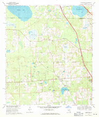
 1966 Worthington Springs1967 Print · USGSNorth central Florida’s river-crossing communities are documented here in the mid-1960s, showing a landscape of small hamlets and riverside industry. Genealogists can trace family landmarks at Bethany Cem or Fort Call Cem and follow the old Atlantic Coast Line rail route through Worthington Springs.
 - 1966 Map of Gainesville West, 1967 Print
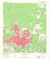
 1966 Gainesville West1967 Print · USGSGainesville and Alachua County are captured during a period of rapid westward suburbanization in the mid-sixties. Researchers can trace the development of neighborhoods like Buckingham West alongside older landmarks such as Warren Cave and Terwilliger Sch.6 unique versions available
 - 1966 Map of Rochelle, 1967 Print
 1966 Rochelle1967 Print · USGSAlachua County is captured in the mid-1960s as a landscape of rail-linked settlements and ancient land grants. Researchers can trace family history at St Pauls Cem or locate the old Seaboard Coast Line junction at Micanopy Junction.3 unique versions available
 - 1966 Map of Melrose, 1967 Print
 1966 Melrose1967 Print · USGSThe northern Florida lake country comes alive in the 1960s, showing a landscape defined by the convergence of four county lines at Melrose. Genealogists and historians can trace rail-side communities like Campville and find local landmarks such as St Johns Ch and Nelson Cem.3 unique versions available
 - 1966 Map of Arredondo, 1967 Print
 1966 Arredondo1967 Print · USGSAlachua County in the mid-sixties shows a landscape of sinkholes and prairies shaped by old rail lines and new post-war growth. Researchers can trace the Arredondo Grant Boundary or locate historic sites like Kanapaha Cem and the Gainesville Speedway.3 unique versions available
 - 1966 Map of Gainesville East, 1967 Print
 1966 Gainesville East1967 Print · USGSGainesville is shown during a period of significant mid-century growth, as the university and residential developments expand into the surrounding pine lands and bays. Researchers can trace the footprints of Sunland Training Center, Lincoln High Sch, and old rail lines like the Seaboard Coast Line.4 unique versions available
 - 1966 Map of Monteocha, 1967 Print
 1966 Monteocha1967 Print · USGSThe Florida borderlands of Bradford and Alachua Counties come into focus in the mid-1960s, showing a landscape defined by the Santa Fe River and Mud Swamp. Genealogists and historians can trace community roots through numerous landmarks like Rhuda Branch Cem, Monteocha, and Old Jerusalem Ch.2 unique versions available
 - 1966 Map of Hawthorne, 1967 Print
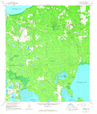
 1966 Hawthorne1967 Print · USGSHawthorne and its surrounding lake country are captured in the mid-1960s, showing a landscape defined by the Seaboard Coast Line and numerous Florida prairies. Researchers can find old community hubs like McMeekin, the Gordon Chapel at the edge of Bream Lake, and the rural Drummond Cem.3 unique versions available
 - 1966 Map of Brooker, 1967 Print
 1966 Brooker1967 Print · USGSBrooker and the New River basin are shown in the mid-1960s, documenting a landscape of rural settlements and timberlands. Researchers can locate family-named landmarks like Dekles Millpond, the Dedan Cem, and several local churches including Long Bridge Ch.4 unique versions available
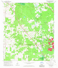
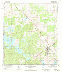
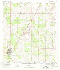
 - 1966 Map of Alachua, 1967 Print
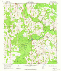
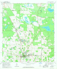
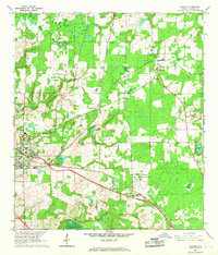 1966 Alachua1967 Print · USGSAlachua and the surrounding farmlands are captured in the mid-sixties during a period of agricultural and rail transition. Genealogists can trace family footprints at Newnansville Cem and Old Thomas Cem, or locate rural landmarks like Shiloh Ch.4 unique versions available
 - 1967 Map of Citra, 1969 Print
 1967 Citra1969 Print · USGSThe Florida lake country around Citra and Island Grove is captured here in the late sixties as the region transitioned toward modern agriculture. Genealogists and historians can locate several rural cemeteries like Antioch Cem and trace the path of the Seaboard Coast Line railroad.3 unique versions available
 - 1968 Map of Newberry SW, 1969 Print
 1968 Newberry SW1969 Print · USGSThe swampy lowlands of the Levy and Gilchrist county line are documented here in the late sixties, showing a landscape defined by springs and ponds. Genealogists and historians can locate the Fort Waccasassa Site, Ebenezer Ch, and family landmarks like Asbell Creek Bridge.2 unique versions available
 - 1968 Map of Waters Lake, 1970 Print
 1968 Waters Lake1970 Print · USGSFlorida's northern interior at the end of the 1960s reveals a landscape of isolated farmsteads and scattered rural churches along the Gilchrist Co border. Genealogists and local historians can trace family ties to Center Hill Cem or the small community of Buda near the Seaboard Coast Line.3 unique versions available
 - 1968 Map of Archer, 1970 Print
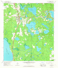
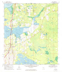
 1968 Archer1970 Print · USGSArcher and its surrounding pond country are captured here in the late sixties as the local rail and agricultural economy persisted. Researchers can locate family landmarks like Laurel Hill Cem, the Archer Community Sch, and old community nodes at Pinesville.3 unique versions available
 - 1968 Map of Newberry, 1970 Print
 1968 Newberry1970 Print · USGSAlachua County in the late sixties reveals a landscape of limestone extraction and rural crossroads communities. Genealogists and historians can locate family landmarks like Forest Grove Cem, the community of Haile, and numerous industrial quarries along the SEABOARD COAST LINE.4 unique versions available
 - 1968 Map of McIntosh, 1971 Print
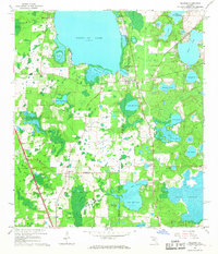
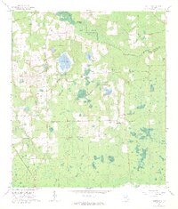
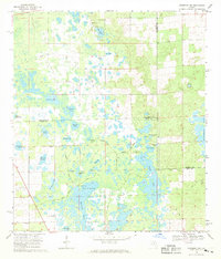
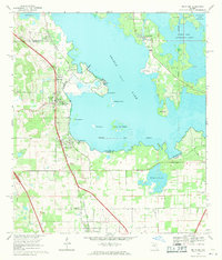 1968 McIntosh1971 Print · USGSNorth-central Florida's lake country is captured here in the late sixties as the rail-and-road corridor through McIntosh served a landscape of citrus and wetlands. Genealogists can trace property near the Arredondo Grant Boundary or locate family landmarks like Rawlings Park and the small town of Evinston.3 unique versions available
 - 1969 Map of High Springs SW, 1971 Print
 1969 High Springs SW1971 Print · USGSThe riverfronts of Gilchrist and Columbia counties are captured here in the late sixties, as the Santa Fe River winds past numerous natural springs. Trace the rural railroad settlements of Buda and Neals or locate family history at Nobel Hill Cem.3 unique versions available
 - 1969 Map of Flemington, 1971 Print
 1969 Flemington1971 Print · USGSThis late 1960s survey of the Marion and Alachua county borderlands shows a landscape of wet prairies and quiet rural settlements. Genealogists can trace family roots through sites like Shiloh Cem and Canaan Ch, or locate old landmarks like the Lookout Tower.2 unique versions available
 - 1969 Map of Williston, 1971 Print
 1969 Williston1971 Print · USGSFlorida's limestone country and the rail corridors of Levy County are documented here in the late sixties. Genealogists and researchers can locate several rural churches and burial grounds like New Hope Cem, the Orange Hill Cem, and St Josephs Ch.2 unique versions available
End of results
Showing maps 1-23 of 23
Top cities of Alachua County
- Gainesville historical maps
- Alachua historical maps
- High Springs historical maps
- Newberry historical maps
- Hawthorne historical maps
- Archer historical maps
See more
Frequently asked questions
- What are the different types of historical maps available for Alachua County?
- What is the oldest map of Alachua County?
- Where can I purchase historical maps of Alachua County for my home or office?
- Where can I download high-res historical maps of Alachua County?
- Are there historical topographic maps available for Alachua County?
- Is there historical aerial imagery available for Alachua County?
- Where are historical maps of Alachua County sourced from?