Old Maps of Olustee, Florida for Genealogy
Trace your family roots with 11 historic maps of Olustee. These high-res maps reveal old neighborhoods, homesites, landmarks, and streets — helping you uncover where your ancestors lived and how the area evolved over time.
- Explore historic neighborhoods: Identify where your relatives may have lived in the 1800s or 1900s.
- Compare maps over time: Trace the changes in streets, buildings, and landmarks for multi-generational research.
- Perfect for genealogy & ancestry research: Used by family historians and researchers to map out lineage and migration.
These maps are an incredible resource for exploring your personal connection to Olustee's past.
Olustee, FL maps
(11)- 1954 Map of Valdosta, 1967 Print
 1954 Valdosta1967 Print · USGSThe South Georgia and North Florida borderlands are captured here in the mid-fifties, showing the deep timber and wetland networks of the coastal plain. Researchers can trace the path of the Atlantic Coast Line through Valdosta or explore the interior of the Okefenokee Swamp.2 unique versions available
 - 1958 Map of Valdosta
 1958 Valdosta1958 Print · USGSSouth Georgia and North Florida are captured here in the mid-fifties, showing the vast Okefenokee Swamp and the vital timber and rail corridors connecting the two states. Researchers can locate the footprint of Moody Air Force Base, trace the Live Oak Perry and Gulf railroad, or find early community sites like Bakers Mill and Paradise Church.
 - 1959 Map of Valdosta
 1959 Valdosta1959 Print · USGSThe Georgia-Florida borderlands in the mid-fifties reveal a landscape of massive blackwater swamps and emerging military aviation hubs. Genealogists and historians can trace rail-stop towns like Fargo and Stockton or explore the interior reaches of the Okefenokee Swamp and Billys Island.
 - 1963 Map of Olustee, 1964 Print
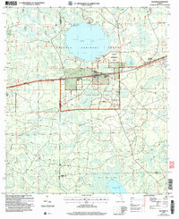
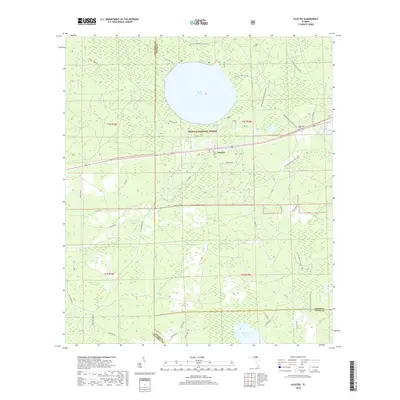
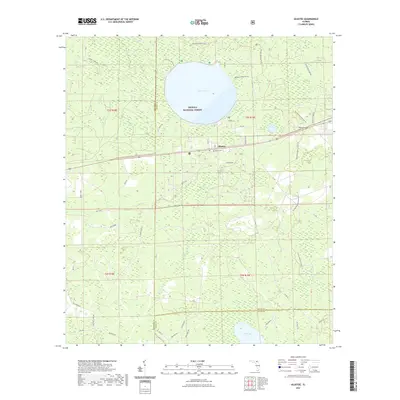
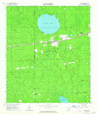 1963 Olustee1964 Print · USGSBaker County at the dawn of the sixties remains a landscape of dense pine woods and significant Civil War heritage. Researchers can trace the rail lines of the Seaboard Air Line or locate family sites near Dyess Cem and the Olustee Battlefield State Mon.3 unique versions available
 - 1981 Map of Lake City
 1981 Lake City1981 Print · USGSNorth Florida and South Georgia are mapped in the early eighties as the region balanced forestry with growing infrastructure. Genealogists can trace family names and locations from Live Oak to Macclenny, or find cultural landmarks like the Stephen Foster State Folk Culture Center.2 unique versions available
 - 2005 Map of Olustee, 2006 Print
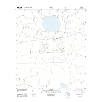
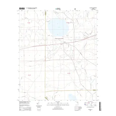
 2005 Olustee2006 Print · USGSBaker County at the start of the 21st century remains a landscape of managed timberlands and significant Civil War heritage. Local historians can trace the grounds of the Olustee Battlefield Hist Site or locate family markers at Dyess Cem and Monument Cem.
 - 2012 Map of Olustee, 2012 Print
 2012 Olustee2012 Print · USGSCovers Olustee, including Columbia County, Baker County, and other nearby areas
 - 2015 Map of Olustee, 2015 Print
 2015 Olustee2015 Print · USGSCovers Olustee, including Columbia County, Baker County, and other nearby areas
 - 2018 Map of Olustee, 2018 Print
 2018 Olustee2018 Print · USGSCovers Olustee, including Columbia County, Baker County, and other nearby areas
 - 2021 Map of Olustee, 2021 Print
 2021 Olustee2021 Print · USGSCovers Olustee, including Columbia County, Baker County, and other nearby areas
 - 2024 Map of Olustee, 2024 Print
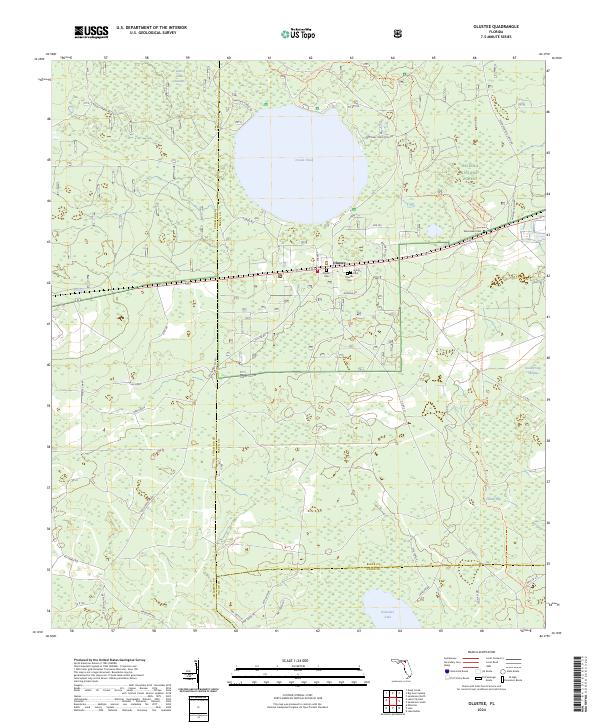 2024 Olustee2024 Print · USGSThe Osceola National Forest in the mid-2020s remains a landscape of deep swamps and forest trails. Genealogists and historians can locate family landmarks like Dyess Cem and Arline Cem or trace the path of the Olustee Battlefield Trl.
End of results
Showing maps 1-11 of 11
Top cities near Olustee
Frequently asked questions
- What are the different types of historical maps available for Olustee?
- What is the oldest map of Olustee?
- Where can I purchase historical maps of Olustee for my home or office?
- Where can I download high-res historical maps of Olustee?
- Are there historical topographic maps available for Olustee?
- Is there historical aerial imagery available for Olustee?
- Where are historical maps of Olustee sourced from?