1960s Maps of Bradford County, Florida
Explore 5 historic maps of Bradford County from the 1960s. These maps offer a rare glimpse into what life looked like during the 1960s — showing old roads, neighborhoods, homes, and landmarks that have changed or disappeared over time.
Whether you're researching your family's past, planning a metal detecting trip, or studying how Bradford County's landscape evolved across the 1960s, these high-resolution maps are a powerful tool for exploring the history of this region.
- Focus on a specific era: All maps on this page are from the 1960s, giving you a focused view of this time period.
- See what’s changed: Compare century-old streets, trails, and buildings to today's modern landscape using overlays and satellite layers.
- Research with precision: Use these maps for genealogy, historical research, land use analysis, or educational projects.
- View, download, or print: Maps are fully viewable online in high resolution, and can be downloaded or printed for your own records.
Start exploring Bradford County's history through authentic maps from the 1960s. This is your window into the past.
Bradford County, FL maps
(5)- 1966 Map of Lake Butler
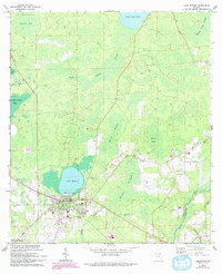 1966 Lake Butler1966 Print · USGSLake Butler and its surrounding Union County wetlands are captured here in the mid-sixties, showing a landscape shaped by timber and water. Genealogists can trace family landmarks like Varnes Cemetery or the community at Johnstown, while explorers can follow the Old Railroad Grade and Richard Millpond.3 unique versions available
 - 1966 Map of Worthington Springs, 1967 Print
 1966 Worthington Springs1967 Print · USGSNorth central Florida’s river-crossing communities are documented here in the mid-1960s, showing a landscape of small hamlets and riverside industry. Genealogists can trace family landmarks at Bethany Cem or Fort Call Cem and follow the old Atlantic Coast Line rail route through Worthington Springs.
 - 1966 Map of Melrose, 1967 Print
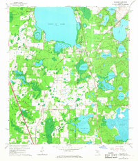 1966 Melrose1967 Print · USGSThe northern Florida lake country comes alive in the 1960s, showing a landscape defined by the convergence of four county lines at Melrose. Genealogists and historians can trace rail-side communities like Campville and find local landmarks such as St Johns Ch and Nelson Cem.3 unique versions available
 - 1966 Map of Monteocha, 1967 Print
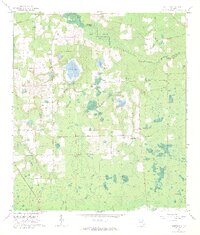 1966 Monteocha1967 Print · USGSThe Florida borderlands of Bradford and Alachua Counties come into focus in the mid-1960s, showing a landscape defined by the Santa Fe River and Mud Swamp. Genealogists and historians can trace community roots through numerous landmarks like Rhuda Branch Cem, Monteocha, and Old Jerusalem Ch.2 unique versions available
 - 1966 Map of Brooker, 1967 Print
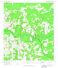
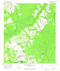 1966 Brooker1967 Print · USGSBrooker and the New River basin are shown in the mid-1960s, documenting a landscape of rural settlements and timberlands. Researchers can locate family-named landmarks like Dekles Millpond, the Dedan Cem, and several local churches including Long Bridge Ch.4 unique versions available
End of results
Showing maps 1-5 of 5
Top cities of Bradford County
Frequently asked questions
- What are the different types of historical maps available for Bradford County?
- What is the oldest map of Bradford County?
- Where can I purchase historical maps of Bradford County for my home or office?
- Where can I download high-res historical maps of Bradford County?
- Are there historical topographic maps available for Bradford County?
- Is there historical aerial imagery available for Bradford County?
- Where are historical maps of Bradford County sourced from?