Old Maps of Palm Bay, Florida
Explore 63 old maps of Palm Bay, spanning from 1949 to today. These high-resolution historic maps reveal how streets, neighborhoods, landmarks, and natural features evolved over time — perfect for genealogy, metal detecting, research, and local history exploration.
What you can do with these maps:
- See how Palm Bay changed over time: Compare historical maps to modern-day views to trace roads, homesites, rail lines & more.
- View detailed metadata: Each map includes creators, publishers, year, scale, and archive source.
- Overlay maps with satellite & LiDAR: Visualize the past alongside modern tools to explore terrain & human change.
- Trusted historical sources: Maps sourced from the USGS, Library of Congress, and other archives.
- Access maps your way: View online, download high-res files, or order prints for personal or research use.
Start exploring old maps of Palm Bay to uncover forgotten places, hidden landmarks, and the deep history beneath your feet.
Palm Bay, FL maps
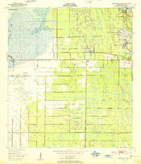
(63)- 1949 Map of Melbourne West, 1958 Print
 1949 Melbourne West1958 Print · USGSBrevard County underwent a post-war transition as the aviation industry and land reclamation reshaped the interior marshlands. Researchers can trace the layout of the Malabar Naval Air Station and early residential pockets like Melbourne Village or June Park.8 unique versions available
 - 1949 Map of Fellsmere, 1959 Print
 1949 Fellsmere1959 Print · USGSThe town of Fellsmere and its surrounding marshlands are captured here in the post-war era, showing a landscape defined by drainage and rail. Researchers can trace the path of the Trans Florida Central Line and locate the Old Sebastian Cem.5 unique versions available
 - 1949 Map of Melbourne East, 1960 Print
 1949 Melbourne East1960 Print · USGSThe Florida coast near the mid-century shows a network of citrus and rail towns connected by the Melbourne Causeway. Genealogists and researchers can trace the early development of Eau Gallie, find the cemetery at Crane Creek, or locate the Ruins near Malabar.5 unique versions available
 - 1949 Map of Grant, 1968 Print
 1949 Grant1968 Print · USGSThe Florida coastline between Malabar and Micco appears here just after the war, featuring the Valkaria Naval Air Station. Researchers can trace the Florida East Coast rail line through Grant and explore islands like Grant Farm Island.4 unique versions available
 - 1951 Map of Melbourne East
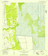
 1951 Melbourne East1951 Print · USGSThe Space Coast shoreline comes alive in the early fifties, showing the mainland growth of Melbourne and Eau Gallie before the height of the space race. Trace the early layout of Indialantic, the path of the Florida East Coast rail line, and waterfront landmarks like Wells Park.
 - 1951 Map of Fellsmere
 1951 Fellsmere1951 Print · USGSIndian River County's inland landscape was a mix of canal engineering and citrus-era transport just after the war. Researchers can trace the Trans Florida Central Line, locate the Old Sebastian Cem, and find Brookside.
 - 1951 Map of Melbourne West
 1951 Melbourne West1951 Print · USGSBrevard County was entering a new era of growth and aviation during the early fifties, before the space age transformed the region. Researchers can trace the layout of the Malabar Naval Air Station and early neighborhoods like June Park and Eau Gallie.
 - 1951 Map of Grant
 1951 Grant1951 Print · USGSCoastal Brevard County comes into focus in the early fifties, showing the interplay of naval aviation and quiet riverfront life. Genealogists and local historians can trace the foundations of Valkaria, the Cemetery near Grant, and the rail stops along the Florida East Coast.
 - 1953 Map of Fellsmere SW, 1954 Print
 1953 Fellsmere SW1954 Print · USGSThe Florida marshlands during the early 1950s show an environment being actively reshaped by drainage engineering. Trace the early water management systems of St Johns Marsh through its network of Levees, Flowing Wells, and the Trans Florida rail line.3 unique versions available
 - 1953 Map of Fellsmere NW, 1954 Print
 1953 Fellsmere NW1954 Print · USGSBrevard County was undergoing a major transformation in the early 1950s as engineers reshaped the Florida wetlands. Researchers can trace the mid-century hydrological changes through the network of Levee and Spoil Bank systems surrounding St Johns Marsh.3 unique versions available
 - 1953 Map of Deer Park SE, 1954 Print
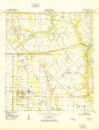
 1953 Deer Park SE1954 Print · USGSThe Upper St. Johns River Basin in the early 1950s is a landscape of vast wetlands and early water management. Researchers can trace the path of the Old Railroad Grade and locate significant archaeological sites such as North Indian Field and Middle Indian Field.5 unique versions available
 - 1953 Map of Kenansville NE, 1954 Print
 1953 Kenansville NE1954 Print · USGSFlorida’s interior wetlands come into focus in the early fifties as engineers began to reshape the landscape. Local historians can trace the early infrastructure of Tenmile Ranch, find several Flowing Well sites, and locate landmarks like Mulberry Mound.3 unique versions available
 - 1955 Map of Orlando, 1969 Print
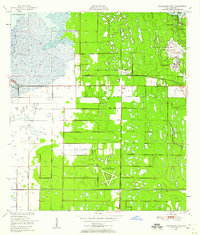
 1955 Orlando1969 Print · USGSCentral Florida was entering the space age in the mid-fifties, balancing its citrus heritage with new military and aerospace frontiers. You can trace early developments at Kennedy Space Center or locate interior settlements like Eatonville and Pine Castle.3 unique versions available
 - 1956 Map of Fort Pierce, 1965 Print
 1956 Fort Pierce1965 Print · USGSCentral and coastal Florida appear here during a period of rapid post-war growth and industrial expansion. Researchers can trace the mid-century rail-to-highway transition along the Sunshine State Parkway or locate old settlements like Ankona, Walton, and Indrio.4 unique versions available
 - 1957 Map of Orlando
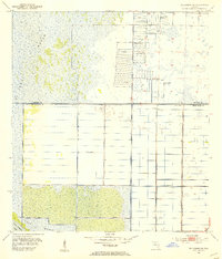
 1957 Orlando1957 Print · USGSCovers Palm Bay, including Orlando, Lakeland, and other nearby areas
 - 1958 Map of Fort Pierce
 1958 Fort Pierce1958 Print · USGSCentral and South Florida are captured here in the late fifties as the citrus and ranching interior met the modern highway era. Researchers can trace the early path of the Sunshine State Parkway and locate established rail depots in Sebring, Okeechobee, and Arcadia.
 - 1958 Map of Orlando
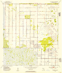
 1958 Orlando1958 Print · USGSCentral Florida was a landscape of citrus, rail, and emerging aerospace technology during the late fifties. Researchers can trace the early footprints of Cape Canaveral and Patrick Air Force Base or locate inland citrus and rail hubs like Sanford and Lakeland.
 - 1959 Map of Fort Pierce
 1959 Fort Pierce1959 Print · USGSCentral Florida and the Treasure Coast are shown here in the late fifties, during a period of steady citrus and coastal growth. Trace the historic routes of the Florida East Coast Ry or locate the boundaries of the Seminole Indian Reservation and Highlands Hammock State Park.3 unique versions available
 - 1962 Map of Orlando
 1962 Orlando1962 Print · USGSCentral Florida was transformed by aerospace and citrus at the start of the sixties. Genealogists and historians can trace old community footprints from Eau Gallie to Leesburg, alongside landmarks like McCoy AFB and the winding Econlockhatchee River.
 - 1981 Map of Vero Beach, 1982 Print
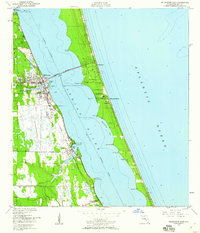
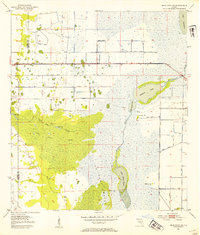
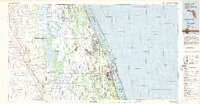 1981 Vero Beach1982 Print · USGSThe Florida Atlantic coast and the upper St. Johns River basin are shown here in the early 1980s during a period of steady coastal growth. Researchers can trace the development of Vero Beach and Palm Bay or locate inland landmarks like Blue Cypress Lake and the Valkaria Missile Tracking Station.
 - 1981 Map of Cape Canaveral, 1983 Print
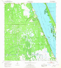
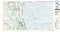 1981 Cape Canaveral1983 Print · USGSThe Space Coast and the Florida marshlands meet in the early eighties as aerospace technology and nature preserves sit side-by-side. Trace the development of Cocoa Beach, the sprawling grounds of the Kennedy Space Center, and the inland waters of Lake Poinsett.
 - 1985 Map of Vero Beach, 1986 Print
 1985 Vero Beach1986 Print · USGSThe Florida coast and St. Johns River headwaters are captured here in the mid-eighties, from the Atlantic shoreline to the interior marshes. You can trace the Florida East Coast RR through Sebastian or locate the Valkaria Missile Tracking Station near the coast.
 - 1988 Map of Fort Pierce
 1988 Fort Pierce1988 Print · USGSThe Atlantic coast and Florida’s interior lakelands are captured in the late eighties, just as the Treasure Coast was experiencing rapid development. Genealogists and historians can trace the rail lines of the Florida East Coast and explore the bounds of the Brighton Indian Reservation.
 - 2012 Map of Melbourne East, 2012 Print
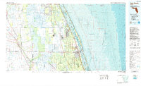
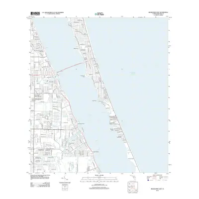 2012 Melbourne East2012 Print · USGSCovers Palm Bay, including Melbourne, Melbourne Beach, and other nearby areas
 - 2012 Map of Deer Park SE, 2012 Print
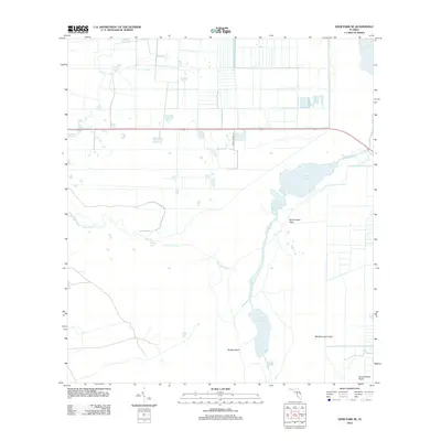 2012 Deer Park SE2012 Print · USGSCovers Palm Bay, including Brevard County, Osceola County, and other nearby areas
Showing maps 1-25 of 63
Top cities near Palm Bay
- Melbourne historical maps
- West Melbourne historical maps
- Sebastian historical maps
- Satellite Beach historical maps
- Micco historical maps
- Indian Harbour Beach historical maps
See more
Top neighborhoods of Palm Bay
- Bayside Lakes historical maps
- Country Club Vista historical maps
- Holiday Park historical maps
- Woodlake Village historical maps
- The Falls historical maps
- Vista Oaks historical maps
See more
Frequently asked questions
- What are the different types of historical maps available for Palm Bay?
- What is the oldest map of Palm Bay?
- Where can I purchase historical maps of Palm Bay for my home or office?
- Where can I download high-res historical maps of Palm Bay?
- Are there historical topographic maps available for Palm Bay?
- Is there historical aerial imagery available for Palm Bay?
- Where are historical maps of Palm Bay sourced from?