1960s Maps of Citrus County, Florida
Explore 3 historic maps of Citrus County from the 1960s. These maps offer a rare glimpse into what life looked like during the 1960s — showing old roads, neighborhoods, homes, and landmarks that have changed or disappeared over time.
Whether you're researching your family's past, planning a metal detecting trip, or studying how Citrus County's landscape evolved across the 1960s, these high-resolution maps are a powerful tool for exploring the history of this region.
- Focus on a specific era: All maps on this page are from the 1960s, giving you a focused view of this time period.
- See what’s changed: Compare century-old streets, trails, and buildings to today's modern landscape using overlays and satellite layers.
- Research with precision: Use these maps for genealogy, historical research, land use analysis, or educational projects.
- View, download, or print: Maps are fully viewable online in high resolution, and can be downloaded or printed for your own records.
Start exploring Citrus County's history through authentic maps from the 1960s. This is your window into the past.
Citrus County, FL maps
(3)- 1964 Map of Plant City
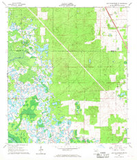
 1964 Plant City1964 Print · USGSThe West Florida coast and its interior rail corridors come alive in this mid-sixties survey, spanning from the gulf marshes to the agricultural heartland. Researchers can trace the routes of the Atlantic Coast Line through settlements like Bushnell, Inverness, and Plant City.
 - 1966 Map of Lake Panasoffkee NW, 1968 Print
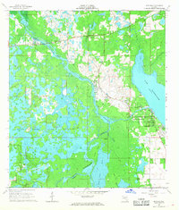
 1966 Lake Panasoffkee NW1968 Print · USGSThe wetlands of Sumter and Marion County were a complex maze of springs and swamps during the mid-1960s. Researchers can trace the Old Railroad Grade or locate the Nichols Cem and Gum Springs within this riverine landscape.4 unique versions available
 - 1967 Map of Rutland, 1968 Print
 1967 Rutland1968 Print · USGSSumter County was a labyrinth of wetlands and river bends in the late 1960s, dominated by the winding course of the Withlacoochee River. Genealogists and historians can trace old homesteads near Rutland, locate the Rutland Cem, or follow the path of an old Railroad Grade.2 unique versions available
End of results
Showing maps 1-3 of 3
Top cities of Citrus County
- Homosassa Springs historical maps
- Sugarmill Woods historical maps
- Pine Ridge historical maps
- Beverly Hills historical maps
- Citrus Hills historical maps
- Hernando historical maps
See more
Frequently asked questions
- What are the different types of historical maps available for Citrus County?
- What is the oldest map of Citrus County?
- Where can I purchase historical maps of Citrus County for my home or office?
- Where can I download high-res historical maps of Citrus County?
- Are there historical topographic maps available for Citrus County?
- Is there historical aerial imagery available for Citrus County?
- Where are historical maps of Citrus County sourced from?