Old Maps of Middleburg, Florida for Academic Research
Study the evolution of Middleburg with 17 high-resolution historic maps. Whether you're teaching, researching, or modeling changes in land use, these maps provide essential visual documentation of urban, environmental, and geographic change.
- Analyze long-term change: Track patterns in development, transportation, and natural features.
- Ideal for environmental or urban studies: Support academic projects with primary historical map data.
- Use in the classroom or lab: Educators and researchers rely on these maps to bring historical context to life.
These maps are a powerful tool for teaching, research, and visualizing how Middleburg has changed over the decades.
Middleburg, FL maps
(17)- 1918 Map of Middleburg
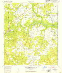
 1918 Middleburg1918 Print · USGSClay County near the end of the Great War reveals a landscape of isolated settlements and vital creek crossings. Genealogists and historians can trace the foundations of local communities through the locations of Rideout Ferry, Black Creek Church, and several namesake institutions like the Bell School.4 unique versions available
 - 1941 Map of Middleburg, 1943 Print
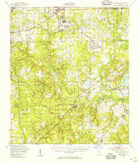
 1941 Middleburg1943 Print · USGSClay County at the dawn of the motorized era reveals a landscape of ferry crossings and rural schoolhouses connected by early roads. Researchers can trace the legacy of the Middleburg area through sites like the Rideout Ferry, Black Creek Church, and several named family schools.
 - 1948 Map of Jacksonville
 1948 Jacksonville1948 Print · USGSNortheast Florida and Southeast Georgia's coastal waterways and railroad towns are captured here in the years following the war. Genealogists can trace family connections through river towns like St Marys or identify long-standing military landmarks like Jacksonville NAS.
 - 1949 Map of Middleburg, 1953 Print
 1949 Middleburg1953 Print · USGSMiddleburg and the forks of Black Creek are captured here in the late Forties, showing a landscape of river ferries and rural airfields. Genealogists can locate family landmarks like Black Pond Ch or trace the Atlantic Coast Line near the abandoned kilns at Doctors Inlet.5 unique versions available
 - 1949 Map of Middleburg, 1955 Print
 1949 Middleburg1955 Print · USGSClay County at mid-century shows a landscape of deep-rooted river settlements and emerging Cold War aviation. Genealogists and historians can trace the foundations of Middleburg and Doctors Inlet, alongside notable sites like Rideout Ferry and Peoria Ch.
 - 1957 Map of Jacksonville, 1967 Print
 1957 Jacksonville1967 Print · USGSCoastal Florida and Georgia meet in the late fifties, showcasing a landscape of naval aviation, deep-water terminals, and barrier island communities. Researchers can trace the mid-century footprints of NAS Jacksonville, find small communities like Franklintown, and locate the historic Fort Clinch State Park.3 unique versions available
 - 1959 Map of Jacksonville
 1959 Jacksonville1959 Print · USGSNortheast Florida and Southeast Georgia are seen here in the late fifties, dominated by the maritime activity of the St Johns River and the Atlantic coast. Researchers can trace the mid-century layout of Jacksonville and identify sprawling military sites like Camp Blanding Military Reservation and Kings Bay Ammunition Terminal.
 - 1960 Map of Jacksonville
 1960 Jacksonville1960 Print · USGSCoastal Florida and Georgia meet in this mid-century portrait of a region shaped by naval power and the winding St Johns River. Researchers can trace the development of military sites like Cecil Field or locate historic rural landmarks such as Jerusalem Ch and Kings Ferry.
 - 1977 Map of Jacksonville, 1983 Print
 1977 Jacksonville1983 Print · USGSNortheast Florida during the late seventies shows a region defined by its deep-water naval bases and burgeoning riverfront suburbs. You can trace the rail networks of the Seaboard Coast Line, locate the Kingsley Plantation, and study the sprawling grounds of Cecil Field Naval Air Station.
 - 1980 Map of Jacksonville, 1984 Print
 1980 Jacksonville1984 Print · USGSThe Jacksonville metropolitan area and the Atlantic coast are captured here during a period of significant late-century growth. Researchers can trace the massive military footprints of Cecil Field and Mayport Naval Station alongside historic communities like Mandarin and Switzerland.
 - 1988 Map of Jacksonville
 1988 Jacksonville1988 Print · USGSCoastal Florida and Georgia are captured here during the late eighties, documenting the rapid growth of the First Coast and its vital military installations. Researchers can trace the development of beach communities like Fernandina Beach and Atlantic Beach or locate family landmarks near Mickler Landing and Orange Park.
 - 1993 Map of Middleburg
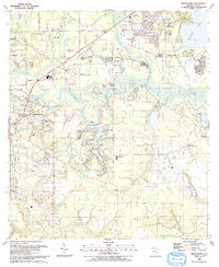 1993 Middleburg1993 Print · USGSClay County in the early nineties shows a landscape of deep river forks and growing residential communities. Genealogists and local historians can trace the development of Middleburg and Doctors Inlet, locating landmarks like Black Pond Ch and the St Johns River Community College.
 - 2012 Map of Middleburg, 2012 Print
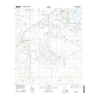
 2012 Middleburg2012 Print · USGSCovers Middleburg, including Rideout, Rattlesnake Bend, and other nearby areas
 - 2015 Map of Middleburg, 2015 Print
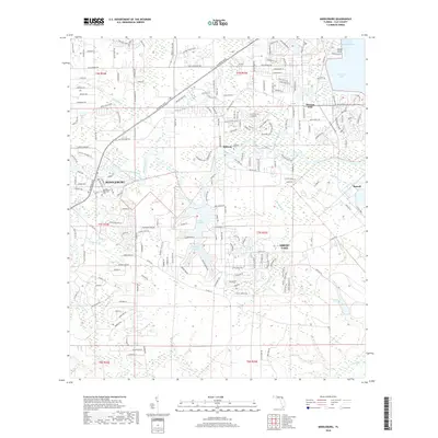
 2015 Middleburg2015 Print · USGSCovers Middleburg, including Rideout, Rattlesnake Bend, and other nearby areas
 - 2018 Map of Middleburg, 2018 Print
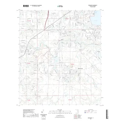
 2018 Middleburg2018 Print · USGSCovers Middleburg, including Rideout, Rattlesnake Bend, and other nearby areas
 - 2021 Map of Middleburg, 2021 Print
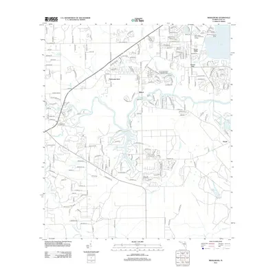
 2021 Middleburg2021 Print · USGSCovers Middleburg, including Rideout, Rattlesnake Bend, and other nearby areas
 - 2024 Map of Middleburg, 2024 Print
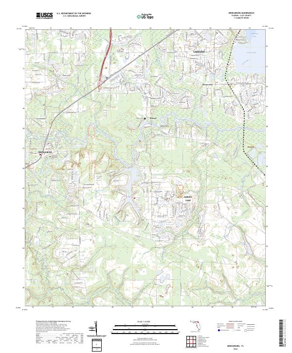 2024 Middleburg2024 Print · USGSClay County's interior and the sprawling banks of the Black Creek system are shown here as they appear in the early twenty-first century. Researchers can trace local heritage through the Middleburg Methodist Cem or explore the preserved wildlands of Jennings State Forest.
End of results
Showing maps 1-17 of 17
Top cities near Middleburg
- Jacksonville historical maps
- Orange Park historical maps
- Green Cove Springs historical maps
- Lawtey historical maps
- Penney Farms historical maps
Frequently asked questions
- What are the different types of historical maps available for Middleburg?
- What is the oldest map of Middleburg?
- Where can I purchase historical maps of Middleburg for my home or office?
- Where can I download high-res historical maps of Middleburg?
- Are there historical topographic maps available for Middleburg?
- Is there historical aerial imagery available for Middleburg?
- Where are historical maps of Middleburg sourced from?