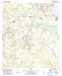
2024 Map of Middleburg
USGS Topo · Published 2024About this map
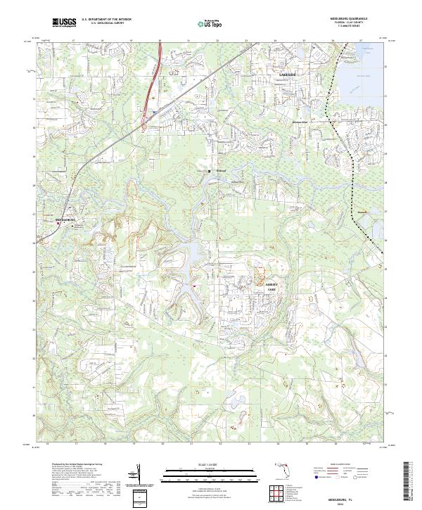
Middleburg and its surrounding communities sit at the confluence of the North Fork Black Creek and South Fork Black Creek, where the landscape transitions into a network of tributaries feeding the Doctors Lake basin. This modern mapping reflects the density of suburban development around Asbury Lake and Lakeside, juxtaposed against large preserved tracts like Jennings State Forest and the Black Creek Ravines Conservation Area. Genealogists will find historical continuity at the Middleburg Methodist Cem and the Rideout Cem near the settlement of Rideout. The map captures the current road network, including Blanding Blvd and Co Rd 218, illustrating how modern infrastructure has integrated with older locales such as Peoria Point and Russell.
Find a feature on this map
36 named features on this map. Tap any name to fly to it.
Don’t see what you’re looking for? This feature index may not catch every label — zoom into the map to look around manually.
Map Details
Editions of this 2024 Middleburg Map
This is the sole edition of this map. No revisions or reprints were ever made.
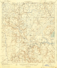
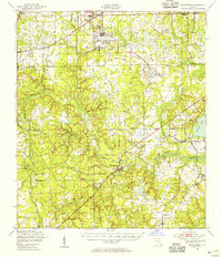
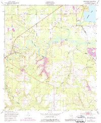
Historical Maps of Middleburg Through Time
6 maps found