Old Maps of Flagler Beach, Florida for Academic Research
Study the evolution of Flagler Beach with 29 high-resolution historic maps. Whether you're teaching, researching, or modeling changes in land use, these maps provide essential visual documentation of urban, environmental, and geographic change.
- Analyze long-term change: Track patterns in development, transportation, and natural features.
- Ideal for environmental or urban studies: Support academic projects with primary historical map data.
- Use in the classroom or lab: Educators and researchers rely on these maps to bring historical context to life.
These maps are a powerful tool for teaching, research, and visualizing how Flagler Beach has changed over the decades.
Flagler Beach, FL maps
(29)- 1927 Map of Matanzas
 1927 Matanzas1927 Print · USGSThe Florida coast near the border of St. Johns and Flagler Counties comes to life in this mid-1930s survey. Researchers can trace the early path of State Hy No 140 and locate vanished coastal sites like Summer Haven, Shell, and Hopper.
 - 1937 Map of Ormond
 1937 Ormond1937 Print · USGSCoastal Florida in the late thirties is defined by a landscape of vast cypress swamps and emerging rail towns. Genealogists and historians can trace old homesteads and industrial sites like the Relay Turpentine Still, Haywood Sta., and National Gardens.
 - 1943 Map of Matanzas, 1957 Print
 1943 Matanzas1957 Print · USGSThe Florida coast near the St. Johns and Flagler line is captured here during the mid-century, before massive development altered the shoreline. Researchers can trace the path of the Old Kings Road and locate sites like Marineland and Ft Matanzas.
 - 1944 Map of Ormond
 1944 Ormond1944 Print · USGSThe Florida coast south of Flagler Beach is captured here during the mid-forties as the railroad and the historic Old Kings Road shaped the shoreline. Genealogists and researchers can trace the early footprints of Ormond and Flagler Beach or locate the interior Turpentine Still.2 unique versions available
 - 1944 Map of Matanzas
 1944 Matanzas1944 Print · USGSThe Florida coast near the St. Johns and Flagler line is shown here in the mid-1940s, just as the region began its modern growth. Researchers can trace the historical Old Kings Road and locate early landmarks like Ft Matanzas, Summer Haven, and Marineland.
 - 1954 Map of Daytona Beach, 1974 Print
 1954 Daytona Beach1974 Print · USGSNortheast Florida is captured in the mid-1950s, showing the transition from river-based commerce to coastal tourism. Researchers can trace the Florida East Coast rail lines and find historic sites like Castillo de San Marcos Nat Mon and Palatka.
 - 1956 Map of Flagler Beach East, 1960 Print
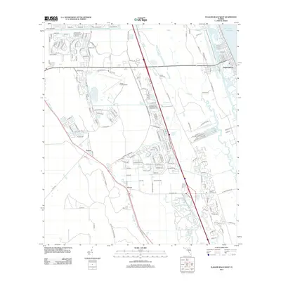
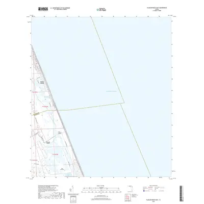
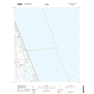
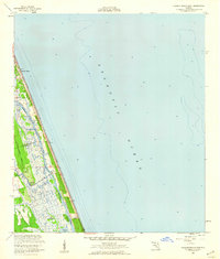 1956 Flagler Beach East1960 Print · USGSThe Florida coast at Flagler Beach is shown in the mid-fifties as the region's inland waterways and marshes remained largely undeveloped. Researchers can trace the Intracoastal Waterway past Mound Grove and locate the U S Coast Guard Reservation.3 unique versions available
 - 1956 Map of Flagler Beach West, 1960 Print
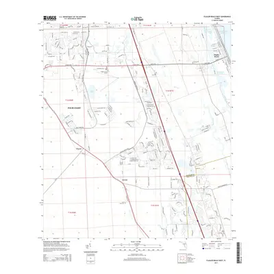
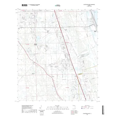
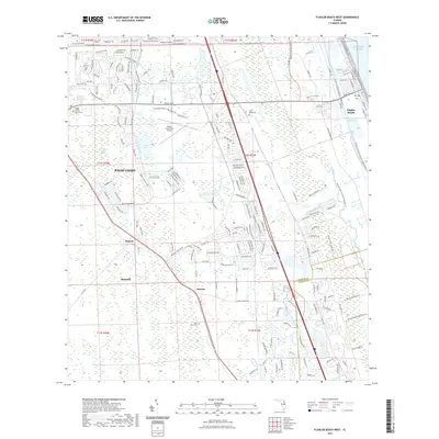
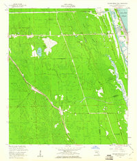 1956 Flagler Beach West1960 Print · USGSCoastal Florida in the mid-fifties is captured here as the interior marshes met growing transit corridors. Researchers can trace the legacy of the Florida East Coast railway or find local landmarks like the Good Hope Cem and Bulow Ruins State Monument.5 unique versions available
 - 1956 Map of Beverly Beach, 1961 Print
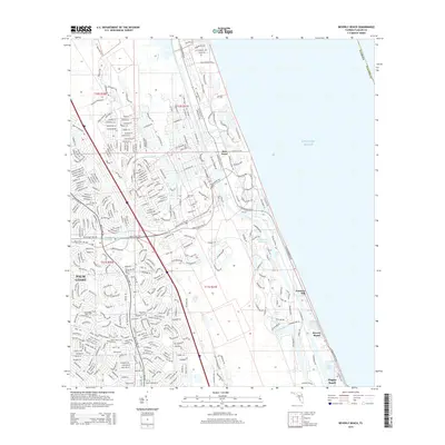
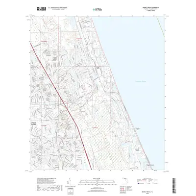
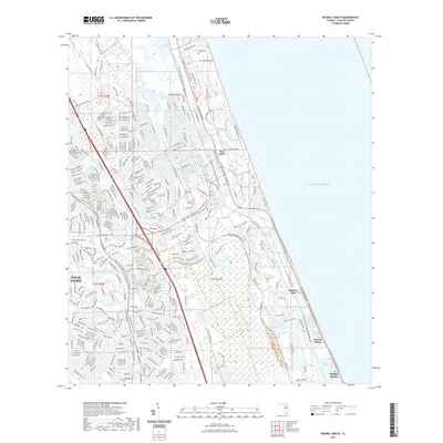
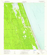 1956 Beverly Beach1961 Print · USGSThe Florida coast in the mid-fifties shows a delicate balance between new beachfront growth and the wild interior marshes. Genealogists and historians can trace the early layout of Beverly Beach or locate sites like Johnson Memorial Chapel and the historic Old Kings Road.5 unique versions available
 - 1958 Map of Daytona Beach
 1958 Daytona Beach1958 Print · USGSThe Florida coast and St. Johns River valley are captured in the late 1950s, showing a landscape defined by citrus-belt rail towns and Atlantic shorelines. Genealogists can trace family roots through riverside settlements like Palatka and Welaka or coastal hubs like Daytona Beach.2 unique versions available
 - 1964 Map of Daytona Beach
 1964 Daytona Beach1964 Print · USGSCoastal Florida in the mid-1960s shows a fascinating balance between burgeoning beach tourism and the deep interior wilderness of the Ocala National Forest. Researchers can trace the path of the Florida East Coast railway through historic settlements like St. Augustine, Marineland, and Palatka.
 - 1978 Map of Daytona Beach, 1980 Print
 1978 Daytona Beach1980 Print · USGSCoastal development meets the wild Florida interior in the late seventies, spanning from the Atlantic beaches to the St. Johns River. Trace the growth of Daytona Beach or find inland outposts like Salt Springs, De Leon Springs, and the U S Naval Reservation.2 unique versions available
 - 1981 Map of Saint Augustine, 1982 Print
 1981 Saint Augustine1982 Print · USGSNortheast Florida in the early eighties shows a landscape of deep river commerce and coastal growth. Genealogists and historians can trace the inland rail network of the Seaboard Coast Line through rural Hastings or explore the military footprint of Camp Blanding.2 unique versions available
 - 2012 Map of Beverly Beach, 2012 Print
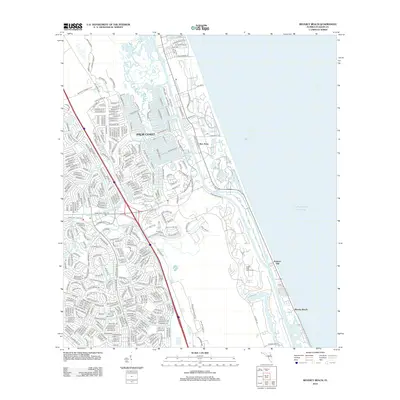 2012 Beverly Beach2012 Print · USGSCovers Flagler Beach, including Palm Coast, Beverly Beach, and other nearby areas
 - 2012 Map of Flagler Beach West, 2012 Print
 2012 Flagler Beach West2012 Print · USGSCovers Flagler Beach, including Palm Coast, Bunnell, and other nearby areas
 - 2012 Map of Flagler Beach East, 2012 Print
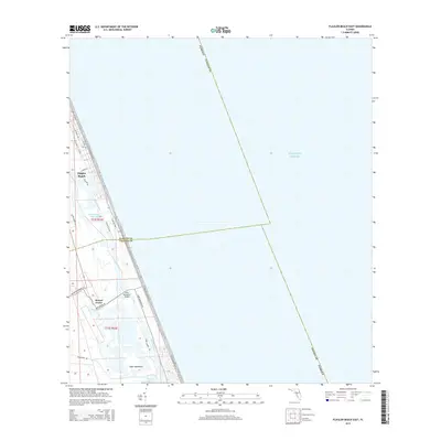
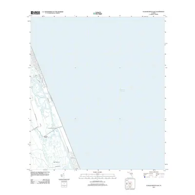 2012 Flagler Beach East2012 Print · USGSCovers Flagler Beach, including Mound Grove, Volusia County, and other nearby areas
 - 2015 Map of Flagler Beach East, 2015 Print
 2015 Flagler Beach East2015 Print · USGSCovers Flagler Beach, including Mound Grove, Volusia County, and other nearby areas
 - 2015 Map of Flagler Beach West, 2015 Print
 2015 Flagler Beach West2015 Print · USGSCovers Flagler Beach, including Palm Coast, Bunnell, and other nearby areas
 - 2015 Map of Beverly Beach, 2015 Print
 2015 Beverly Beach2015 Print · USGSCovers Flagler Beach, including Palm Coast, Beverly Beach, and other nearby areas
 - 2018 Map of Flagler Beach East, 2018 Print
 2018 Flagler Beach East2018 Print · USGSCovers Flagler Beach, including Mound Grove, Volusia County, and other nearby areas
 - 2018 Map of Flagler Beach West, 2018 Print
 2018 Flagler Beach West2018 Print · USGSCovers Flagler Beach, including Palm Coast, Bunnell, and other nearby areas
 - 2018 Map of Beverly Beach, 2018 Print
 2018 Beverly Beach2018 Print · USGSCovers Flagler Beach, including Palm Coast, Beverly Beach, and other nearby areas
 - 2021 Map of Flagler Beach East, 2021 Print
 2021 Flagler Beach East2021 Print · USGSCovers Flagler Beach, including Mound Grove, Volusia County, and other nearby areas
 - 2021 Map of Flagler Beach West, 2021 Print
 2021 Flagler Beach West2021 Print · USGSCovers Flagler Beach, including Palm Coast, Bunnell, and other nearby areas
 - 2021 Map of Beverly Beach, 2021 Print
 2021 Beverly Beach2021 Print · USGSCovers Flagler Beach, including Palm Coast, Beverly Beach, and other nearby areas
Showing maps 1-25 of 29
Top cities near Flagler Beach
- Palm Coast historical maps
- Daytona Beach historical maps
- Ormond Beach historical maps
- Holly Hill historical maps
- Bunnell historical maps
- Beverly Beach historical maps
See more
Top neighborhoods of Flagler Beach
Frequently asked questions
- What are the different types of historical maps available for Flagler Beach?
- What is the oldest map of Flagler Beach?
- Where can I purchase historical maps of Flagler Beach for my home or office?
- Where can I download high-res historical maps of Flagler Beach?
- Are there historical topographic maps available for Flagler Beach?
- Is there historical aerial imagery available for Flagler Beach?
- Where are historical maps of Flagler Beach sourced from?