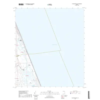
2018 Map of Flagler Beach East
USGS Topo · Published 2018About this map
Flagler Beach occupies a narrow barrier strip between the Atlantic Ocean and the Intracoastal Waterway, marking a landscape defined by its coastal geography and early 21st-century residential patterns. This coastal region transitions from the urban grid of S Central Ave and S Daytona Ave into the ecologically complex wetlands of the Halifax River and Tomoka Basin. To the south, the settlement of Mound Grove and the landmark Knox Memorial Bridge anchor the area where Bulow Creek meets the tidal marshes. The map documents the intricate network of canals and waterways that parallel Ocean Shore Blvd, providing a clear view of how land development has historically navigated the barrier island's low-lying terrain near Smith Creek and Tiger Hammock.
Find a feature on this map
28 named features on this map. Tap any name to fly to it.
Don’t see what you’re looking for? This feature index may not catch every label — zoom into the map to look around manually.
Map Details
Editions of this 2018 Flagler Beach East Map
This is the sole edition of this map. No revisions or reprints were ever made.
Other maps of this area

1927 · Matanzas
USGS Topo · 1:48,000

1937 · Ormond
USGS Topo · 1:48,000

1943 · Matanzas
USGS Topo · 1:62,500

1944 · Ormond
USGS Topo · 1:62,500

1944 · Matanzas
USGS Topo · 1:62,500

1954 · Daytona Beach
USGS Topo · 1:250,000

1956 · Favoretta
USGS Topo · 1:24,000

1956 · Flagler Beach East
USGS Topo · 1:24,000

1956 · Flagler Beach West
USGS Topo · 1:24,000

1956 · Ormond Beach
USGS Topo · 1:24,000