
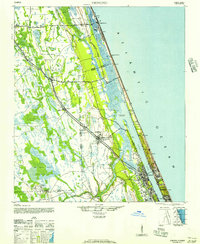
1944 Map of Ormond
USGS Topo · Published 1944About this map
Halifax River and the barrier island coastline anchor this mid-century survey of the Florida coast, where the transition from saltwater marshes to interior pine and cypress stands is clearly mapped. The landscape is defined by the parallel paths of the Florida East Coast railroad and the Old Kings Road, which served as the primary conduits for settlement and early industry. Interior tracts show the presence of the Turpentine Still south of the Hell Cypress Swamp, reflecting the region's reliance on naval stores during this era.
Find a feature on this map
30 named features on this map. Tap any name to fly to it.
Don’t see what you’re looking for? This feature index may not catch every label — zoom into the map to look around manually.
Map Details
Editions of this 1944 Ormond Map
2 editions found
Other maps of this area

1927 · Matanzas
USGS Topo · 1:48,000

1937 · Dinner Island
USGS Topo · 1:48,000

1937 · Port Orange
USGS Topo · 1:48,000

1937 · Ormond
USGS Topo · 1:48,000

1943 · Dinner Island
USGS Topo · 1:62,500

1943 · Matanzas
USGS Topo · 1:62,500

1943 · Port Orange
USGS Topo · 1:62,500

1944 · Dinner Island
USGS Topo · 1:62,500

1944 · Matanzas
USGS Topo · 1:62,500

1944 · Port Orange
USGS Topo · 1:62,500