
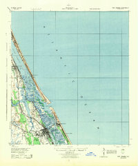
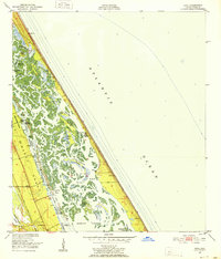
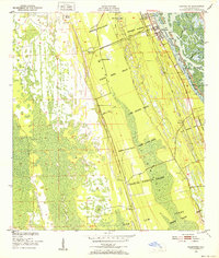
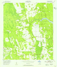
1943 Map of Port Orange
USGS Topo · Published 1959About this map
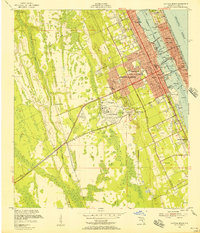
Coastal Volusia County is defined by a intricate network of barrier islands and tidal inlets as they appeared during the mid-1940s. The landscape is anchored by the Halifax River and Indian River North, which serve as the primary conduits for the Intracoastal Waterway. This era shows the developed waterfronts of Port Orange and New Smyrna, connected by the steel rails of the Florida East Coast railroad. A prominent historical landmark, the Old Franciscan Mission, stands inland from the coast, suggesting the deep colonial roots of the region south of Glencoe.
Find a feature on this map
34 named features on this map. Tap any name to fly to it.
Don’t see what you’re looking for? This feature index may not catch every label — zoom into the map to look around manually.
Map Details
Editions of this 1943 Port Orange Map
This is the sole edition of this map. No revisions or reprints were ever made.
Other maps of this area

1937 · Port Orange
USGS Topo · 1:48,000

1937 · Ormond
USGS Topo · 1:48,000

1944 · Ormond
USGS Topo · 1:62,500
1944 · Port Orange
USGS Topo · 1:62,500
1950 · Ariel
USGS Topo · 1:24,000
1950 · Edgewater
USGS Topo · 1:24,000
1952 · Samsula
USGS Topo · 1:24,000
1952 · Daytona Beach
USGS Topo · 1:24,000

1954 · Daytona Beach
USGS Topo · 1:250,000

1955 · Orlando
USGS Topo · 1:250,000