
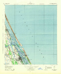
1937 Map of Port Orange
USGS Topo · Published 1937About this map
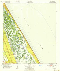
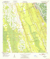
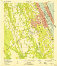
New Smyrna and Port Orange anchor this coastal survey, reflecting a landscape defined by its intricate waterways and early 20th-century transportation lines. The East Coast Railway and Florida Highway No 4 run parallel to the shore, facilitating growth in small communities like Allandale and Glencoe. Of particular interest to local historians is the Old Franciscan Mission located south of the main settlement, a site that hints at the area's deeper colonial origins. The geography is dominated by the Halifax River and the Indian River North, which are bridged by the Intracoastal Waterway. Along the Atlantic coast, established beach colonies such as Coronado Beach and Wilbur-By-The-Sea highlight the region's developing role as a seaside destination, while the Ponce De Leon Inlet remains the critical passage between the ocean and the interior lagoons.
Find a feature on this map
39 named features on this map. Tap any name to fly to it.
Don’t see what you’re looking for? This feature index may not catch every label — zoom into the map to look around manually.
Map Details
Editions of this 1937 Port Orange Map
This is the sole edition of this map. No revisions or reprints were ever made.
Other maps of this area

1937 · Ormond
USGS Topo · 1:48,000

1943 · Port Orange
USGS Topo · 1:62,500

1944 · Ormond
USGS Topo · 1:62,500
1944 · Port Orange
USGS Topo · 1:62,500
1950 · Ariel
USGS Topo · 1:24,000
1950 · Edgewater
USGS Topo · 1:24,000
1952 · Samsula
USGS Topo · 1:24,000
1952 · Daytona Beach
USGS Topo · 1:24,000

1954 · Daytona Beach
USGS Topo · 1:250,000

1955 · Orlando
USGS Topo · 1:250,000