Old Maps of Tampa, Florida
Explore 46 old maps of Tampa, spanning from 1921 to today. These high-resolution historic maps reveal how streets, neighborhoods, landmarks, and natural features evolved over time — perfect for genealogy, metal detecting, research, and local history exploration.
What you can do with these maps:
- See how Tampa changed over time: Compare historical maps to modern-day views to trace roads, homesites, rail lines & more.
- View detailed metadata: Each map includes creators, publishers, year, scale, and archive source.
- Overlay maps with satellite & LiDAR: Visualize the past alongside modern tools to explore terrain & human change.
- Trusted historical sources: Maps sourced from the USGS, Library of Congress, and other archives.
- Access maps your way: View online, download high-res files, or order prints for personal or research use.
Start exploring old maps of Tampa to uncover forgotten places, hidden landmarks, and the deep history beneath your feet.
Tampa, FL maps
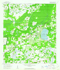
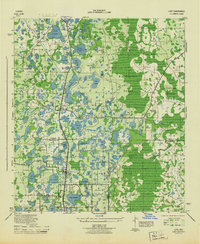
(46)- 1921 Map of Tampa
 1921 Tampa1921 Print · USGSCovers Tampa, including Brandon, Riverview, and other nearby areas
 - 1921 Map of St Petersburg
 1921 St Petersburg1921 Print · USGSCovers Tampa, including Saint Petersburg, Clearwater, and other nearby areas2 unique versions available
 - 1943 Map of Gandy Bridge
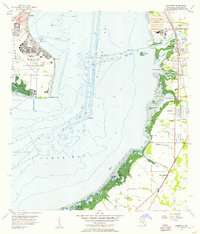
 1943 Gandy Bridge1943 Print · USGSCovers Tampa, including Saint Petersburg, Feather Sound, and other nearby areas
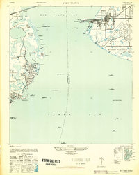
 - 1943 Map of Port Tampa
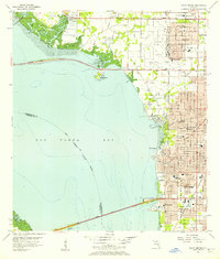
 1943 Port Tampa1943 Print · USGSCovers Tampa, including Saint Petersburg, Monnette, and other nearby areas
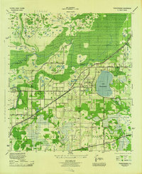
 - 1943 Map of Thonotosassa, 1961 Print
 1943 Thonotosassa1961 Print · USGSCovers Tampa, including Efird Farms, Temple Terrace Junction, and other nearby areas2 unique versions available
 - 1943 Map of Lutz, 1961 Print
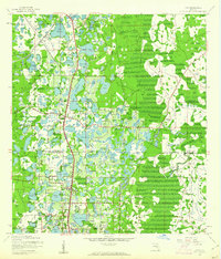 1943 Lutz1961 Print · USGSCovers Tampa, including Lutz, Grand Hampton, and other nearby areas2 unique versions available
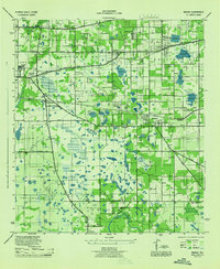
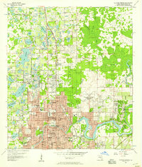
 - 1944 Map of Sulphur Springs
 1944 Sulphur Springs1944 Print · USGSCovers Tampa, including Temple Terrace, Lutz, and other nearby areas
 - 1944 Map of Mango
 1944 Mango1944 Print · USGSCovers Tampa, including Brandon, Alexandria Place, and other nearby areas
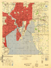
 - 1944 Map of Tampa
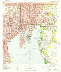
 1944 Tampa1944 Print · USGSCovers Tampa, including East Bay Farms, Powhatan Heights, and other nearby areas
 - 1944 Map of Wesley Chapel
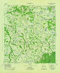 1944 Wesley Chapel1944 Print · USGSCovers Tampa, including Wesley Chapel, Seven Oaks, and other nearby areas3 unique versions available
 - 1944 Map of Lutz
 1944 Lutz1944 Print · USGSCovers Tampa, including Lutz, Grand Hampton, and other nearby areas
 - 1944 Map of Thonotosassa
 1944 Thonotosassa1944 Print · USGSCovers Tampa, including Efird Farms, Temple Terrace Junction, and other nearby areas
 - 1945 Map of Gadsden Point
 1945 Gadsden Point1945 Print · USGSCovers Tampa, including Allens, Apollo Key Village, and other nearby areas
 - 1945 Map of Sulphur Springs
 1945 Sulphur Springs1945 Print · USGSCovers Tampa, including Temple Terrace, Lutz, and other nearby areas
 - 1947 Map of Tampa
 1947 Tampa1947 Print · USGSCovers Tampa, including East Bay Farms, Powhatan Heights, and other nearby areas2 unique versions available
 - 1947 Map of Port Tampa
 1947 Port Tampa1947 Print · USGSCovers Tampa, including Saint Petersburg, Monnette, and other nearby areas3 unique versions available
 - 1947 Map of Gandy Bridge
 1947 Gandy Bridge1947 Print · USGSCovers Tampa, including Saint Petersburg, Feather Sound, and other nearby areas3 unique versions available
 - 1947 Map of Gadsden Point
 1947 Gadsden Point1947 Print · USGSCovers Tampa, including Allens, Apollo Key Village, and other nearby areas
 - 1949 Map of Sulphur Springs
 1949 Sulphur Springs1949 Print · USGSCovers Tampa, including Temple Terrace, Lutz, and other nearby areas
 - 1955 Map of Plant City, 1966 Print
 1955 Plant City1966 Print · USGSCovers Tampa, including Lakeland, Clearwater, and other nearby areas6 unique versions available
 - 1956 Map of Tampa, 1957 Print
 1956 Tampa1957 Print · USGSCovers Tampa, including East Bay Farms, Powhatan Heights, and other nearby areas4 unique versions available
 - 1956 Map of Gandy Bridge, 1957 Print
 1956 Gandy Bridge1957 Print · USGSCovers Tampa, including Saint Petersburg, Feather Sound, and other nearby areas6 unique versions available
 - 1956 Map of Sulphur Springs, 1957 Print
 1956 Sulphur Springs1957 Print · USGSCovers Tampa, including Temple Terrace, Lutz, and other nearby areas4 unique versions available
 - 1956 Map of Gibsonton, 1957 Print
 1956 Gibsonton1957 Print · USGSCovers Tampa, including Allens, Apollo Key Village, and other nearby areas6 unique versions available
 - 1956 Map of Port Tampa, 1957 Print
 1956 Port Tampa1957 Print · USGSCovers Tampa, including Saint Petersburg, Monnette, and other nearby areas6 unique versions available
Showing maps 1-25 of 46
Top cities near Tampa
- Saint Petersburg historical maps
- Brandon historical maps
- Riverview historical maps
- Temple Terrace historical maps
- Lutz historical maps
- Feather Sound historical maps
Top neighborhoods of Tampa
- Georgia Terrace historical maps
- Mora historical maps
- Edwards historical maps
- Armenia Gardens historical maps
- Alta Vista historical maps
- Bour Lands historical maps
See more
Frequently asked questions
- What are the different types of historical maps available for Tampa?
- What is the oldest map of Tampa?
- Where can I purchase historical maps of Tampa for my home or office?
- Where can I download high-res historical maps of Tampa?
- Are there historical topographic maps available for Tampa?
- Is there historical aerial imagery available for Tampa?
- Where are historical maps of Tampa sourced from?