Old Maps of Indian River County, Florida
Explore 108 old maps of Indian River County, spanning from 1948 to today. These high-resolution historic maps reveal how streets, neighborhoods, landmarks, and natural features evolved over time — perfect for genealogy, metal detecting, research, and local history exploration.
What you can do with these maps:
- See how Indian River County changed over time: Compare historical maps to modern-day views to trace roads, homesites, rail lines & more.
- View detailed metadata: Each map includes creators, publishers, year, scale, and archive source.
- Overlay maps with satellite & LiDAR: Visualize the past alongside modern tools to explore terrain & human change.
- Trusted historical sources: Maps sourced from the USGS, Library of Congress, and other archives.
- Access maps your way: View online, download high-res files, or order prints for personal or research use.
Start exploring old maps of Indian River County to uncover forgotten places, hidden landmarks, and the deep history beneath your feet.
Indian River County, FL maps
(108)- 1948 Map of Riomar, 1966 Print
 1948 Riomar1966 Print · USGSThe Florida coast at Vero Beach appears here in the late 1940s, capturing the early post-war development of the barrier island. Researchers can trace the original footprints of the Riomar Country Club Golf Course and the crossing of the Vero Beach Bridge.4 unique versions available
 - 1948 Map of Indrio, 1968 Print
 1948 Indrio1968 Print · USGSThe Florida coast near the Indian River and St. Lucie line appears here in the late 1940s, just as the postwar era began to reach these shores. Genealogists and local historians can trace the Florida East Coast railroad through Viking and Indrio, or locate the old Cem near the riverfront.4 unique versions available
 - 1949 Map of Fellsmere, 1959 Print
 1949 Fellsmere1959 Print · USGSThe town of Fellsmere and its surrounding marshlands are captured here in the post-war era, showing a landscape defined by drainage and rail. Researchers can trace the path of the Trans Florida Central Line and locate the Old Sebastian Cem.5 unique versions available
 - 1949 Map of Vero Beach, 1960 Print
 1949 Vero Beach1960 Print · USGSThe Florida coast near the Indian River was undergoing significant post-war development when this survey was conducted. Researchers can trace the early layout of Vero Beach, the paths of the Florida East Coast railway, and coastal landmarks like Johns Island and Copelands Landing.6 unique versions available
 - 1949 Map of Sebastian, 1960 Print
 1949 Sebastian1960 Print · USGSThe Florida coast near Sebastian and Roseland appears here just after the war, showing a landscape shaped by the rail and river. You can trace the Florida East Coast Railway through the Fleming Grant or locate early landmarks like Macedonia Ch and the Pelican Island Bird Sanctuary.5 unique versions available
 - 1949 Map of Oslo, 1964 Print
 1949 Oslo1964 Print · USGSCoastal Florida in the late forties shows a landscape of citrus groves and early development along the Florida East Coast railway. Researchers can trace the layout of McKee Jungle Gardens and the old settlement sites of Oslo and Indrio.3 unique versions available
 - 1950 Map of Riomar
 1950 Riomar1950 Print · USGSThe Florida barrier island around Vero Beach is captured here at mid-century, before the era of intensive high-rise development. Trace the early layout of the Riomar Country Club Golf Course and coastal landmarks like the Vero Beach Bridge and Bethel Creek.
 - 1950 Map of Oslo
 1950 Oslo1950 Print · USGSCoastal Florida in the early postwar years reveals a landscape of expanding citrus groves and drainage projects near the Indian River Co line. You can trace the Florida East Coast rail corridor and find early roadside landmarks like McKee Jungle Gardens and the settlement of Oslo.2 unique versions available
 - 1950 Map of Indrio
 1950 Indrio1950 Print · USGSThe Florida Atlantic coast and Indian River lagoon are shown here in the late 1940s as citrus groves and coastal hamlets began to expand. You can trace early transport routes and the small settlement of Viking or explore the marshy banks of Prang Island Cr.
 - 1950 Map of Vero Beach
 1950 Vero Beach1950 Print · USGSMid-century Vero Beach and the Indian River lagoon system come alive in this 1950 survey. Genealogists and historians can trace early neighborhood layouts and landmarks like Copelands Landing, the Royal Park Golf Course, and the Florida East Coast rail line.2 unique versions available
 - 1951 Map of Fellsmere
 1951 Fellsmere1951 Print · USGSIndian River County's inland landscape was a mix of canal engineering and citrus-era transport just after the war. Researchers can trace the Trans Florida Central Line, locate the Old Sebastian Cem, and find Brookside.
 - 1951 Map of Sebastian
 1951 Sebastian1951 Print · USGSThe Florida shoreline in the mid-century shows a landscape of rail-centered citrus and fishing communities nestled between the lagoon and the sea. Researchers can locate the Sebastian Cem, trace the Florida East Coast tracks, and explore the wetlands of the Pelican Island Bird Sanctuary.
 - 1953 Map of Fellsmere SW, 1954 Print
 1953 Fellsmere SW1954 Print · USGSThe Florida marshlands during the early 1950s show an environment being actively reshaped by drainage engineering. Trace the early water management systems of St Johns Marsh through its network of Levees, Flowing Wells, and the Trans Florida rail line.3 unique versions available
 - 1953 Map of Fort Drum, 1954 Print
 1953 Fort Drum1954 Print · USGSCovers Indian River County, including Osowaw Junction, Fort Drum, and other nearby areas3 unique versions available
 - 1953 Map of Fort Drum NW, 1954 Print
 1953 Fort Drum NW1954 Print · USGSOsceola County and the surrounding marshlands are captured in the early 1950s, centered on the remote crossroads of the interior. Genealogists and historians can trace the paths of the Old Railroad Grade and the early layout of Yeehaw Junction near Blue Cypress Creek.4 unique versions available
 - 1953 Map of Kenansville SW, 1954 Print
 1953 Kenansville SW1954 Print · USGSThe Florida interior near the Osceola and Indian River county line was a landscape of wetlands and drainage projects in the early 1950s. Local history researchers can trace the Old Railroad Grade and locate the settlements of Kenansville and Lokosee.2 unique versions available
 - 1953 Map of Fellsmere 4 SE, 1954 Print
 1953 Fellsmere 4 SE1954 Print · USGSThe Florida interior near the Indian River and St. Lucie line appears here in the early fifties as a managed wetland frontier. Researchers can trace the extensive hydrological works of the era, including a major Levee, numerous Spoil Banks, and several Flowing Wells bordering Johns Marsh.5 unique versions available
 - 1953 Map of Fort Drum NE, 1954 Print
 1953 Fort Drum NE1954 Print · USGSCovers Indian River County, including Osceola County, Okeechobee County, and other nearby areas3 unique versions available
 - 1953 Map of Fellsmere 4 SW, 1954 Print
 1953 Fellsmere 4 SW1954 Print · USGSFlorida's inland wetlands meet mid-century engineering along the tri-county line of Indian River, Okeechobee, and St Lucie. Researchers can trace the massive drainage efforts through early Levee systems and isolated landmarks like Sick Island and Gum Slough.4 unique versions available
 - 1953 Map of Kenansville SE, 1954 Print
 1953 Kenansville SE1954 Print · USGSFlorida's upper St. Johns River basin is captured here in the early fifties, showing a wilderness being reshaped by ranching and water control. Trace the early agricultural footprint of Leonard Ranch or follow the path of an Old RR Grade through the St Johns Marsh.3 unique versions available
 - 1953 Map of Fellsmere 4 NW, 1954 Print
 1953 Fellsmere 4 NW1954 Print · USGSFlorida's interior marshlands were being heavily reshaped for agriculture in the early fifties. Local historians can trace the industrial footprint of the Sugar Processing Plant and the intricate drainage network of Levee and Flowing Well systems.3 unique versions available
 - 1953 Map of Fellsmere 4 NE, 1955 Print
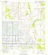 1953 Fellsmere 4 NE1955 Print · USGSIndian River County's landscape undergoes a massive engineering shift in the early fifties as wetlands are drained and gridded. Researchers can trace the legacy of early infrastructure through the Old Railroad Grade and numerous Levee systems.5 unique versions available
 - 1956 Map of Fort Pierce, 1965 Print
 1956 Fort Pierce1965 Print · USGSCentral and coastal Florida appear here during a period of rapid post-war growth and industrial expansion. Researchers can trace the mid-century rail-to-highway transition along the Sunshine State Parkway or locate old settlements like Ankona, Walton, and Indrio.4 unique versions available
 - 1958 Map of Fort Pierce
 1958 Fort Pierce1958 Print · USGSCentral and South Florida are captured here in the late fifties as the citrus and ranching interior met the modern highway era. Researchers can trace the early path of the Sunshine State Parkway and locate established rail depots in Sebring, Okeechobee, and Arcadia.
 - 1959 Map of Fort Pierce
 1959 Fort Pierce1959 Print · USGSCentral Florida and the Treasure Coast are shown here in the late fifties, during a period of steady citrus and coastal growth. Trace the historic routes of the Florida East Coast Ry or locate the boundaries of the Seminole Indian Reservation and Highlands Hammock State Park.3 unique versions available
Showing maps 1-25 of 108
Top cities of Indian River County
- Sebastian historical maps
- Vero Beach historical maps
- Gifford historical maps
- West Vero Corridor historical maps
- Fellsmere historical maps
- Indian River Shores historical maps
See more
Frequently asked questions
- What are the different types of historical maps available for Indian River County?
- What is the oldest map of Indian River County?
- Where can I purchase historical maps of Indian River County for my home or office?
- Where can I download high-res historical maps of Indian River County?
- Are there historical topographic maps available for Indian River County?
- Is there historical aerial imagery available for Indian River County?
- Where are historical maps of Indian River County sourced from?