1980s Maps of Liberty County, Florida
Explore 6 historic maps of Liberty County from the 1980s. These maps offer a rare glimpse into what life looked like during the 1980s — showing old roads, neighborhoods, homes, and landmarks that have changed or disappeared over time.
Whether you're researching your family's past, planning a metal detecting trip, or studying how Liberty County's landscape evolved across the 1980s, these high-resolution maps are a powerful tool for exploring the history of this region.
- Focus on a specific era: All maps on this page are from the 1980s, giving you a focused view of this time period.
- See what’s changed: Compare century-old streets, trails, and buildings to today's modern landscape using overlays and satellite layers.
- Research with precision: Use these maps for genealogy, historical research, land use analysis, or educational projects.
- View, download, or print: Maps are fully viewable online in high resolution, and can be downloaded or printed for your own records.
Start exploring Liberty County's history through authentic maps from the 1980s. This is your window into the past.
Liberty County, FL maps
(6)- 1981 Map of Panama City
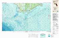
 1981 Panama City1981 Print · USGSPanama City and the Florida Panhandle coast are captured here in the early eighties, showing the region's balance of military installations and maritime industry. Researchers can trace the Atlanta and St Andrews Bay RR or locate coastal sites like Tyndall Air Force Base and Dead Lake.2 unique versions available
 - 1982 Map of Rock Bluff, 1983 Print
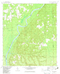 1982 Rock Bluff1983 Print · USGSThe Apalachicola River bluffs of Liberty County are captured here in the early eighties, centered on the diverse terrain of Torreya State Park. Researchers can trace old river access points like Hickory Landing and Porters Landing alongside several local churches and burial sites.
 - 1982 Map of Sycamore, 1983 Print
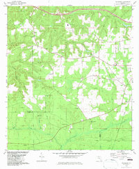 1982 Sycamore1983 Print · USGSGadsden and Liberty counties are shown here in the early eighties, a rural landscape shaped by old land grants and deep-seated family roots. Genealogists and local historians can trace legacy sites like Gause Cem, Sycamore Ch, and the historical Forbes Purchase Line.
 - 1982 Map of Forbes Island, 1984 Print
 1982 Forbes Island1984 Print · USGSThe river-driven life of Gulf and Liberty counties is revealed in this early 1980s orthophotomap of the Apalachicola River basin. Researchers can trace landing sites and historic river camps such as Howard Creek, Lister Camp, and the Fort Gadsden State Historic Site.
 - 1988 Map of Tallahassee
 1988 Tallahassee1988 Print · USGSThe Florida Panhandle and South Georgia are captured here in the late eighties, showing the expansion of the regional highway network and coastal growth. Genealogists and historians can trace rail lines like the Seaboard System Railroad or locate family roots in Blountstown, Graceville, or Crawfordville.2 unique versions available
 - 1988 Map of Apalachicola
 1988 Apalachicola1988 Print · USGSThe Florida Panhandle's Forgotten Coast comes to life in the late eighties, showing the delicate balance between wild marshlands and historic waterfront towns. Researchers can trace the shoreline from Cape San Blas to Bald Point, locating family-named landings like Hays Place and the historic grounds of Fort Gadsden.
End of results
Showing maps 1-6 of 6
Top cities of Liberty County
Frequently asked questions
- What are the different types of historical maps available for Liberty County?
- What is the oldest map of Liberty County?
- Where can I purchase historical maps of Liberty County for my home or office?
- Where can I download high-res historical maps of Liberty County?
- Are there historical topographic maps available for Liberty County?
- Is there historical aerial imagery available for Liberty County?
- Where are historical maps of Liberty County sourced from?