Old Maps of Liberty County, Florida for Academic Research
Study the evolution of Liberty County with 172 high-resolution historic maps. Whether you're teaching, researching, or modeling changes in land use, these maps provide essential visual documentation of urban, environmental, and geographic change.
- Analyze long-term change: Track patterns in development, transportation, and natural features.
- Ideal for environmental or urban studies: Support academic projects with primary historical map data.
- Use in the classroom or lab: Educators and researchers rely on these maps to bring historical context to life.
These maps are a powerful tool for teaching, research, and visualizing how Liberty County has changed over the decades.
Liberty County, FL maps
(172)- 1943 Map of Lake Talquin
 1943 Lake Talquin1943 Print · USGSFlorida's northern forest and river country are mapped here in the early 1940s as the Apalachicola National Forest meets the shores of Lake Talquin. Genealogists can locate family landmarks like Bradwell Sch, Antioch Ch, and numerous private landings along the Ochlockonee River.2 unique versions available
 - 1944 Map of Forbes Island, 1960 Print
 1944 Forbes Island1960 Print · USGSThe Florida Panhandle river system is frozen in time during the mid-1940s, highlighting the industrial timber operations of the Gulf and Liberty county borders. Researchers can trace the path of the Logging RR to remote sites like Lister Camp or locate riverfront hubs such as Brickyard Landing.2 unique versions available
 - 1944 Map of Queens Bay, 1968 Print
 1944 Queens Bay1968 Print · USGSLiberty County was a landscape of dense timber and sprawling wetlands during the mid-forties. Researchers can trace the path of the Apalachicola Northern railroad as it skirts Saplin Head Swamp and the Black Cat Islands.
 - 1945 Map of Dead Lake
 1945 Dead Lake1945 Print · USGSThe river and swamp country of the Florida Panhandle is captured here at the end of the war, revealing a landscape defined by its waterways. Researchers can trace historic river landings and family sites like Kentucky Ldg, Iola, and Jehu Cem.4 unique versions available
 - 1945 Map of Forbes Island
 1945 Forbes Island1945 Print · USGSThe river-driven economy of Gulf County is captured here in the mid-1940s, highlighting a landscape of wetlands and timber camps. Genealogists and researchers can trace local landings like Smith Creek Landing and isolated outposts such as Lister Camp or Glenn Hammock.3 unique versions available
 - 1945 Map of Blountstown
 1945 Blountstown1945 Print · USGSCalhoun County's river-and-rail economy is on full display in the mid-1940s, centered on the growing community of Blountstown. Researchers can trace the Marianna and Blountstown rail line and locate community landmarks like Nettle Ridge Cem or the rural settlement of Leonards.4 unique versions available
 - 1945 Map of Thousand Yard Bay
 1945 Thousand Yard Bay1945 Print · USGSLiberty County during the mid-1940s reveals a landscape defined by the winding Ochlockonee River and the depths of the Apalachicola National Forest. Trace local history at Roberts Landing and explore the distinct topography of Thousand Yard Bay.3 unique versions available
 - 1945 Map of Smith Creek
 1945 Smith Creek1945 Print · USGSThe Florida Panhandle river country is captured here during the mid-forties as the river served as the primary artery through the forest. Researchers can locate community hubs like Smith Creek Sch and Mt Elon Ch or trace old river landings such as Blazed Pine Landing and Big River Landing.4 unique versions available
 - 1945 Map of Kennedy Creek
 1945 Kennedy Creek1945 Print · USGSThe Florida Panhandle at the close of the war shows a river-dependent landscape where Liberty and Gulf counties meet. Local historians can trace old river outposts like White Oak Landing and Owl Landing, or locate the Graveyard Pole Lookout deep in the swampy interior.4 unique versions available
 - 1945 Map of Hosford
 1945 Hosford1945 Print · USGSLiberty County was characterized by its timber-hauling rail lines and creek-fed bottomlands in the mid-1940s. Local researchers can trace the old Apalachicola Northern tracks, locate Kent Cem, and explore the rural layouts of Hosford and Lowry.3 unique versions available
 - 1945 Map of Estiffanulga
 1945 Estiffanulga1945 Print · USGSThe Apalachicola River corridor in the mid-1940s served as a vital water highway between Calhoun and Liberty counties. Genealogists and historians can trace old river connections at Shingle Landing and locate communities like Estiffanulga and Sharptown.4 unique versions available
 - 1945 Map of Orange
 1945 Orange1945 Print · USGSThe Florida panhandle river country comes into focus during the mid-forties as the river and forest dominate the border of Liberty and Calhoun counties. Researchers can trace historic river access at Gunn Landing, locate the Orange Cem, and explore the swampy terrain around Larkin Fish Camp.4 unique versions available
 - 1945 Map of Bristol
 1945 Bristol1945 Print · USGSLiberty County life centered on the river during the mid-1940s, when Bristol stood as a key settlement overlooking the Apalachicola River. Local researchers can trace old family land markers and geographic features like Lake Mystic, Alum Bluff, and a rural Cem.3 unique versions available
 - 1945 Map of Wewahitchka
 1945 Wewahitchka1945 Print · USGSGulf County river life in the mid-1940s centered on the confluence of the Chipola and Apalachicola. Researchers can trace historic river access at Cockran Landing or locate family roots in settlements like Wewahitchka, Honeyville, and Dalkeith.4 unique versions available
 - 1945 Map of Woods
 1945 Woods1945 Print · USGSLiberty County's remote timber and swamp lands are captured here at the end of the Second World War. Researchers can trace traditional backcountry routes through the Apalachicola National Forest and identify old landmarks like Smokehouse Crossing and Half Open Pond.4 unique versions available
 - 1945 Map of Sanborn
 1945 Sanborn1945 Print · USGSThe river bottomlands and pine forests of Wakulla and Liberty counties are shown here just as the war ended. Researchers can trace family sites like Sanborn, find the Mt Beeser Church, and locate the West Sopchoppy Cemetery and Curtis Mill.3 unique versions available
 - 1945 Map of Telogia, 1960 Print
 1945 Telogia1960 Print · USGSLiberty County was a landscape of deep pine woods and cypress strands at the end of the Second World War. Researchers can trace the Apalachicola Northern rail line through Telogia or locate rural family landmarks like Mc Nair Cem and Evans Cem.
 - 1946 Map of Queens Bay
 1946 Queens Bay1946 Print · USGSLiberty County's interior was a maze of wetlands and timber tracks during the mid-1940s. Genealogists and historians can trace the course of the Apalachicola Northern rail line past the Black Cat Islands and through the Saplin Head Swamp.3 unique versions available
 - 1946 Map of Sumatra
 1946 Sumatra1946 Print · USGSLiberty County's pine forests and wetlands are captured in the mid-1940s during a period of steady forest management. Genealogists and local historians can locate the old settlement at Sumatra, the Sumatra Fire Tower, and the remote homesites of Bon Ami.3 unique versions available
 - 1946 Map of Telogia
 1946 Telogia1946 Print · USGSLiberty County's timberlands and wetlands are captured here in the mid-1940s as the railroad and forestry shaped local life. Genealogists and historians can locate family burial sites like Marys Cem and trace the route of the Apalachicola Northern rail line.2 unique versions available
 - 1946 Map of Owens Bridge
 1946 Owens Bridge1946 Print · USGSThe Florida Panhandle's deep woods and river bottomlands are captured here just after the war. Researchers can trace rural life and forestry landmarks like Owens Bridge, the Tate Firetower, and family-named sites such as Morgan Place.4 unique versions available
 - 1946 Map of Wilma
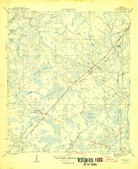 1946 Wilma1946 Print · USGSThe Florida panhandle's timber and rail interior is documented here in the mid-1940s. Genealogists and historians can locate small railroad-era settlements like Wilma and Vilas, and trace the path of the Apalachicola Northern line through the forest.3 unique versions available
 - 1949 Map of Apalachicola
 1949 Apalachicola1949 Print · USGSThe Florida Panhandle's Forgotten Coast is captured mid-century, showcasing the intricate web of swamps, sounds, and barrier islands. Genealogists and historians can trace the Apalachicola Northern rail line and locate old landmarks like Fort Gadsden or the St Joe Fire Tower.
 - 1954 Map of Tallahassee, 1967 Print
 1954 Tallahassee1967 Print · USGSThe Florida Panhandle and South Georgia are captured here during a period of mid-century growth and military expansion. Researchers can trace the development of Panama City, the footprint of Tyndall Air Force Base, and the rail lines of the Atlantic Coast Line.4 unique versions available
 - 1955 Map of Rock Bluff, 1956 Print
 1955 Rock Bluff1956 Print · USGSThe Florida Panhandle river country is captured here in the mid-fifties, centered on the winding Apalachicola River. Genealogists and historians can trace rural lifeways through landmarks like Rock Bluff, St Stephens Ch, and the high ridges of Torreya State Park.2 unique versions available
Showing maps 1-25 of 172
Top cities of Liberty County
Frequently asked questions
- What are the different types of historical maps available for Liberty County?
- What is the oldest map of Liberty County?
- Where can I purchase historical maps of Liberty County for my home or office?
- Where can I download high-res historical maps of Liberty County?
- Are there historical topographic maps available for Liberty County?
- Is there historical aerial imagery available for Liberty County?
- Where are historical maps of Liberty County sourced from?