Old Maps of Rubonia, Florida for Genealogy
Trace your family roots with 14 historic maps of Rubonia. These high-res maps reveal old neighborhoods, homesites, landmarks, and streets — helping you uncover where your ancestors lived and how the area evolved over time.
- Explore historic neighborhoods: Identify where your relatives may have lived in the 1800s or 1900s.
- Compare maps over time: Trace the changes in streets, buildings, and landmarks for multi-generational research.
- Perfect for genealogy & ancestry research: Used by family historians and researchers to map out lineage and migration.
These maps are an incredible resource for exploring your personal connection to Rubonia's past.
Rubonia, FL maps
(14)- 1921 Map of Fort De Soto
 1921 Fort De Soto1921 Print · USGSThe Florida coast at the start of the twenties reveals a landscape of isolated military outposts and emerging rail towns along the Gulf. Genealogists and historians can trace early families in Bradentown, locate the U.S. Quarantine Station, and follow the Seaboard Air Line tracks.2 unique versions available
 - 1944 Map of Ellenton
 1944 Ellenton1944 Print · USGSThe Manatee River coastline and Tampa Bay wetlands appear here during the mid-1940s, showing the early footprints of coastal Florida towns. Trace historical rail lines and settlements like Ellenton and Rubonia, or find the clay deposits at Fullers Earth.2 unique versions available
 - 1956 Map of Tampa, 1964 Print
 1956 Tampa1964 Print · USGSThe Florida Gulf Coast thrived in the mid-fifties, from the bustling docks of Tampa to the quiet shores of Sanibel. Genealogists and historians can trace old rail lines like the Atlantic Coast Line or find early layouts of Port Charlotte and Bokeelia.2 unique versions available
 - 1959 Map of Tampa
 1959 Tampa1959 Print · USGSThe Florida Gulf Coast appears in this late fifties survey during a period of steady coastal growth and established rail commerce. Researchers can trace historic neighborhoods and transit lines from Tampa to St Petersburg, or locate landmarks like Mac Dill AFB and Boca Grande.
 - 1960 Map of Tampa
 1960 Tampa1960 Print · USGSThe Florida Gulf Coast was undergoing a major transformation at the start of the sixties, with new bridges linking burgeoning cities across the bays. Researchers can trace the mid-century footprints of St Petersburg and Tampa, or locate coastal landmarks like Mac Dill AFB and the Sunshine Skyway.2 unique versions available
 - 1964 Map of Palmetto, 1965 Print
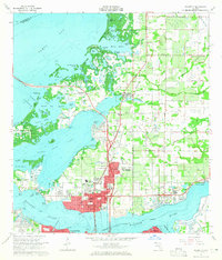 1964 Palmetto1965 Print · USGSPalmetto and the shores of Tampa Bay are captured here in the mid-sixties as post-war growth transformed the Manatee County coast. Genealogists and researchers can trace local landmarks like Lincoln Memorial Sch, the Madira Bickel Mound, and the old Atlantic Coast Line Railroad corridors.5 unique versions available
 - 1972 Map of Tampa, 1974 Print
 1972 Tampa1974 Print · USGSThe Florida Gulf Coast appears in a period of significant growth during the early seventies, from the urban centers of the bay to the quiet southern keys. Researchers can trace the expansion of St Petersburg or locate family sites near Safety Harbor, Valrico, and Boca Ciega.
 - 1981 Map of St Petersburg, 1983 Print
 1981 St Petersburg1983 Print · USGSThe Tampa Bay region is shown here in the early eighties as the urban centers of St Petersburg and Tampa expanded along the coastline. Genealogists and historians can trace rail lines like the Seaboard Coast Line and landmarks from Mac Dill Air Force Base to the Sunshine Skyway.
 - 1988 Map of St Petersburg
 1988 St Petersburg1988 Print · USGSThe Florida Gulf Coast reached a peak of late-twentieth-century development as seen in this late-1980s look at the growing corridor from St Petersburg to Port Charlotte. Researchers can trace the expansion of coastal infrastructure, including MacDill Air Force Base, the Seaboard System RR, and regional parks like Fort De Soto Park.
 - 2012 Map of Palmetto, 2012 Print
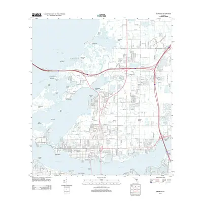 2012 Palmetto2012 Print · USGSCovers Rubonia, including Bradenton, Palmetto, and other nearby areas
 - 2015 Map of Palmetto, 2015 Print
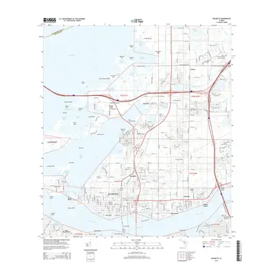 2015 Palmetto2015 Print · USGSCovers Rubonia, including Bradenton, Palmetto, and other nearby areas
 - 2018 Map of Palmetto, 2018 Print
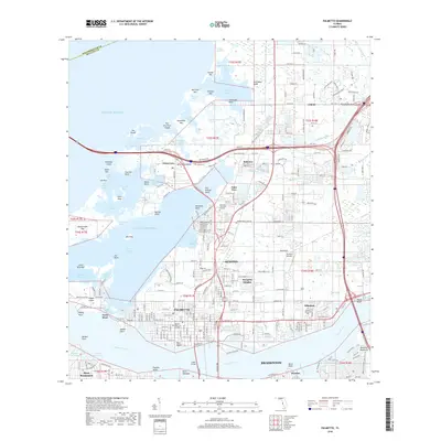 2018 Palmetto2018 Print · USGSCovers Rubonia, including Bradenton, Palmetto, and other nearby areas
 - 2021 Map of Palmetto, 2021 Print
 2021 Palmetto2021 Print · USGSCovers Rubonia, including Bradenton, Palmetto, and other nearby areas
 - 2024 Map of Palmetto, 2024 Print
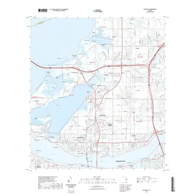
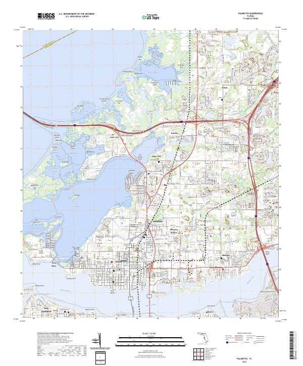 2024 Palmetto2024 Print · USGSCoastal Manatee County at the modern era shows a landscape of established waterfront settlements and intricate bayous. Trace family roots and local history at Old Memphis Cem, explore the shoreline around Terra Ceia, or locate the historic Gillette Ch.
End of results
Showing maps 1-14 of 14
Top cities near Rubonia
- Saint Petersburg historical maps
- Bradenton historical maps
- Sarasota historical maps
- Palmetto historical maps
- Gulfport historical maps
- Saint Pete Beach historical maps
See more
Frequently asked questions
- What are the different types of historical maps available for Rubonia?
- What is the oldest map of Rubonia?
- Where can I purchase historical maps of Rubonia for my home or office?
- Where can I download high-res historical maps of Rubonia?
- Are there historical topographic maps available for Rubonia?
- Is there historical aerial imagery available for Rubonia?
- Where are historical maps of Rubonia sourced from?