1940s Maps of Martin County, Florida
Explore 11 historic maps of Martin County from the 1940s. These maps offer a rare glimpse into what life looked like during the 1940s — showing old roads, neighborhoods, homes, and landmarks that have changed or disappeared over time.
Whether you're researching your family's past, planning a metal detecting trip, or studying how Martin County's landscape evolved across the 1940s, these high-resolution maps are a powerful tool for exploring the history of this region.
- Focus on a specific era: All maps on this page are from the 1940s, giving you a focused view of this time period.
- See what’s changed: Compare century-old streets, trails, and buildings to today's modern landscape using overlays and satellite layers.
- Research with precision: Use these maps for genealogy, historical research, land use analysis, or educational projects.
- View, download, or print: Maps are fully viewable online in high resolution, and can be downloaded or printed for your own records.
Start exploring Martin County's history through authentic maps from the 1940s. This is your window into the past.
Martin County, FL maps
(11)- 1948 Map of Palm City, 1956 Print
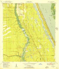
 1948 Palm City1956 Print · USGSThe St. Lucie River waterfront comes alive in this post-war survey, showing the rail and river networks of the Florida coast. Researchers can trace the development of Stuart and Palm City alongside landmarks like the Roosevelt Bridge and Union Ch.5 unique versions available
 - 1948 Map of Ankona, 1956 Print
 1948 Ankona1956 Print · USGSThe St. Lucie riverfront and coastal lagoons appear here in the late 1940s, just as the regional drainage and transport networks were maturing. Researchers can trace early infrastructure through the Florida East Coast rail line and communities like White City and Ankona.4 unique versions available
 - 1948 Map of Rood, 1958 Print
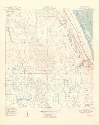
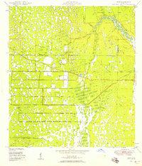 1948 Rood1958 Print · USGSCoastal Florida's interior wetlands meet early development at the mid-century mark in this 1948 survey. Genealogists and historians can trace the local community around Rood, including the Jupiter School and landmarks like the Indian Mound and Trappers Zoo.5 unique versions available
 - 1948 Map of St. Lucie Inlet, 1958 Print
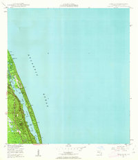
 1948 St. Lucie Inlet1958 Print · USGSCoastal Martin County comes alive in this post-war survey of the riverfronts and barrier islands near the St Lucie Inlet. Researchers can trace the rail corridor of the Florida East Coast, early neighborhoods like Rio and Salerno, and the sprawling grounds of Witham Field.4 unique versions available
 - 1948 Map of Gomez, 1958 Print
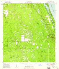 1948 Gomez1958 Print · USGSThe Florida Treasure Coast comes into focus in the years after the war, showing the distinct early footprints of Gomez and Hobe Sound. Trace the coastal development along the Florida East Coast railway or find local landmarks like the Hobe Sound Ch and the expansive Jupiter State Park.5 unique versions available
 - 1948 Map of Hobe Sound, 1962 Print
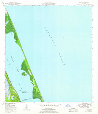
 1948 Hobe Sound1962 Print · USGSThe Martin County coast is seen here in the late 1940s, balancing pristine shoreline with early private developments. Genealogists and historians can trace coastal landmarks like the US Coast Guard Station and the sprawling Jonathan Dickinson State Park.4 unique versions available
 - 1948 Map of Jupiter, 1962 Print
 1948 Jupiter1962 Print · USGSCoastal Palm Beach County comes into focus in the late 1940s, highlighting the strategic maritime and rail corridor of the Loxahatchee River. Researchers can locate historical landmarks including the Jupiter Lighthouse Reservation, the Jupiter Cem, and the local US Navy Marine Base.5 unique versions available
 - 1948 Map of Eden, 1965 Print
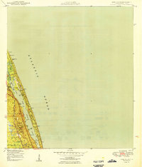
 1948 Eden1965 Print · USGSThe Florida coast near the St. Lucie and Martin County line appears here just after the war, defined by the narrow barrier of Hutchinson Island. You can trace the path of the Florida East Coast railway through Eden and find the early footprint of Jensen Beach.3 unique versions available
 - 1949 Map of Rood
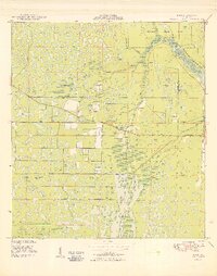 1949 Rood1949 Print · USGSThe Florida wetlands of Palm Beach and Martin counties are captured here just after the war, showing a landscape defined by cypress creeks and early water management. Researchers can locate the settlement of Rood, the Trappers Zoo, and the Jupiter Sch.2 unique versions available
 - 1949 Map of Gomez
 1949 Gomez1949 Print · USGSCoastal Martin County comes into focus in the late 1940s, showing the early infrastructure of the Atlantic seaboard and the large historical land grants. Researchers can trace the development of Hobe Sound and Gomez alongside the Florida East Coast rail line and Peck Lake.2 unique versions available
 - 1949 Map of Hobe Sound
 1949 Hobe Sound1949 Print · USGSThe Florida coast near Hobe Sound appears here in the late 1940s, just as the postwar era began to shape the shoreline. Trace early landmarks like the US Coast Guard Station, the Gomez Grant boundaries, and Jupiter State Park.2 unique versions available
End of results
Showing maps 1-11 of 11
Top cities of Martin County
- Stuart historical maps
- Jensen Beach historical maps
- Port Salerno historical maps
- North River Shores historical maps
- Sewall's Point historical maps
- Jupiter Island historical maps
See more
Frequently asked questions
- What are the different types of historical maps available for Martin County?
- What is the oldest map of Martin County?
- Where can I purchase historical maps of Martin County for my home or office?
- Where can I download high-res historical maps of Martin County?
- Are there historical topographic maps available for Martin County?
- Is there historical aerial imagery available for Martin County?
- Where are historical maps of Martin County sourced from?