Old Maps of Doral, Miami-Dade County for Academic Research
Study the evolution of Doral with 21 high-resolution historic maps. Whether you're teaching, researching, or modeling changes in land use, these maps provide essential visual documentation of urban, environmental, and geographic change.
- Analyze long-term change: Track patterns in development, transportation, and natural features.
- Ideal for environmental or urban studies: Support academic projects with primary historical map data.
- Use in the classroom or lab: Educators and researchers rely on these maps to bring historical context to life.
These maps are a powerful tool for teaching, research, and visualizing how Doral has changed over the decades.
Doral, Miami-Dade County maps
(21)- 1950 Map of Hialeah
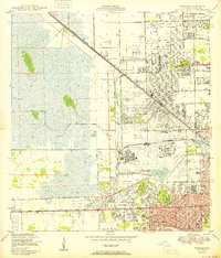 1950 Hialeah1950 Print · USGSMid-century Miami-Dade County is shown here during a period of rapid suburban and industrial expansion. Researchers can trace the early layout of Hialeah, the grounds of Hialeah Park, and numerous family burial sites like Mt Nebo Cem.
 - 1956 Map of Miami, 1963 Print
 1956 Miami1963 Print · USGSSouthern Florida experiences post-war expansion in the 1950s, even as the wilderness remains dominant across the southern peninsula. Genealogists and historians can trace suburban growth in Opa-locka and Perrine or locate remote sites like the Tamiami Ranger Station.5 unique versions available
 - 1958 Map of Miami
 1958 Miami1958 Print · USGSSoutheast Florida in the late fifties reveals a coastal boom held in balance with the wild sawgrass and mangroves of Everglades National Park. Trace the paths of the Florida East Coast RR through Homestead or locate the U S Marine Corps Air Station during the height of the Cold War.
 - 1962 Map of Hialeah, 1964 Print
 1962 Hialeah1964 Print · USGSMiami-Dade County during the early sixties shows a landscape of rapid suburban and industrial growth. Genealogists and local historians can trace family locations near Flagler Memorial Park or explore the rail-dependent economy of the Hialeah Yards and Medley.3 unique versions available
 - 1973 Map of Hialeah SW, 1976 Print
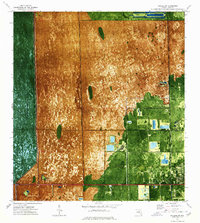 1973 Hialeah SW1976 Print · USGSIn the early 1970s, the western edge of Miami-Dade County balanced between the wild Everglades and rapid suburban expansion. Trace the development of Sweetwater and the early Florida International University campus alongside the historic Tamiami Trail.2 unique versions available
 - 1981 Map of Miami, 1982 Print
 1981 Miami1982 Print · USGSThe Miami metropolitan corridor and the vast marshlands of the interior are seen here in the early 1980s. Trace the reach of Florida's Turnpike and the Florida East Coast Railway past Opa-locka, Coral Gables, and the Miami International Airport.
 - 1988 Map of Miami
 1988 Miami1988 Print · USGSSouth Florida in the late eighties shows the sharp edge between the growing urban Atlantic coast and the vast wetlands of Everglades National Park. Researchers can trace the path of the Tamiami Trail and locate coastal settlements like Ochopee or Chokoloskee.
 - 1988 Map of Hialeah
 1988 Hialeah1988 Print · USGSMiami-Dade County in the late eighties shows a landscape shaped by rapid suburban expansion and massive infrastructure. Genealogists and local historians can trace the development of Hialeah and Sweetwater, locating sites like Flagler Mem Park Cem and the Hialeah Speedway.
 - 1988 Map of Hialeah SW
 1988 Hialeah SW1988 Print · USGSThe Miami-Dade wetlands met suburban expansion in the late eighties, showing a landscape of massive quarries and new institutional hubs. Trace the development of Sweetwater and facilities like the South Florida Reception Center.
 - 1994 Map of Hialeah, 1999 Print
 1994 Hialeah1999 Print · USGSGreater Hialeah in the 1990s is captured here as a bustling intersection of aviation, industry, and suburbia. Researchers can trace the development of Hialeah Race Track, the massive Hialeah Yards, and local schools like Hialeah High Sch.
 - 1995 Map of Hialeah SW, 2000 Print
 1995 Hialeah SW2000 Print · USGSGreater Miami's western edge meets the sawgrass frontier in the mid-nineties, showing where suburban growth confronts the Everglades. Locate local landmarks like Sweetwater, the Florida International University (Tamiami Campus), and the Our Lady of Mercy Cem alongside the engineered Tamiami Canal.
 - 2012 Map of Hialeah SW, 2012 Print
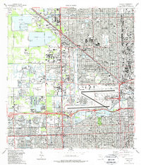
 2012 Hialeah SW2012 Print · USGSCovers Doral, including Lil Abner Mobile Home Park, University Lakes Mobile Home Park, and other nearby areas
 - 2012 Map of Hialeah, 2012 Print
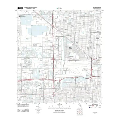 2012 Hialeah2012 Print · USGSCovers Doral, including Miami, Hialeah, and other nearby areas
 - 2015 Map of Hialeah, 2015 Print
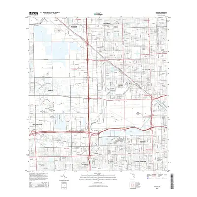 2015 Hialeah2015 Print · USGSCovers Doral, including Miami, Hialeah, and other nearby areas
 - 2015 Map of Hialeah SW, 2015 Print
 2015 Hialeah SW2015 Print · USGSCovers Doral, including Lil Abner Mobile Home Park, University Lakes Mobile Home Park, and other nearby areas
 - 2018 Map of Hialeah, 2018 Print
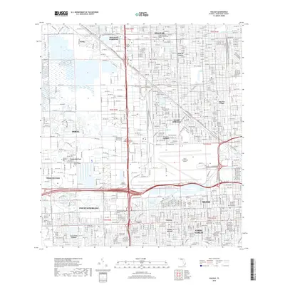 2018 Hialeah2018 Print · USGSCovers Doral, including Miami, Hialeah, and other nearby areas
 - 2018 Map of Hialeah SW, 2018 Print
 2018 Hialeah SW2018 Print · USGSCovers Doral, including Lil Abner Mobile Home Park, University Lakes Mobile Home Park, and other nearby areas
 - 2021 Map of Hialeah SW, 2021 Print
 2021 Hialeah SW2021 Print · USGSCovers Doral, including Lil Abner Mobile Home Park, University Lakes Mobile Home Park, and other nearby areas
 - 2021 Map of Hialeah, 2021 Print
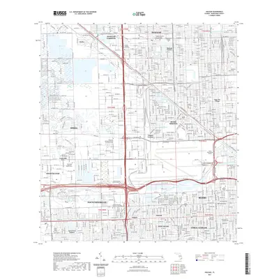 2021 Hialeah2021 Print · USGSCovers Doral, including Miami, Hialeah, and other nearby areas
 - 2024 Map of Hialeah SW, 2024 Print
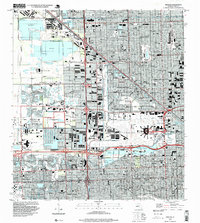
 2024 Hialeah SW2024 Print · USGSMiami-Dade County's western edge comes into sharp focus during the mid-2020s, where the suburban grid meets the protected wetlands of the Florida glades. Researchers can trace the boundaries of Everglades National Park and locate local landmarks like Our Lady of Mercy Catholic Cem and Florida International University.
 - 2024 Map of Hialeah, 2024 Print
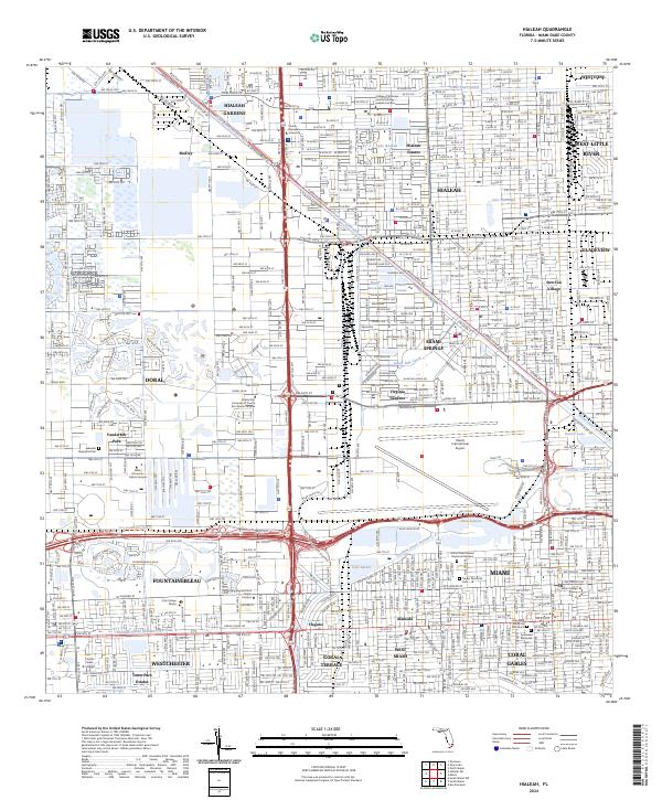 2024 Hialeah2024 Print · USGSMiami-Dade County comes alive in this current-era survey, showing the dense urban development surrounding the airport and the canal system. Researchers can trace local landmarks like Sun-Tan Village, Miami International Airport, and Flagler Memorial Park.
End of results
Showing maps 1-21 of 21
Frequently asked questions
- What are the different types of historical maps available for Doral?
- What is the oldest map of Doral?
- Where can I purchase historical maps of Doral for my home or office?
- Where can I download high-res historical maps of Doral?
- Are there historical topographic maps available for Doral?
- Is there historical aerial imagery available for Doral?
- Where are historical maps of Doral sourced from?