1990s Maps of Doral, Miami-Dade County
Explore 2 historic maps of Doral from the 1990s. These maps offer a rare glimpse into what life looked like during the 1990s — showing old roads, neighborhoods, homes, and landmarks that have changed or disappeared over time.
Whether you're researching your family's past, planning a metal detecting trip, or studying how Doral's landscape evolved across the 1990s, these high-resolution maps are a powerful tool for exploring the history of this region.
- Focus on a specific era: All maps on this page are from the 1990s, giving you a focused view of this time period.
- See what’s changed: Compare century-old streets, trails, and buildings to today's modern landscape using overlays and satellite layers.
- Research with precision: Use these maps for genealogy, historical research, land use analysis, or educational projects.
- View, download, or print: Maps are fully viewable online in high resolution, and can be downloaded or printed for your own records.
Start exploring Doral's history through authentic maps from the 1990s. This is your window into the past.
Doral, Miami-Dade County maps
(2)- 1994 Map of Hialeah, 1999 Print
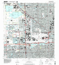 1994 Hialeah1999 Print · USGSGreater Hialeah in the 1990s is captured here as a bustling intersection of aviation, industry, and suburbia. Researchers can trace the development of Hialeah Race Track, the massive Hialeah Yards, and local schools like Hialeah High Sch.
 - 1995 Map of Hialeah SW, 2000 Print
 1995 Hialeah SW2000 Print · USGSGreater Miami's western edge meets the sawgrass frontier in the mid-nineties, showing where suburban growth confronts the Everglades. Locate local landmarks like Sweetwater, the Florida International University (Tamiami Campus), and the Our Lady of Mercy Cem alongside the engineered Tamiami Canal.
End of results
Showing maps 1-2 of 2
Frequently asked questions
- What are the different types of historical maps available for Doral?
- What is the oldest map of Doral?
- Where can I purchase historical maps of Doral for my home or office?
- Where can I download high-res historical maps of Doral?
- Are there historical topographic maps available for Doral?
- Is there historical aerial imagery available for Doral?
- Where are historical maps of Doral sourced from?