2020s Maps of Medley, Florida
Explore 6 historic maps of Medley from the 2020s. These maps offer a rare glimpse into what life looked like during the 2020s — showing old roads, neighborhoods, homes, and landmarks that have changed or disappeared over time.
Whether you're researching your family's past, planning a metal detecting trip, or studying how Medley's landscape evolved across the 2020s, these high-resolution maps are a powerful tool for exploring the history of this region.
- Focus on a specific era: All maps on this page are from the 2020s, giving you a focused view of this time period.
- See what’s changed: Compare century-old streets, trails, and buildings to today's modern landscape using overlays and satellite layers.
- Research with precision: Use these maps for genealogy, historical research, land use analysis, or educational projects.
- View, download, or print: Maps are fully viewable online in high resolution, and can be downloaded or printed for your own records.
Start exploring Medley's history through authentic maps from the 2020s. This is your window into the past.
Medley, FL maps
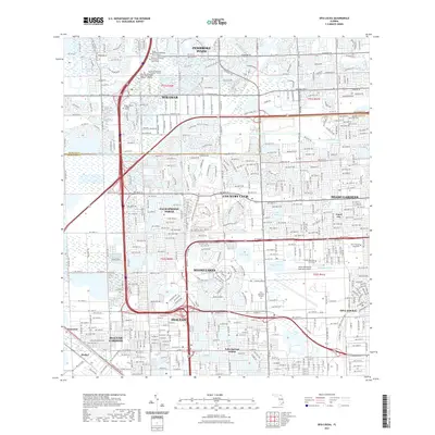
(6)- 2021 Map of Pennsuco, 2021 Print
 2021 Pennsuco2021 Print · USGSCovers Medley, including Pennsuco, Miami-Dade County, and other nearby areas
 - 2021 Map of Opa-locka, 2021 Print
 2021 Opa-locka2021 Print · USGSCovers Medley, including Miami Lakes, Opa-locka, and other nearby areas
 - 2021 Map of Hialeah, 2021 Print
 2021 Hialeah2021 Print · USGSCovers Medley, including Miami, Hialeah, and other nearby areas
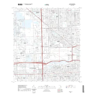
 - 2024 Map of Pennsuco, 2024 Print
 2024 Pennsuco2024 Print · USGSThe Florida Everglades meet the expanding suburbs of Miami-Dade and Broward counties in the mid-2020s. Researchers can trace the drainage network of the Miami Canal or locate the edge of settlements like Pennsuco and Hialeah Gardens.
 - 2024 Map of Opa-locka, 2024 Print
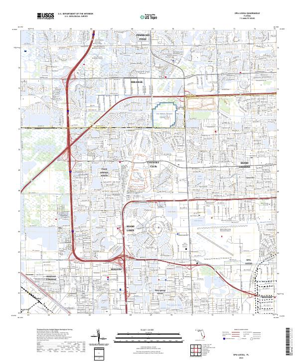 2024 Opa-locka2024 Print · USGSThe northern reaches of the Miami metro area are shown in modern detail as suburban growth bridges the county line. Researchers can trace established neighborhoods like Carol City and Miami Lakes alongside major landmarks like Miami-Opa Locka Executive Airport.
 - 2024 Map of Hialeah, 2024 Print
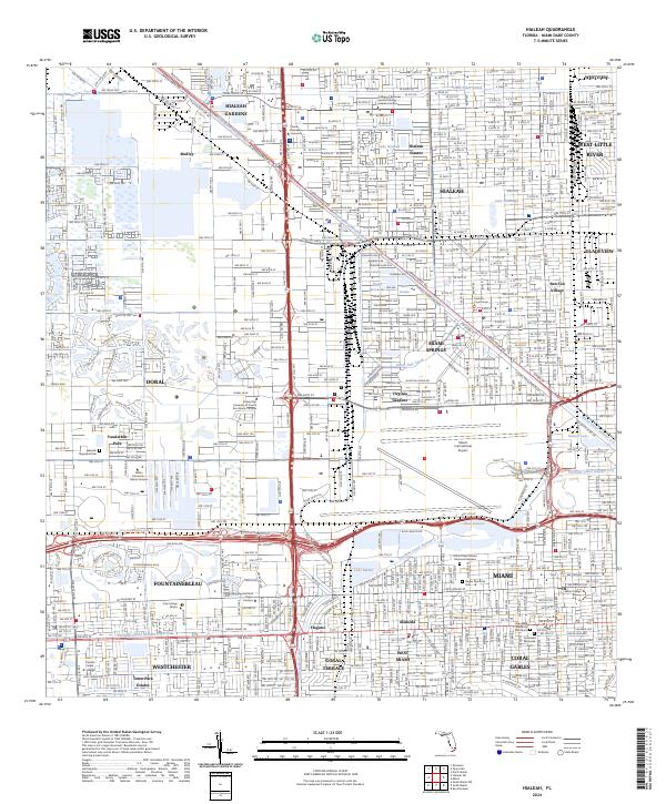 2024 Hialeah2024 Print · USGSMiami-Dade County comes alive in this current-era survey, showing the dense urban development surrounding the airport and the canal system. Researchers can trace local landmarks like Sun-Tan Village, Miami International Airport, and Flagler Memorial Park.
End of results
Showing maps 1-6 of 6
Top cities near Medley
- Miami historical maps
- Hialeah historical maps
- Fort Lauderdale historical maps
- Pembroke Pines historical maps
- Hollywood historical maps
- Kendall historical maps
See more
Top neighborhoods of Medley
Frequently asked questions
- What are the different types of historical maps available for Medley?
- What is the oldest map of Medley?
- Where can I purchase historical maps of Medley for my home or office?
- Where can I download high-res historical maps of Medley?
- Are there historical topographic maps available for Medley?
- Is there historical aerial imagery available for Medley?
- Where are historical maps of Medley sourced from?