Old Maps of Medley, Florida for Hiking & Exploration
Hike through history with 29 historic maps of Medley. Explore old trails, ghost towns, and forgotten backroads — perfect for outdoor adventurers and local explorers.
- Rediscover forgotten places: Map out old mining camps, roads, and footpaths that no longer exist on modern maps.
- Layer with modern tools: Combine with LiDAR or satellite views to plan hikes through historical terrain.
- Made for exploration: Popular among hikers, overlanders, and local history lovers.
Use these maps to find adventure and explore the hidden past of Medley.
Medley, FL maps
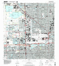
(29)- 1949 Map of Opalocka
 1949 Opalocka1949 Print · USGSNorth Miami-Dade was a hub of military aviation and early suburban expansion in the years following World War II. Researchers can trace the layout of the U S Naval Air Station and several regional airfields like Master Field and Municipal Field.2 unique versions available
 - 1950 Map of Hialeah
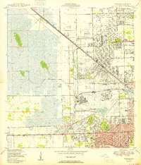 1950 Hialeah1950 Print · USGSMid-century Miami-Dade County is shown here during a period of rapid suburban and industrial expansion. Researchers can trace the early layout of Hialeah, the grounds of Hialeah Park, and numerous family burial sites like Mt Nebo Cem.
 - 1956 Map of Miami, 1963 Print
 1956 Miami1963 Print · USGSSouthern Florida experiences post-war expansion in the 1950s, even as the wilderness remains dominant across the southern peninsula. Genealogists and historians can trace suburban growth in Opa-locka and Perrine or locate remote sites like the Tamiami Ranger Station.5 unique versions available
 - 1958 Map of Miami
 1958 Miami1958 Print · USGSSoutheast Florida in the late fifties reveals a coastal boom held in balance with the wild sawgrass and mangroves of Everglades National Park. Trace the paths of the Florida East Coast RR through Homestead or locate the U S Marine Corps Air Station during the height of the Cold War.
 - 1962 Map of Hialeah, 1964 Print
 1962 Hialeah1964 Print · USGSMiami-Dade County during the early sixties shows a landscape of rapid suburban and industrial growth. Genealogists and local historians can trace family locations near Flagler Memorial Park or explore the rail-dependent economy of the Hialeah Yards and Medley.3 unique versions available
 - 1962 Map of Opa-locka, 1964 Print
 1962 Opa-locka1964 Print · USGSNorth Dade County was undergoing a massive suburban transformation in the early sixties as new subdivisions began to border the Everglades. Researchers can trace early street layouts in Carol City and locate local landmarks like Biscayne College and the South Florida State Hospital.4 unique versions available
 - 1963 Map of Pennsuco, 1964 Print
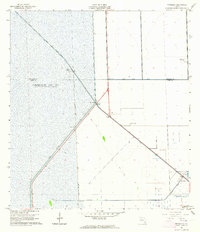 1963 Pennsuco1964 Print · USGSThe Florida Everglades meet industrial development in the early sixties as water management projects reshape the Dade and Broward County border. Trace the intersection of the Miami Canal and Pennsuco Canal near the Quarry and Pennsuco settlement.4 unique versions available
 - 1981 Map of Miami, 1982 Print
 1981 Miami1982 Print · USGSThe Miami metropolitan corridor and the vast marshlands of the interior are seen here in the early 1980s. Trace the reach of Florida's Turnpike and the Florida East Coast Railway past Opa-locka, Coral Gables, and the Miami International Airport.
 - 1988 Map of Pennsuco
 1988 Pennsuco1988 Print · USGSThe Florida Everglades meet the growing suburban edge of Broward and Dade Counties in the late eighties. Researchers can trace water management history and local industry through features like the Miami Canal No C-6, the Opa-Locka West Airport, and the industrial quarries near Pennsuco.2 unique versions available
 - 1988 Map of Miami
 1988 Miami1988 Print · USGSSouth Florida in the late eighties shows the sharp edge between the growing urban Atlantic coast and the vast wetlands of Everglades National Park. Researchers can trace the path of the Tamiami Trail and locate coastal settlements like Ochopee or Chokoloskee.
 - 1988 Map of Opa-Locka
 1988 Opa-Locka1988 Print · USGSNorth Dade and South Broward counties come into focus during a period of rapid suburban maturation in the late eighties. Genealogists and local historians can trace the development of Miami Lakes and Carol City, identifying neighborhood landmarks like Florida Memorial College and Vista Memorial Gardens.
 - 1988 Map of Hialeah
 1988 Hialeah1988 Print · USGSMiami-Dade County in the late eighties shows a landscape shaped by rapid suburban expansion and massive infrastructure. Genealogists and local historians can trace the development of Hialeah and Sweetwater, locating sites like Flagler Mem Park Cem and the Hialeah Speedway.
 - 1994 Map of Hialeah, 1999 Print
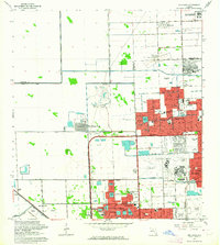
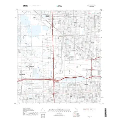
 1994 Hialeah1999 Print · USGSGreater Hialeah in the 1990s is captured here as a bustling intersection of aviation, industry, and suburbia. Researchers can trace the development of Hialeah Race Track, the massive Hialeah Yards, and local schools like Hialeah High Sch.
 - 1994 Map of Pennsuco, 2000 Print
 1994 Pennsuco2000 Print · USGSFlorida's edge at the turn of the millennium shows the intersection of massive water management and suburban expansion. Trace the engineering of the Miami Canal and find local landmarks like the Opa-Locka West Airport and the Pennsuco Footbridge.
 - 2012 Map of Hialeah, 2012 Print
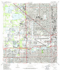
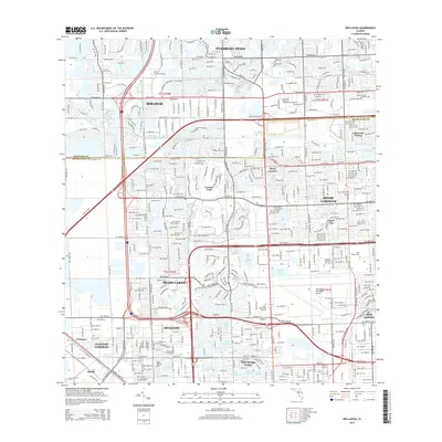
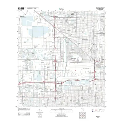 2012 Hialeah2012 Print · USGSCovers Medley, including Miami, Hialeah, and other nearby areas
 - 2012 Map of Opa-locka, 2012 Print
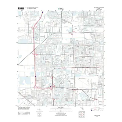 2012 Opa-locka2012 Print · USGSCovers Medley, including Miami Lakes, Opa-locka, and other nearby areas
 - 2012 Map of Pennsuco, 2012 Print
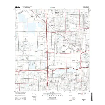
 2012 Pennsuco2012 Print · USGSCovers Medley, including Pennsuco, Miami-Dade County, and other nearby areas
 - 2015 Map of Hialeah, 2015 Print
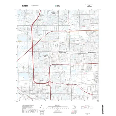
 2015 Hialeah2015 Print · USGSCovers Medley, including Miami, Hialeah, and other nearby areas
 - 2015 Map of Opa-locka, 2015 Print
 2015 Opa-locka2015 Print · USGSCovers Medley, including Miami Lakes, Opa-locka, and other nearby areas
 - 2015 Map of Pennsuco, 2015 Print
 2015 Pennsuco2015 Print · USGSCovers Medley, including Pennsuco, Miami-Dade County, and other nearby areas
 - 2018 Map of Hialeah, 2018 Print
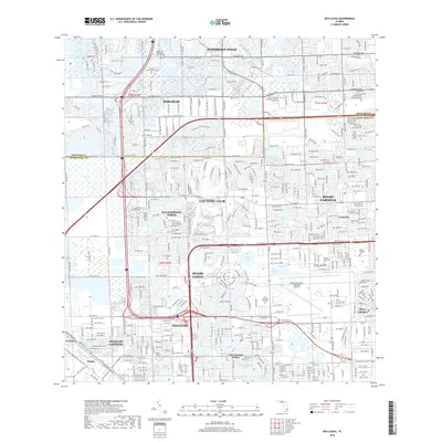
 2018 Hialeah2018 Print · USGSCovers Medley, including Miami, Hialeah, and other nearby areas
 - 2018 Map of Pennsuco, 2018 Print
 2018 Pennsuco2018 Print · USGSCovers Medley, including Pennsuco, Miami-Dade County, and other nearby areas
 - 2018 Map of Opa-locka, 2018 Print
 2018 Opa-locka2018 Print · USGSCovers Medley, including Miami Lakes, Opa-locka, and other nearby areas
 - 2021 Map of Pennsuco, 2021 Print
 2021 Pennsuco2021 Print · USGSCovers Medley, including Pennsuco, Miami-Dade County, and other nearby areas
 - 2021 Map of Opa-locka, 2021 Print
 2021 Opa-locka2021 Print · USGSCovers Medley, including Miami Lakes, Opa-locka, and other nearby areas
Showing maps 1-25 of 29
Top cities near Medley
- Miami historical maps
- Hialeah historical maps
- Fort Lauderdale historical maps
- Pembroke Pines historical maps
- Hollywood historical maps
- Kendall historical maps
See more
Top neighborhoods of Medley
Frequently asked questions
- What are the different types of historical maps available for Medley?
- What is the oldest map of Medley?
- Where can I purchase historical maps of Medley for my home or office?
- Where can I download high-res historical maps of Medley?
- Are there historical topographic maps available for Medley?
- Is there historical aerial imagery available for Medley?
- Where are historical maps of Medley sourced from?