Old Maps of Miami Beach, Florida for Genealogy
Trace your family roots with 28 historic maps of Miami Beach. These high-res maps reveal old neighborhoods, homesites, landmarks, and streets — helping you uncover where your ancestors lived and how the area evolved over time.
- Explore historic neighborhoods: Identify where your relatives may have lived in the 1800s or 1900s.
- Compare maps over time: Trace the changes in streets, buildings, and landmarks for multi-generational research.
- Perfect for genealogy & ancestry research: Used by family historians and researchers to map out lineage and migration.
These maps are an incredible resource for exploring your personal connection to Miami Beach's past.
Miami Beach, FL maps
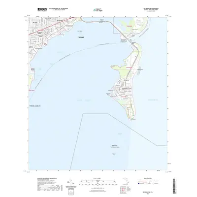
(28)- 1947 Map of Key Biscayne, 1961 Print
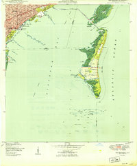
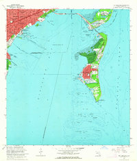
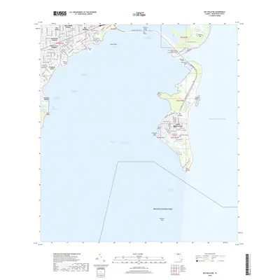
 1947 Key Biscayne1961 Print · USGSKey Biscayne and the Miami waterfront are shown here just after the war, as the new causeway began to transform the islands. Researchers can trace early infrastructure like the US Coast Guard Air Station, Crandon Park, and the grounds of the Fla Adirondack Prep Sch.
 - 1949 Map of Key Biscayne
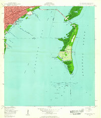
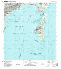
 1949 Key Biscayne1949 Print · USGSBiscayne Bay and its barrier islands are captured here in the late 1940s, just as the Rickenbacker Causeway opened new access to the keys. Researchers can trace early infrastructure like Airline Road and landmarks like the Fla Adirondack Prep Sch or Cape Florida.2 unique versions available
 - 1950 Map of Miami
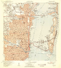 1950 Miami1950 Print · USGSGreater Miami at the midpoint of the century reveals a landscape of dredging and development across Biscayne Bay. Genealogists and researchers can trace neighborhood growth through dozens of named sites like Liberty Square, Bethel Ch, and the Burdine Stadium.2 unique versions available
 - 1956 Map of Miami, 1963 Print
 1956 Miami1963 Print · USGSSouthern Florida experiences post-war expansion in the 1950s, even as the wilderness remains dominant across the southern peninsula. Genealogists and historians can trace suburban growth in Opa-locka and Perrine or locate remote sites like the Tamiami Ranger Station.5 unique versions available
 - 1958 Map of Miami
 1958 Miami1958 Print · USGSSoutheast Florida in the late fifties reveals a coastal boom held in balance with the wild sawgrass and mangroves of Everglades National Park. Trace the paths of the Florida East Coast RR through Homestead or locate the U S Marine Corps Air Station during the height of the Cold War.
 - 1962 Map of Miami, 1964 Print
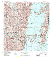
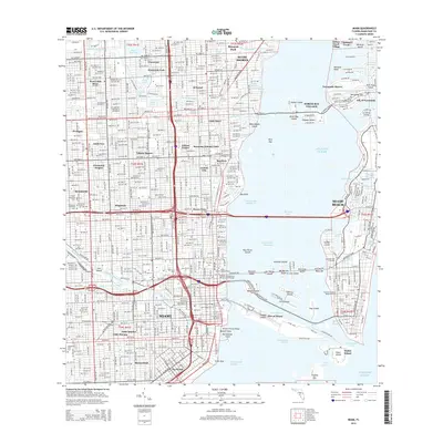
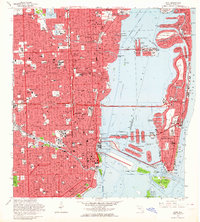 1962 Miami1964 Print · USGSMiami and its surrounding coastal islands are shown in the early sixties as the modern city's footprint solidified. Researchers can trace historic neighborhoods like Edison Center, locate the iconic Orange Bowl, and study the early layout of North Bay Village.3 unique versions available
 - 1962 Map of Key Biscayne, 1964 Print
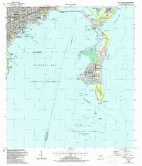
 1962 Key Biscayne1964 Print · USGSCoastal Miami-Dade County in the early sixties showcases a period of rapid development and maritime expansion. Genealogists and historians can trace the growth of Coconut Grove and Key Biscayne, or locate landmarks like the Seaquarium and Cape Florida Old Lighthouse Tower.3 unique versions available
 - 1981 Map of Miami, 1982 Print
 1981 Miami1982 Print · USGSThe Miami metropolitan corridor and the vast marshlands of the interior are seen here in the early 1980s. Trace the reach of Florida's Turnpike and the Florida East Coast Railway past Opa-locka, Coral Gables, and the Miami International Airport.
 - 1988 Map of Miami
 1988 Miami1988 Print · USGSSouth Florida in the late eighties shows the sharp edge between the growing urban Atlantic coast and the vast wetlands of Everglades National Park. Researchers can trace the path of the Tamiami Trail and locate coastal settlements like Ochopee or Chokoloskee.
 - 1988 Map of Key Biscayne
 1988 Key Biscayne1988 Print · USGSMiami and the northern Keys are captured in the late eighties as urban growth met protected coastal waters. Researchers can trace the layout of Coconut Grove or find local landmarks like St Agnes Sch and the Old Lighthouse Tower.
 - 1988 Map of Miami
 1988 Miami1988 Print · USGSGreater Miami flourished as a global gateway by the late eighties, spanning from the mainland neighborhoods to the artificial islands of the bay. You can trace urban expansion and maritime infrastructure through landmarks like the Orange Bowl Stadium, Lincoln Mem Park (Cem), and the Seaboard System rail lines.2 unique versions available
 - 1994 Map of Miami, 1999 Print
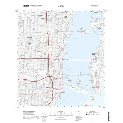
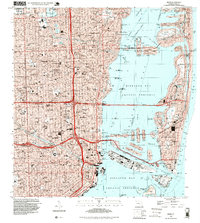 1994 Miami1999 Print · USGSGreater Miami in the mid-nineties shows a metropolis deeply integrated with the surrounding waters of the Biscayne Bay Aquatic Preserve. Researchers can locate historic landmarks like the Orange Bowl Stadium or trace the development of neighborhoods from Edison Center to Shenandoah.
 - 1994 Map of Key Biscayne, 1999 Print
 1994 Key Biscayne1999 Print · USGSBiscayne Bay and the Miami coastline are seen here in the mid-nineties, showing a landscape shaped by coastal preservation and urban expansion. Researchers can trace the development of Virginia Key and Key Biscayne through landmarks like the Seaquarium, St Agnes Sch, and the Old Lighthouse Tower.
 - 2012 Map of Miami OE E, 2012 Print
 2012 Miami OE E2012 Print · USGSCovers Miami Beach, including Surfside, Atlantic Heights, and other nearby areas
 - 2012 Map of Miami, 2012 Print
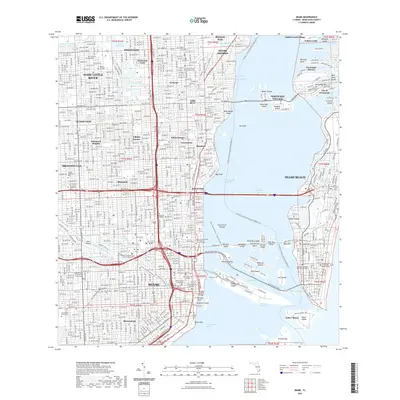
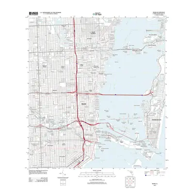 2012 Miami2012 Print · USGSCovers Miami Beach, including Miami, Miami Shores, and other nearby areas
 - 2012 Map of Key Biscayne, 2012 Print
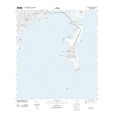 2012 Key Biscayne2012 Print · USGSCovers Miami Beach, including Miami, Key Biscayne, and other nearby areas
 - 2015 Map of Key Biscayne, 2015 Print
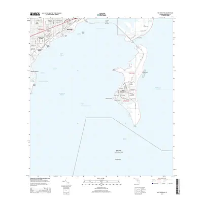 2015 Key Biscayne2015 Print · USGSCovers Miami Beach, including Miami, Key Biscayne, and other nearby areas
 - 2015 Map of Miami OE E, 2015 Print
 2015 Miami OE E2015 Print · USGSCovers Miami Beach, including Surfside, Atlantic Heights, and other nearby areas
 - 2015 Map of Miami, 2015 Print
 2015 Miami2015 Print · USGSCovers Miami Beach, including Miami, Miami Shores, and other nearby areas
 - 2018 Map of Key Biscayne, 2018 Print
 2018 Key Biscayne2018 Print · USGSCovers Miami Beach, including Miami, Key Biscayne, and other nearby areas
 - 2018 Map of Miami, 2018 Print
 2018 Miami2018 Print · USGSCovers Miami Beach, including Miami, Miami Shores, and other nearby areas
 - 2018 Map of Miami OE E, 2018 Print
 2018 Miami OE E2018 Print · USGSCovers Miami Beach, including Surfside, Atlantic Heights, and other nearby areas
 - 2021 Map of Miami OE E, 2021 Print
 2021 Miami OE E2021 Print · USGSCovers Miami Beach, including Surfside, Atlantic Heights, and other nearby areas
 - 2021 Map of Miami, 2021 Print
 2021 Miami2021 Print · USGSCovers Miami Beach, including Miami, Miami Shores, and other nearby areas
 - 2021 Map of Key Biscayne, 2021 Print
 2021 Key Biscayne2021 Print · USGSCovers Miami Beach, including Miami, Key Biscayne, and other nearby areas
Showing maps 1-25 of 28
Top cities near Miami Beach
- Miami historical maps
- Hialeah historical maps
- Pembroke Pines historical maps
- Hollywood historical maps
- Kendall historical maps
- Miramar historical maps
See more
Top neighborhoods of Miami Beach
- Atlantic Heights historical maps
- Isle of Normandy historical maps
- Normandy Shores historical maps
- Mary & Howard Frank Plaza historical maps
- North Beach historical maps
- South Beach historical maps
Frequently asked questions
- What are the different types of historical maps available for Miami Beach?
- What is the oldest map of Miami Beach?
- Where can I purchase historical maps of Miami Beach for my home or office?
- Where can I download high-res historical maps of Miami Beach?
- Are there historical topographic maps available for Miami Beach?
- Is there historical aerial imagery available for Miami Beach?
- Where are historical maps of Miami Beach sourced from?