Old Maps of The Pines, Miami for Academic Research
Study the evolution of The Pines with 14 high-resolution historic maps. Whether you're teaching, researching, or modeling changes in land use, these maps provide essential visual documentation of urban, environmental, and geographic change.
- Analyze long-term change: Track patterns in development, transportation, and natural features.
- Ideal for environmental or urban studies: Support academic projects with primary historical map data.
- Use in the classroom or lab: Educators and researchers rely on these maps to bring historical context to life.
These maps are a powerful tool for teaching, research, and visualizing how The Pines has changed over the decades.
The Pines, Miami maps
(14)- 1947 Map of Key Biscayne, 1961 Print
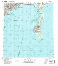
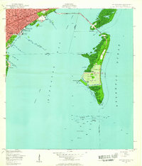 1947 Key Biscayne1961 Print · USGSKey Biscayne and the Miami waterfront are shown here just after the war, as the new causeway began to transform the islands. Researchers can trace early infrastructure like the US Coast Guard Air Station, Crandon Park, and the grounds of the Fla Adirondack Prep Sch.
 - 1949 Map of Key Biscayne
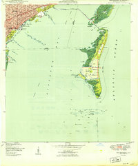 1949 Key Biscayne1949 Print · USGSBiscayne Bay and its barrier islands are captured here in the late 1940s, just as the Rickenbacker Causeway opened new access to the keys. Researchers can trace early infrastructure like Airline Road and landmarks like the Fla Adirondack Prep Sch or Cape Florida.2 unique versions available
 - 1956 Map of Miami, 1963 Print
 1956 Miami1963 Print · USGSSouthern Florida experiences post-war expansion in the 1950s, even as the wilderness remains dominant across the southern peninsula. Genealogists and historians can trace suburban growth in Opa-locka and Perrine or locate remote sites like the Tamiami Ranger Station.5 unique versions available
 - 1958 Map of Miami
 1958 Miami1958 Print · USGSSoutheast Florida in the late fifties reveals a coastal boom held in balance with the wild sawgrass and mangroves of Everglades National Park. Trace the paths of the Florida East Coast RR through Homestead or locate the U S Marine Corps Air Station during the height of the Cold War.
 - 1962 Map of Key Biscayne, 1964 Print
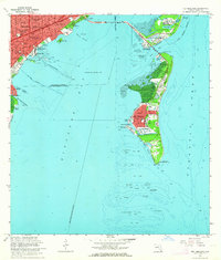 1962 Key Biscayne1964 Print · USGSCoastal Miami-Dade County in the early sixties showcases a period of rapid development and maritime expansion. Genealogists and historians can trace the growth of Coconut Grove and Key Biscayne, or locate landmarks like the Seaquarium and Cape Florida Old Lighthouse Tower.3 unique versions available
 - 1981 Map of Miami, 1982 Print
 1981 Miami1982 Print · USGSThe Miami metropolitan corridor and the vast marshlands of the interior are seen here in the early 1980s. Trace the reach of Florida's Turnpike and the Florida East Coast Railway past Opa-locka, Coral Gables, and the Miami International Airport.
 - 1988 Map of Miami
 1988 Miami1988 Print · USGSSouth Florida in the late eighties shows the sharp edge between the growing urban Atlantic coast and the vast wetlands of Everglades National Park. Researchers can trace the path of the Tamiami Trail and locate coastal settlements like Ochopee or Chokoloskee.
 - 1988 Map of Key Biscayne
 1988 Key Biscayne1988 Print · USGSMiami and the northern Keys are captured in the late eighties as urban growth met protected coastal waters. Researchers can trace the layout of Coconut Grove or find local landmarks like St Agnes Sch and the Old Lighthouse Tower.
 - 1994 Map of Key Biscayne, 1999 Print
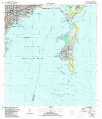
 1994 Key Biscayne1999 Print · USGSBiscayne Bay and the Miami coastline are seen here in the mid-nineties, showing a landscape shaped by coastal preservation and urban expansion. Researchers can trace the development of Virginia Key and Key Biscayne through landmarks like the Seaquarium, St Agnes Sch, and the Old Lighthouse Tower.
 - 2012 Map of Key Biscayne, 2012 Print
 2012 Key Biscayne2012 Print · USGSCovers The Pines, including Miami, Miami Beach, and other nearby areas
 - 2015 Map of Key Biscayne, 2015 Print
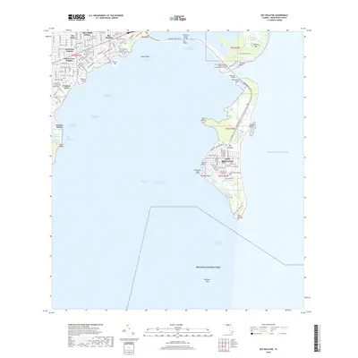
 2015 Key Biscayne2015 Print · USGSCovers The Pines, including Miami, Miami Beach, and other nearby areas
 - 2018 Map of Key Biscayne, 2018 Print
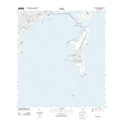
 2018 Key Biscayne2018 Print · USGSCovers The Pines, including Miami, Miami Beach, and other nearby areas
 - 2021 Map of Key Biscayne, 2021 Print
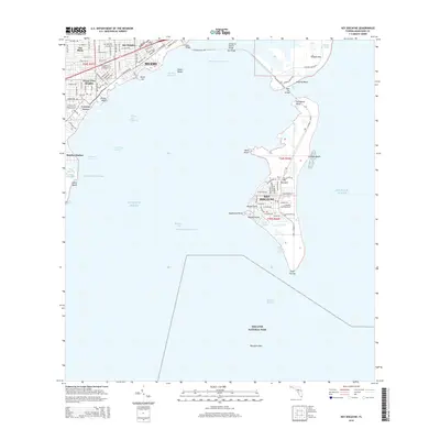
 2021 Key Biscayne2021 Print · USGSCovers The Pines, including Miami, Miami Beach, and other nearby areas
 - 2024 Map of Key Biscayne, 2024 Print
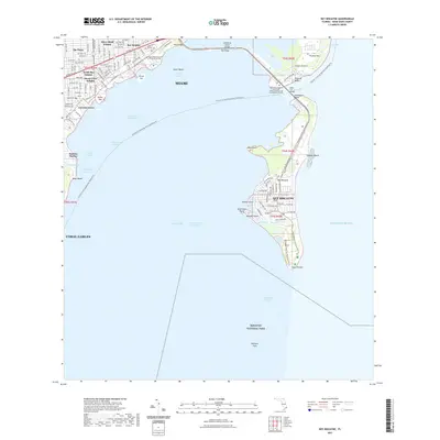
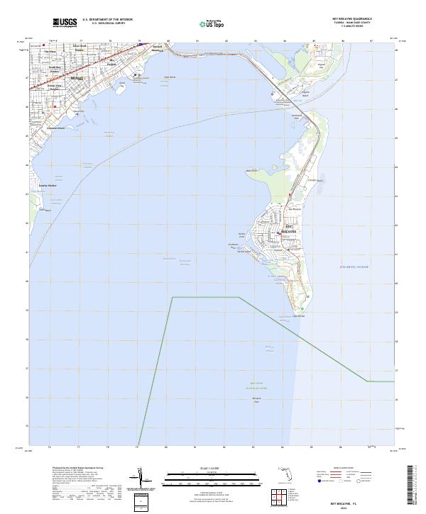 2024 Key Biscayne2024 Print · USGSCoastal Miami and its barrier islands are captured in this contemporary survey of the region's shoreline and residential development. Local historians can trace the urban layout of Coconut Grove or explore the marine geography of Virginia Key and Cape Florida.
End of results
Showing maps 1-14 of 14
Top cities near The Pines
- Miami historical maps
- Hialeah historical maps
- Kendall historical maps
- Miami Gardens historical maps
- Miami Beach historical maps
- North Miami historical maps
See more
Frequently asked questions
- What are the different types of historical maps available for The Pines?
- What is the oldest map of The Pines?
- Where can I purchase historical maps of The Pines for my home or office?
- Where can I download high-res historical maps of The Pines?
- Are there historical topographic maps available for The Pines?
- Is there historical aerial imagery available for The Pines?
- Where are historical maps of The Pines sourced from?