Old Maps of Surfside, Florida for Academic Research
Study the evolution of Surfside with 33 high-resolution historic maps. Whether you're teaching, researching, or modeling changes in land use, these maps provide essential visual documentation of urban, environmental, and geographic change.
- Analyze long-term change: Track patterns in development, transportation, and natural features.
- Ideal for environmental or urban studies: Support academic projects with primary historical map data.
- Use in the classroom or lab: Educators and researchers rely on these maps to bring historical context to life.
These maps are a powerful tool for teaching, research, and visualizing how Surfside has changed over the decades.
Surfside, FL maps
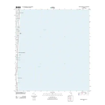
(33)- 1947 Map of North Miami, 1959 Print
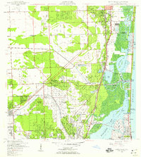 1947 North Miami1959 Print · USGSCoastal Florida is shown in a period of significant post-war expansion between Hollywood and Miami Shores. Researchers can trace the layout of early communities and landmarks like the U S Naval Air Station, MacArthur Airport, and the Hollywood Kennel Club.
 - 1950 Map of Miami
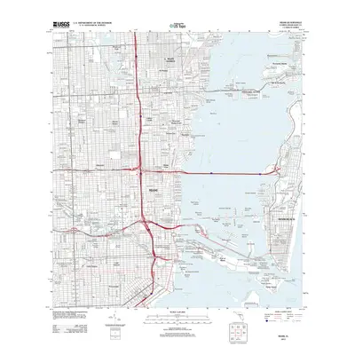
 1950 Miami1950 Print · USGSGreater Miami at the midpoint of the century reveals a landscape of dredging and development across Biscayne Bay. Genealogists and researchers can trace neighborhood growth through dozens of named sites like Liberty Square, Bethel Ch, and the Burdine Stadium.2 unique versions available
 - 1950 Map of North Miami
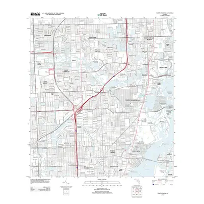
 1950 North Miami1950 Print · USGSMid-century Miami-Dade County comes to life as coastal settlements like Bal Harbour and Surfside begin to take shape. Genealogists and historians can trace the foundations of Opa-locka and the sprawling U S Naval Air Station during this era of rapid growth.
 - 1956 Map of Miami, 1963 Print
 1956 Miami1963 Print · USGSSouthern Florida experiences post-war expansion in the 1950s, even as the wilderness remains dominant across the southern peninsula. Genealogists and historians can trace suburban growth in Opa-locka and Perrine or locate remote sites like the Tamiami Ranger Station.5 unique versions available
 - 1958 Map of Miami
 1958 Miami1958 Print · USGSSoutheast Florida in the late fifties reveals a coastal boom held in balance with the wild sawgrass and mangroves of Everglades National Park. Trace the paths of the Florida East Coast RR through Homestead or locate the U S Marine Corps Air Station during the height of the Cold War.
 - 1962 Map of Miami, 1964 Print
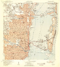
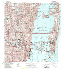
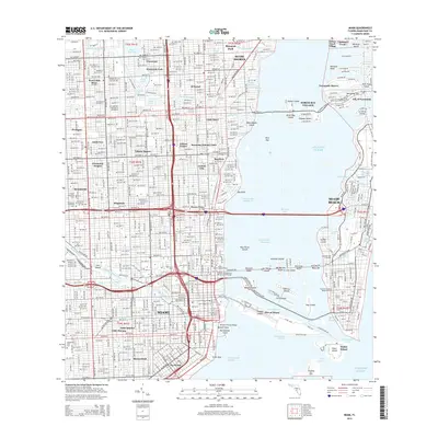
 1962 Miami1964 Print · USGSMiami and its surrounding coastal islands are shown in the early sixties as the modern city's footprint solidified. Researchers can trace historic neighborhoods like Edison Center, locate the iconic Orange Bowl, and study the early layout of North Bay Village.3 unique versions available
 - 1962 Map of North Miami, 1965 Print
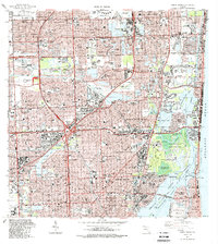
 1962 North Miami1965 Print · USGSCoastal development and suburban growth characterize the North Miami area in the early sixties. Genealogists and local historians can trace family roots through numerous neighborhood schools and landmarks like Dade Memorial Park or the Biscayne Seaplane Base.3 unique versions available
 - 1981 Map of Miami, 1982 Print
 1981 Miami1982 Print · USGSThe Miami metropolitan corridor and the vast marshlands of the interior are seen here in the early 1980s. Trace the reach of Florida's Turnpike and the Florida East Coast Railway past Opa-locka, Coral Gables, and the Miami International Airport.
 - 1988 Map of Miami
 1988 Miami1988 Print · USGSSouth Florida in the late eighties shows the sharp edge between the growing urban Atlantic coast and the vast wetlands of Everglades National Park. Researchers can trace the path of the Tamiami Trail and locate coastal settlements like Ochopee or Chokoloskee.
 - 1988 Map of Miami
 1988 Miami1988 Print · USGSGreater Miami flourished as a global gateway by the late eighties, spanning from the mainland neighborhoods to the artificial islands of the bay. You can trace urban expansion and maritime infrastructure through landmarks like the Orange Bowl Stadium, Lincoln Mem Park (Cem), and the Seaboard System rail lines.2 unique versions available
 - 1988 Map of North Miami
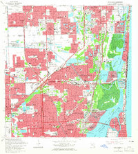
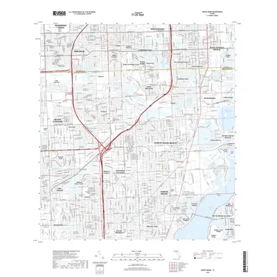
 1988 North Miami1988 Print · USGSNorth Miami and the surrounding Broward-Dade borderlands are shown here in the late eighties during a period of massive residential and commercial growth. Researchers can trace the development of Ives Estates and Carol City or locate landmarks like Joe Robbie Stadium and Barry University.
 - 1994 Map of Miami, 1999 Print
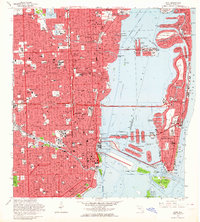
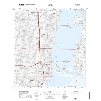
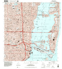 1994 Miami1999 Print · USGSGreater Miami in the mid-nineties shows a metropolis deeply integrated with the surrounding waters of the Biscayne Bay Aquatic Preserve. Researchers can locate historic landmarks like the Orange Bowl Stadium or trace the development of neighborhoods from Edison Center to Shenandoah.
 - 1994 Map of North Miami, 2000 Print
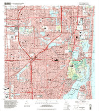 1994 North Miami2000 Print · USGSGreater Miami is captured here in the mid-nineties, showing a sprawling coastal landscape defined by luxury waterfront living and major sports venues. Researchers can trace the layout of Golden Beach and Ives Estates or locate landmarks like Joe Robbie Stadium and Aventura Mall.
 - 2012 Map of Miami OE E, 2012 Print
 2012 Miami OE E2012 Print · USGSCovers Surfside, including Miami Beach, Atlantic Heights, and other nearby areas
 - 2012 Map of North Miami OE E, 2012 Print
 2012 North Miami OE E2012 Print · USGSCovers Surfside, including Sunny Isles Beach, Bal Harbour Village, and other nearby areas
 - 2012 Map of Miami, 2012 Print
 2012 Miami2012 Print · USGSCovers Surfside, including Miami, Miami Beach, and other nearby areas
 - 2012 Map of North Miami, 2012 Print
 2012 North Miami2012 Print · USGSCovers Surfside, including Miramar, Miami Gardens, and other nearby areas
 - 2015 Map of North Miami, 2015 Print
 2015 North Miami2015 Print · USGSCovers Surfside, including Miramar, Miami Gardens, and other nearby areas
 - 2015 Map of Miami OE E, 2015 Print
 2015 Miami OE E2015 Print · USGSCovers Surfside, including Miami Beach, Atlantic Heights, and other nearby areas
 - 2015 Map of North Miami OE E, 2015 Print
 2015 North Miami OE E2015 Print · USGSCovers Surfside, including Sunny Isles Beach, Bal Harbour Village, and other nearby areas
 - 2015 Map of Miami, 2015 Print
 2015 Miami2015 Print · USGSCovers Surfside, including Miami, Miami Beach, and other nearby areas
 - 2018 Map of North Miami OE E, 2018 Print
 2018 North Miami OE E2018 Print · USGSCovers Surfside, including Sunny Isles Beach, Bal Harbour Village, and other nearby areas
 - 2018 Map of North Miami, 2018 Print
 2018 North Miami2018 Print · USGSCovers Surfside, including Miramar, Miami Gardens, and other nearby areas
 - 2018 Map of Miami, 2018 Print
 2018 Miami2018 Print · USGSCovers Surfside, including Miami, Miami Beach, and other nearby areas
 - 2018 Map of Miami OE E, 2018 Print
 2018 Miami OE E2018 Print · USGSCovers Surfside, including Miami Beach, Atlantic Heights, and other nearby areas
Showing maps 1-25 of 33
Top cities near Surfside
- Miami historical maps
- Hialeah historical maps
- Fort Lauderdale historical maps
- Pembroke Pines historical maps
- Hollywood historical maps
- Kendall historical maps
See more
Frequently asked questions
- What are the different types of historical maps available for Surfside?
- What is the oldest map of Surfside?
- Where can I purchase historical maps of Surfside for my home or office?
- Where can I download high-res historical maps of Surfside?
- Are there historical topographic maps available for Surfside?
- Is there historical aerial imagery available for Surfside?
- Where are historical maps of Surfside sourced from?