Old Maps of Marathon, Florida for Academic Research
Study the evolution of Marathon with 29 high-resolution historic maps. Whether you're teaching, researching, or modeling changes in land use, these maps provide essential visual documentation of urban, environmental, and geographic change.
- Analyze long-term change: Track patterns in development, transportation, and natural features.
- Ideal for environmental or urban studies: Support academic projects with primary historical map data.
- Use in the classroom or lab: Educators and researchers rely on these maps to bring historical context to life.
These maps are a powerful tool for teaching, research, and visualizing how Marathon has changed over the decades.
Marathon, FL maps
(29)- 1971 Map of Grassy Key, 1973 Print
 1971 Grassy Key1973 Print · USGSThe Middle Florida Keys are seen in the early seventies during a period of infrastructure growth and coastal mapping. Historians can trace the development of Duck Key, the path of the Long Key Viaduct, and the layout of Grassy Key and Conch Key.2 unique versions available
 - 1971 Map of Marathon, 1973 Print
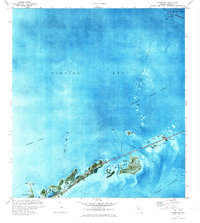
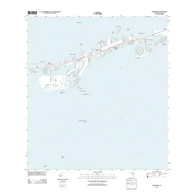
 1971 Marathon1973 Print · USGSMarathon and the Middle Keys are shown in the early seventies as this island community entered a period of significant growth. Trace the development of Key Colony Beach, locate the Coast Guard Sta, or study the grounds of the Sombrero Country Club.
 - 1971 Map of Crawl Key, 1973 Print
 1971 Crawl Key1973 Print · USGSThe middle Florida Keys appear in the early seventies, caught between the shallow waters of Florida Bay and the open Straits of Florida. Marine historians and researchers can trace the navigational hazards of Coffins Patch or locate landmarks on Crawl Key and Grassy Key.
 - 1972 Map of Marathon
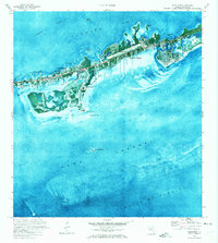
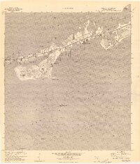 1972 Marathon1972 Print · USGSThe Middle Keys undergo significant development during the early seventies as new canal-front communities expand across Vaca Key. Researchers can trace the growth of Marathon and Key Colony Beach or locate landmarks like the Coast Guard Sta and High Sch.
 - 1972 Map of Bamboo Key, 1973 Print
 1972 Bamboo Key1973 Print · USGSFlorida Bay and its shallow marine landscape are captured here in the early seventies. Boaters and maritime historians can trace the Intracoastal Waterway and locate the navigational light near the solitary Bamboo Key.
 - 1983 Map of Islamorada, 1984 Print
 1983 Islamorada1984 Print · USGSThe Florida Keys at the start of the 1980s show a delicate balance of tourism and preservation along the Overseas Highway. Researchers can trace the development of island communities like Islamorada and Layton, or locate landmarks such as the Long Key Viaduct and Indian Key.
 - 1983 Map of Key West, 1984 Print
 1983 Key West1984 Print · USGSThe Lower Florida Keys are shown in detail in the early 1980s, centered on the military and civilian infrastructure of the archipelago. Trace the path of the Overseas Highway across the Sevenmile Bridge and locate historic sites like Bahia Honda State Park.2 unique versions available
 - 1989 Map of Key West, 1990 Print
 1989 Key West1990 Print · USGSThe Florida Keys at the end of the eighties reveal a complex maritime network of coral islands, military outposts, and protected wilderness. Researchers can trace the Overseas Highway across the Sevenmile Bridge and locate features like the U S Naval Air Station Key West and the National Key Deer Refuge.
 - 2012 Map of Grassy Key, 2012 Print
 2012 Grassy Key2012 Print · USGSCovers Marathon, including Conch Key, Duck Key, and other nearby areas
 - 2012 Map of Crawl Key, 2012 Print
 2012 Crawl Key2012 Print · USGSCovers Marathon, including Valhalla, Monroe County, and other nearby areas
 - 2012 Map of Bamboo Key, 2012 Print
 2012 Bamboo Key2012 Print · USGSCovers Marathon, including Monroe County, United States, and other nearby areas
 - 2012 Map of Marathon, 2012 Print
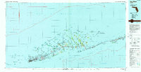
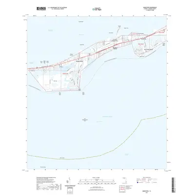
 2012 Marathon2012 Print · USGSCovers Marathon, including Key Colony Beach, Marathon Shores, and other nearby areas
 - 2015 Map of Grassy Key, 2015 Print
 2015 Grassy Key2015 Print · USGSCovers Marathon, including Conch Key, Duck Key, and other nearby areas
 - 2015 Map of Marathon, 2015 Print
 2015 Marathon2015 Print · USGSCovers Marathon, including Key Colony Beach, Marathon Shores, and other nearby areas
 - 2015 Map of Bamboo Key, 2015 Print
 2015 Bamboo Key2015 Print · USGSCovers Marathon, including Monroe County, United States, and other nearby areas
 - 2015 Map of Crawl Key, 2015 Print
 2015 Crawl Key2015 Print · USGSCovers Marathon, including Valhalla, Monroe County, and other nearby areas
 - 2018 Map of Bamboo Key, 2018 Print
 2018 Bamboo Key2018 Print · USGSCovers Marathon, including Monroe County, United States, and other nearby areas
 - 2018 Map of Marathon, 2018 Print
 2018 Marathon2018 Print · USGSCovers Marathon, including Key Colony Beach, Marathon Shores, and other nearby areas
 - 2018 Map of Grassy Key, 2018 Print
 2018 Grassy Key2018 Print · USGSCovers Marathon, including Conch Key, Duck Key, and other nearby areas
 - 2018 Map of Crawl Key, 2018 Print
 2018 Crawl Key2018 Print · USGSCovers Marathon, including Valhalla, Monroe County, and other nearby areas
 - 2021 Map of Crawl Key, 2021 Print
 2021 Crawl Key2021 Print · USGSCovers Marathon, including Valhalla, Monroe County, and other nearby areas
 - 2021 Map of Grassy Key, 2021 Print
 2021 Grassy Key2021 Print · USGSCovers Marathon, including Conch Key, Duck Key, and other nearby areas
 - 2021 Map of Bamboo Key, 2021 Print
 2021 Bamboo Key2021 Print · USGSCovers Marathon, including Monroe County, United States, and other nearby areas
 - 2021 Map of Marathon, 2021 Print
 2021 Marathon2021 Print · USGSCovers Marathon, including Key Colony Beach, Marathon Shores, and other nearby areas
 - 2024 Map of Crawl Key, 2024 Print
 2024 Crawl Key2024 Print · USGSThe northern Florida Keys are captured here in the early 2020s, showing the narrow chain of islands connected by the famous Overseas Hwy. You can trace modern recreational paths like the Florida Keys Overseas Heritage Trl and locate offshore landmarks such as Coffins Patch and Fat Deer Key.
Showing maps 1-25 of 29
Top cities near Marathon
Top neighborhoods of Marathon
Frequently asked questions
- What are the different types of historical maps available for Marathon?
- What is the oldest map of Marathon?
- Where can I purchase historical maps of Marathon for my home or office?
- Where can I download high-res historical maps of Marathon?
- Are there historical topographic maps available for Marathon?
- Is there historical aerial imagery available for Marathon?
- Where are historical maps of Marathon sourced from?