Old Maps of Marathon Shores, Marathon for Genealogy
Trace your family roots with 9 historic maps of Marathon Shores. These high-res maps reveal old neighborhoods, homesites, landmarks, and streets — helping you uncover where your ancestors lived and how the area evolved over time.
- Explore historic neighborhoods: Identify where your relatives may have lived in the 1800s or 1900s.
- Compare maps over time: Trace the changes in streets, buildings, and landmarks for multi-generational research.
- Perfect for genealogy & ancestry research: Used by family historians and researchers to map out lineage and migration.
These maps are an incredible resource for exploring your personal connection to Marathon Shores's past.
Marathon Shores, Marathon maps
(9)- 1971 Map of Marathon, 1973 Print
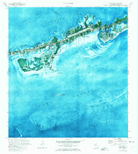 1971 Marathon1973 Print · USGSMarathon and the Middle Keys are shown in the early seventies as this island community entered a period of significant growth. Trace the development of Key Colony Beach, locate the Coast Guard Sta, or study the grounds of the Sombrero Country Club.
 - 1972 Map of Marathon
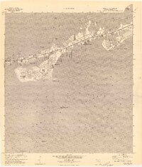 1972 Marathon1972 Print · USGSThe Middle Keys undergo significant development during the early seventies as new canal-front communities expand across Vaca Key. Researchers can trace the growth of Marathon and Key Colony Beach or locate landmarks like the Coast Guard Sta and High Sch.
 - 1983 Map of Key West, 1984 Print
 1983 Key West1984 Print · USGSThe Lower Florida Keys are shown in detail in the early 1980s, centered on the military and civilian infrastructure of the archipelago. Trace the path of the Overseas Highway across the Sevenmile Bridge and locate historic sites like Bahia Honda State Park.2 unique versions available
 - 1989 Map of Key West, 1990 Print
 1989 Key West1990 Print · USGSThe Florida Keys at the end of the eighties reveal a complex maritime network of coral islands, military outposts, and protected wilderness. Researchers can trace the Overseas Highway across the Sevenmile Bridge and locate features like the U S Naval Air Station Key West and the National Key Deer Refuge.
 - 2012 Map of Marathon, 2012 Print
 2012 Marathon2012 Print · USGSCovers Marathon Shores, including Marathon, Key Colony Beach, and other nearby areas
 - 2015 Map of Marathon, 2015 Print
 2015 Marathon2015 Print · USGSCovers Marathon Shores, including Marathon, Key Colony Beach, and other nearby areas
 - 2018 Map of Marathon, 2018 Print
 2018 Marathon2018 Print · USGSCovers Marathon Shores, including Marathon, Key Colony Beach, and other nearby areas
 - 2021 Map of Marathon, 2021 Print
 2021 Marathon2021 Print · USGSCovers Marathon Shores, including Marathon, Key Colony Beach, and other nearby areas
 - 2024 Map of Marathon, 2024 Print
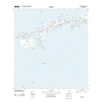
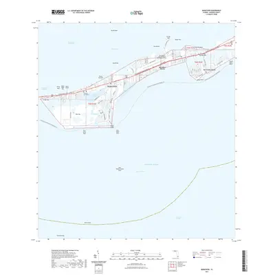
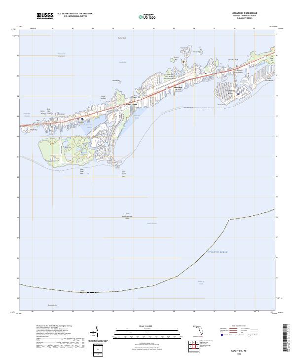 2024 Marathon2024 Print · USGSThe Middle Keys are captured in this recent survey, showing the intensive development and maritime infrastructure of the Marathon area. Researchers can trace the modern street grids of Key Colony Beach and Marathon, or locate coastal landmarks like Boot Key Harbor and Sombrero Key.
End of results
Showing maps 1-9 of 9
Top cities near Marathon Shores
Frequently asked questions
- What are the different types of historical maps available for Marathon Shores?
- What is the oldest map of Marathon Shores?
- Where can I purchase historical maps of Marathon Shores for my home or office?
- Where can I download high-res historical maps of Marathon Shores?
- Are there historical topographic maps available for Marathon Shores?
- Is there historical aerial imagery available for Marathon Shores?
- Where are historical maps of Marathon Shores sourced from?