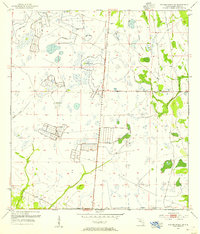
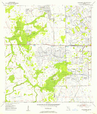
Old Maps of Okeechobee County, Florida for Hiking & Exploration
Hike through history with 171 historic maps of Okeechobee County. Explore old trails, ghost towns, and forgotten backroads — perfect for outdoor adventurers and local explorers.
- Rediscover forgotten places: Map out old mining camps, roads, and footpaths that no longer exist on modern maps.
- Layer with modern tools: Combine with LiDAR or satellite views to plan hikes through historical terrain.
- Made for exploration: Popular among hikers, overlanders, and local history lovers.
Use these maps to find adventure and explore the hidden past of Okeechobee County.
Okeechobee County, FL maps
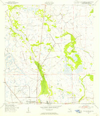
(171)- 1952 Map of Fort Kissimmee, 1953 Print
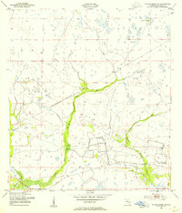
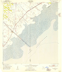
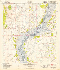 1952 Fort Kissimmee1953 Print · USGSThe Florida cattle country and river marshes are captured here in the early fifties, before major channelization altered the watershed. Researchers can trace the riverfront settlement of Fort Kissimmee, the Fort Kissimmee Cem, and named landmarks like Mc Guire Hammock.4 unique versions available
 - 1952 Map of Fort Kissimmee NW, 1953 Print
 1952 Fort Kissimmee NW1953 Print · USGSCentral Florida's interior in the early fifties is captured here as a landscape of military range lands and winding river wetlands. Researchers can trace the original path of the Kissimmee River and explore named landmarks like Hard Luck Hammock and Ice Cream Slough.3 unique versions available
 - 1952 Map of Okeechobee NW, 1954 Print
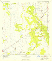
 1952 Okeechobee NW1954 Print · USGSThe Florida Everglades and Kissimmee basin are captured here in the early 1950s, documenting a landscape of complex water management and indigenous lands. Researchers can trace the original winding course of the Kissimmee River and its proximity to the Brighton Seminole Indian Reservation and Paradise Run.3 unique versions available
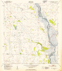
 - 1952 Map of Okeechobee, 1954 Print
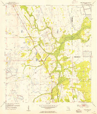
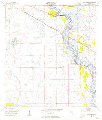
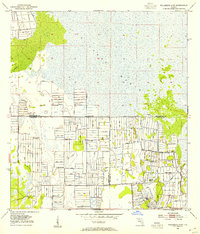
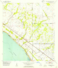
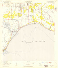 1952 Okeechobee1954 Print · USGSThe northern shores of Lake Okeechobee and the city of Okeechobee are shown in detail during the early 1950s. Researchers can trace the Seaboard Air Line tracks through settlements like Cypress Quarters and Sherman, alongside the emerging Levee system.4 unique versions available
 - 1953 Map of Taylor Creek NW, 1954 Print
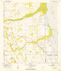
 1953 Taylor Creek NW1954 Print · USGSOkeechobee County was a land of intricate wetlands and seasonal waterways in the early fifties. Local historians can trace the early water management through levee systems and locate family landmarks like Dinner Hammock, Dad Island, and the Flowing Wells.3 unique versions available
 - 1953 Map of Okeechobee 4 SW, 1954 Print
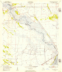
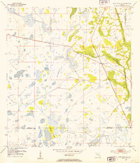
 1953 Okeechobee 4 SW1954 Print · USGSThe eastern shores of Lake Okeechobee are captured here in the early fifties during a period of significant water management. Historians can trace the infrastructure of the day through the Florida East Coast railway, various Windmills, and the extensive Levee system.4 unique versions available
 - 1953 Map of Basinger, 1954 Print
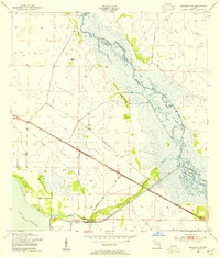
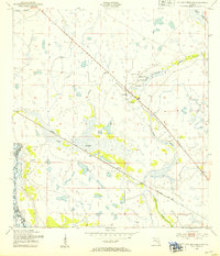
 1953 Basinger1954 Print · USGSThe settlement of Basinger is documented in the early 1950s along the natural, winding course of the Kissimmee River. Genealogists and historians can locate the Basinger Cem, Basinger Sch, and the isolated Peavine Trail through the sawgrass.3 unique versions available
 - 1953 Map of Fort Drum, 1954 Print
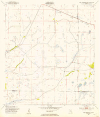
 1953 Fort Drum1954 Print · USGSCovers Okeechobee County, including Osowaw Junction, Fort Drum, and other nearby areas3 unique versions available
 - 1953 Map of Fort Basinger, 1954 Print
 1953 Fort Basinger1954 Print · USGSCentral Florida in the early fifties shows a landscape shaped by the winding Kissimmee River and its intricate wetlands. Genealogists and historians can trace the riverside community at Fort Basinger and the Seaboard Air Line rail route.2 unique versions available
 - 1953 Map of Fort Kissimmee NE, 1954 Print
 1953 Fort Kissimmee NE1954 Print · USGSOsceola and Okeechobee counties meet in this early 1950s survey of the Florida interior during a time of early resource extraction. Trace the historical path of the Old Railroad Grade and Peavine Trail near the Pine Island Slough.3 unique versions available
 - 1953 Map of Fort Drum SW, 1954 Print
 1953 Fort Drum SW1954 Print · USGSFlorida's interior wetlands and hammocks are mapped in detail during the early 1950s, revealing a landscape of seasonal sloughs and early drainage projects. Genealogists and historians can locate family landmarks like Padgett Hammock and Thomas Hammock or trace the early paths of Twelvemile Slough.3 unique versions available
 - 1953 Map of Fort Drum NW, 1954 Print
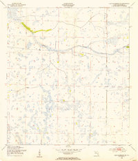
 1953 Fort Drum NW1954 Print · USGSOsceola County and the surrounding marshlands are captured in the early 1950s, centered on the remote crossroads of the interior. Genealogists and historians can trace the paths of the Old Railroad Grade and the early layout of Yeehaw Junction near Blue Cypress Creek.4 unique versions available
 - 1953 Map of Okeechobee SW, 1954 Print
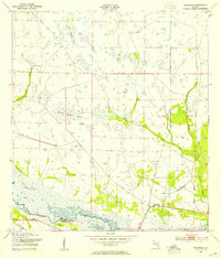
 1953 Okeechobee SW1954 Print · USGSFlorida's marshy interior meets the vast waters of Lake Okeechobee in the early fifties, documenting a landscape reshaped by engineering. Trace the early boundaries of the Brighton Seminole Indian Reservation and the path of the Indian Prairie Canal.2 unique versions available
 - 1953 Map of Basinger NW, 1954 Print
 1953 Basinger NW1954 Print · USGSFlorida's interior wetlands and river systems are documented here in the early fifties, before the significant alteration of the northern Everglades watershed. Genealogists and historians can trace the Seaboard Air Line rail route through Plains and locate the Sunnyland Sch.3 unique versions available
 - 1953 Map of Fort Drum NE, 1954 Print
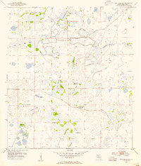
 1953 Fort Drum NE1954 Print · USGSCovers Okeechobee County, including Osceola County, Indian River County, and other nearby areas3 unique versions available
 - 1953 Map of Fellsmere 4 SW, 1954 Print
 1953 Fellsmere 4 SW1954 Print · USGSFlorida's inland wetlands meet mid-century engineering along the tri-county line of Indian River, Okeechobee, and St Lucie. Researchers can trace the massive drainage efforts through early Levee systems and isolated landmarks like Sick Island and Gum Slough.4 unique versions available
 - 1953 Map of Okeechobee 4 NW, 1954 Print
 1953 Okeechobee 4 NW1954 Print · USGSThe northeastern shore of Lake Okeechobee is captured here in the early 1950s, showing a landscape defined by drainage projects and competing rail lines. Researchers can trace the paths of the Seaboard Air Line, find the settlement at Myrtle, and locate numerous Flowing Wells across the marsh.4 unique versions available
 - 1953 Map of Taylor Creek SW, 1954 Print
 1953 Taylor Creek SW1954 Print · USGSThe Florida interior near the Highlands and Okeechobee county line is shown here in the early fifties, before the Kissimmee was channelized. Genealogists and historians can trace the Seaboard Air Line tracks past Mildred and the Dixie Ranch.2 unique versions available
 - 1953 Map of Okeechobee 1 SW, 1954 Print
 1953 Okeechobee 1 SW1954 Print · USGSFlorida's interior scrub and wetlands are documented here in the early fifties before major modern drainage projects. Researchers can trace the natural watercourse of Cypress Creek and locate family-named landmarks like Dark Hammock and Jones Hammock.4 unique versions available
 - 1953 Map of Fort Kissimmee SE, 1954 Print
 1953 Fort Kissimmee SE1954 Print · USGSFlorida's interior wetlands are captured here in the early 1950s before significant modern drainage altered the landscape. Researchers can trace historic transportation corridors like the Old Railroad Grade and the long-established Peavine Trail.3 unique versions available
 - 1953 Map of Taylor Creek SE, 1954 Print
 1953 Taylor Creek SE1954 Print · USGSThe northern edge of Okeechobee comes into focus in the early fifties, showing a landscape of marshy creek basins and residential quarters. Genealogists can locate Evergreen Cem and Brown High Sch or trace the Seaboard Air Line rails.3 unique versions available
 - 1953 Map of Taylor Creek NE, 1954 Print
 1953 Taylor Creek NE1954 Print · USGSCovers Okeechobee County, including Eagle Island, Hilolo, and other nearby areas2 unique versions available
 - 1953 Map of Okeechobee 1 NW, 1955 Print
 1953 Okeechobee 1 NW1955 Print · USGSThe Florida interior along the Okeechobee Co St Lucie Co border was undergoing significant drainage transformation in the early fifties. Researchers can trace the early infrastructure of the region through dozens of a Flowing Well, early Levee systems, and the natural courses of Gomez Creek.3 unique versions available
 - 1956 Map of West Palm Beach, 1964 Print
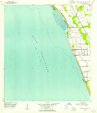
 1956 West Palm Beach1964 Print · USGSSouth Florida during the mid-fifties exhibits a fascinating balance between expanding coastal cities and the vast interior wetlands. Researchers can trace the development of inland settlements like Immokalee and Okeelanta or locate vanished landmarks like Chosen and Buckingham Cem.2 unique versions available
 - 1956 Map of Fort Pierce, 1965 Print
 1956 Fort Pierce1965 Print · USGSCentral and coastal Florida appear here during a period of rapid post-war growth and industrial expansion. Researchers can trace the mid-century rail-to-highway transition along the Sunshine State Parkway or locate old settlements like Ankona, Walton, and Indrio.4 unique versions available
Showing maps 1-25 of 171
Top cities of Okeechobee County
Frequently asked questions
- What are the different types of historical maps available for Okeechobee County?
- What is the oldest map of Okeechobee County?
- Where can I purchase historical maps of Okeechobee County for my home or office?
- Where can I download high-res historical maps of Okeechobee County?
- Are there historical topographic maps available for Okeechobee County?
- Is there historical aerial imagery available for Okeechobee County?
- Where are historical maps of Okeechobee County sourced from?