
1953 Map of Okeechobee 1 SW
USGS Topo · Published 1954About this map
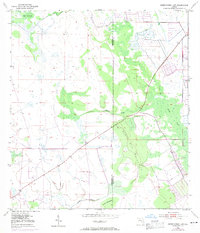
Nigger Jim Scrub dominates the central portion of this 1950s landscape, illustrating the scrubland and hammock terrain characteristic of the Florida interior. Water drainage patterns define the region, with Cypress Creek winding through the center and Nubbin Slough cutting across the southern sections near Jones Hammock. The presence of a Levee and private water management features in the northeast suggests early efforts to control the hydrological flow of the area.
Find a feature on this map
9 named features on this map. Tap any name to fly to it.
Don’t see what you’re looking for? This feature index may not catch every label — zoom into the map to look around manually.
Map Details
Editions of this 1953 Okeechobee 1 SW Map
4 editions found
Other maps of this area

1952 · Okeechobee
USGS Topo · 1:24,000

1953 · Okeechobee 1 SE
USGS Topo · 1:24,000

1953 · Okeechobee 4 NE
USGS Topo · 1:24,000

1953 · Okeechobee 4 NW
USGS Topo · 1:24,000

1953 · Taylor Creek SE
USGS Topo · 1:24,000

1953 · Taylor Creek NE
USGS Topo · 1:24,000

1953 · Okeechobee 1 NE
USGS Topo · 1:24,000

1953 · Okeechobee 1 NW
USGS Topo · 1:24,000

1956 · Fort Pierce
USGS Topo · 1:250,000

1958 · Fort Pierce
USGS Topo · 1:250,000