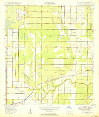
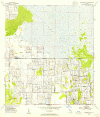
1953 Map of Okeechobee 1 NE
USGS Topo · Published 1955About this map
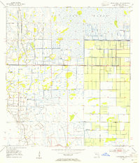
St Johns Marsh dominates the northern landscape of this portion of St. Lucie County, illustrating the massive hydrological engineering projects that shaped southern Florida in the early 1950s. The map captures a moment when the natural wetlands were being aggressively partitioned by an extensive network of drainage infrastructure, including a prominent Rim Ditch and numerous structures labeled Levee. These features delineate the transition of the marshland into organized agricultural or water-management blocks. Scattered throughout the western sections, several sites marked Flowing Well and Flowing Wells indicate the utilization of the artesian aquifer during this period of development. The rectilinear patterns of the ditches and levees stand in sharp contrast to the irregular pockets of water and marsh, recording the deliberate modification of the Florida interior.
Find a feature on this map
6 named features on this map. Tap any name to fly to it.
Don’t see what you’re looking for? This feature index may not catch every label — zoom into the map to look around manually.
Map Details
Editions of this 1953 Okeechobee 1 NE Map
3 editions found
Other maps of this area
1949 · Oslo
USGS Topo · 1:24,000

1949 · Fort Pierce NW
USGS Topo · 1:24,000
1950 · Fort Pierce NW
USGS Topo · 1:24,000
1950 · Oslo
USGS Topo · 1:24,000
1953 · Okeechobee 1 SE
USGS Topo · 1:24,000
1953 · Fellsmere 4 SE
USGS Topo · 1:24,000
1953 · Fellsmere 4 SW
USGS Topo · 1:24,000
1953 · Okeechobee 1 SW
USGS Topo · 1:24,000
1953 · Okeechobee 1 NW
USGS Topo · 1:24,000
1953 · Fort Pierce SW
USGS Topo · 1:24,000