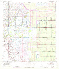
1953 Map of Okeechobee 1 NE
USGS Topo · Published 1971About this map
The St Johns Marsh dominates the northern expanse of this Florida landscape, where the waters of the upper St. Johns River basin meet a meticulously engineered agricultural grid. Revisions from 1970 illustrate the significant impact of modern transportation, most notably the path of Floridas Turnpike (Toll Road) slicing through the marshland. This transition from natural wetlands to managed land is marked by an extensive system of a Levee and drainage canals, essential for the citrus and cattle operations of St. Lucie County. Several instances of a Flowing Well are recorded across the quadrangle, indicating the reliance on artesian water sources in this low-lying region before more centralized water management was fully established. The interplay between the wild Marsh and the rigid survey lines of the Florida-St. Lucie county boundary reveals the mid-century effort to reclaim and define this subtropical terrain.
Find a feature on this map
6 named features on this map. Tap any name to fly to it.
Don’t see what you’re looking for? This feature index may not catch every label — zoom into the map to look around manually.
Map Details
Editions of this 1953 Okeechobee 1 NE Map
3 editions found
Other maps of this area

1949 · Oslo
USGS Topo · 1:24,000

1949 · Fort Pierce NW
USGS Topo · 1:24,000

1950 · Fort Pierce NW
USGS Topo · 1:24,000

1950 · Oslo
USGS Topo · 1:24,000

1953 · Okeechobee 1 SE
USGS Topo · 1:24,000

1953 · Fellsmere 4 SE
USGS Topo · 1:24,000

1953 · Fellsmere 4 SW
USGS Topo · 1:24,000

1953 · Okeechobee 1 SW
USGS Topo · 1:24,000

1953 · Okeechobee 1 NE
USGS Topo · 1:24,000

1953 · Okeechobee 1 NW
USGS Topo · 1:24,000