
1953 Map of Fellsmere 4 SE
USGS Topo · Published 1954About this map
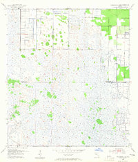
Johns Marsh dominates this mid-century landscape on the border of Indian River and St. Lucie counties. The map captures a moment of transition where the natural wetlands are being systematically reshaped by hydraulic engineering. A network of Spoil Banks and a prominent north-south Levee define the eastern edge of the swamp, indicating significant earth-moving projects to manage water and reclaim land. This grid-like intervention contrasts sharply with the irregular hammock-dotted interior of the marsh. Scattered throughout the eastern reaches are several instances of a Flowing Well, suggesting active groundwater utilization in an area otherwise characterized by its surface water management. This 1953 survey, compiled with assistance from the U. S. Corps of Engineers, provides a technical record of Florida's subtropical interior before extensive modern development.
Find a feature on this map
5 named features on this map. Tap any name to fly to it.
Don’t see what you’re looking for? This feature index may not catch every label — zoom into the map to look around manually.
Map Details
Editions of this 1953 Fellsmere 4 SE Map
5 editions found
Other maps of this area

1949 · Vero Beach
USGS Topo · 1:24,000

1949 · Oslo
USGS Topo · 1:24,000

1949 · Fort Pierce NW
USGS Topo · 1:24,000

1950 · Fort Pierce NW
USGS Topo · 1:24,000

1950 · Oslo
USGS Topo · 1:24,000

1950 · Vero Beach
USGS Topo · 1:24,000

1953 · Fellsmere 4 SW
USGS Topo · 1:24,000

1953 · Fellsmere 4 NW
USGS Topo · 1:24,000

1953 · Okeechobee 1 NE
USGS Topo · 1:24,000

1953 · Okeechobee 1 NW
USGS Topo · 1:24,000