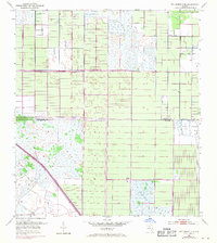
1953 Map of Fellsmere 4 SE
USGS Topo · Published 1971About this map
St Johns Marsh dominates this mid-century Florida landscape, revealing a transition from wetlands to structured water management. The terrain is defined by a dense grid of canals and drainage infrastructure, including numerous Spoil Banks and Levees that signify the engineering efforts to control the local hydrology. This 1953 survey, with revisions into the early 1970s, captures the arrival of modern transportation as Floridas State Turnpike cuts through the southwestern corner of the sheet. Along the boundary of Indian River Co and St Lucie Co, the map documents a sparse but changing interior, where isolated landmarks like a Flowing Well stand as markers of human activity in an otherwise marshy expanse. The pattern of development shown here reflects the large-scale reclamation projects characteristic of the Florida interior during this period.
Find a feature on this map
6 named features on this map. Tap any name to fly to it.
Don’t see what you’re looking for? This feature index may not catch every label — zoom into the map to look around manually.
Map Details
Editions of this 1953 Fellsmere 4 SE Map
5 editions found
Other maps of this area

1949 · Vero Beach
USGS Topo · 1:24,000

1949 · Oslo
USGS Topo · 1:24,000

1949 · Fort Pierce NW
USGS Topo · 1:24,000

1950 · Fort Pierce NW
USGS Topo · 1:24,000

1950 · Oslo
USGS Topo · 1:24,000

1950 · Vero Beach
USGS Topo · 1:24,000

1953 · Fellsmere 4 SE
USGS Topo · 1:24,000

1953 · Fellsmere 4 SW
USGS Topo · 1:24,000

1953 · Fellsmere 4 NW
USGS Topo · 1:24,000

1953 · Okeechobee 1 NE
USGS Topo · 1:24,000