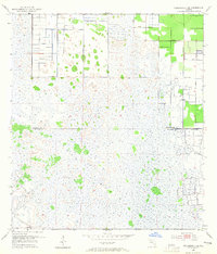
1953 Map of Fellsmere 4 SE
USGS Topo · Published 1965About this map
Johns Marsh dominates the interior of this Florida landscape, where the shifting hydrology of the early 1950s is meticulously documented by the U.S. Corps of Engineers. This specific quadrangle captures a massive drainage and water management effort along the Indian River and St. Lucie county line, defined by an extensive network of human-made infrastructure. The map illustrates the transition of the wetlands through a complex system of Levee structures and numerous Spoil Banks, which reflect the significant dredging and land reclamation projects of the era. Grounded in data from 1951 aerial photography, the sheet identifies isolated water resources such as the Flowing Wells that dot the otherwise marshy terrain, providing essential reference points for understanding the historical development of the Treasure Coast's interior water control systems.
Find a feature on this map
5 named features on this map. Tap any name to fly to it.
Don’t see what you’re looking for? This feature index may not catch every label — zoom into the map to look around manually.
Map Details
Editions of this 1953 Fellsmere 4 SE Map
5 editions found
Other maps of this area

1949 · Vero Beach
USGS Topo · 1:24,000

1949 · Oslo
USGS Topo · 1:24,000

1949 · Fort Pierce NW
USGS Topo · 1:24,000

1950 · Fort Pierce NW
USGS Topo · 1:24,000

1950 · Oslo
USGS Topo · 1:24,000

1950 · Vero Beach
USGS Topo · 1:24,000

1953 · Fellsmere 4 SE
USGS Topo · 1:24,000

1953 · Fellsmere 4 SW
USGS Topo · 1:24,000

1953 · Fellsmere 4 NW
USGS Topo · 1:24,000

1953 · Okeechobee 1 NE
USGS Topo · 1:24,000