
1953 Map of Okeechobee 4 NE
USGS Topo · Published 1954About this map
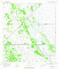
Allapattah Flats dominates this mid-century landscape on the border of St Lucie Co and Martin Co. The terrain is characterized by a series of wetlands and sloughs, including Myrtle Slough and Parker Branch, reflecting the region's natural drainage before extensive modern development. Small interior settlements and landmarks like Bluefield, Boar Hammock, and Myer Hammock offer specific points of interest for local historians studying early twentieth-century Florida habitation. The Florida East Coast railroad cuts a straight line across the marshy ground, serving as a primary corridor for transportation and growth. Man-made interventions are visible through a series of Levee and Spoil Bank features, alongside several identified Flowing Well locations, indicating early efforts to manage the water table for land use.
Find a feature on this map
14 named features on this map. Tap any name to fly to it.
Don’t see what you’re looking for? This feature index may not catch every label — zoom into the map to look around manually.
Map Details
Editions of this 1953 Okeechobee 4 NE Map
4 editions found
Other maps of this area

1953 · Okeechobee 4 SW
USGS Topo · 1:24,000

1953 · Okeechobee 4 SE
USGS Topo · 1:24,000

1953 · Okeechobee 1 SE
USGS Topo · 1:24,000

1953 · Okeechobee 4 NW
USGS Topo · 1:24,000

1953 · Okeechobee 1 SW
USGS Topo · 1:24,000

1953 · Indian Town NW
USGS Topo · 1:24,000

1953 · Fort Pierce SW
USGS Topo · 1:24,000

1953 · Indian Town
USGS Topo · 1:24,000

1956 · Fort Pierce
USGS Topo · 1:250,000

1958 · Fort Pierce
USGS Topo · 1:250,000