
1953 Map of Indian Town
USGS Topo · Published 1955About this map
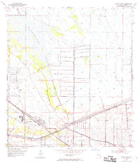
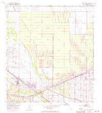
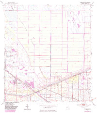
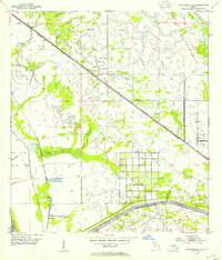
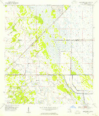
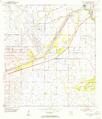
Indian Town serves as the focal point of this mid-century survey, situated at the intersection of critical inland infrastructure. The landscape is dominated by the Allapattah Flats, a sprawling expanse of wetlands and low-lying terrain north of the town site. The water management and transit systems that define this region of Florida are clearly visible, including the St Lucie Canal and the Okeechobee Waterway with its recorded project depth of 8 feet. These waterways, combined with numerous levees and spoil banks, reflect the extensive engineering efforts used to reclaim and navigate the marshy interior. Connectivity is provided by the Seaboard Air Line railroad and a small Landing Field, while scattered windmills suggest the agricultural reliance on groundwater across the flat, open reaches of Martin County.
Find a feature on this map
12 named features on this map. Tap any name to fly to it.
Don’t see what you’re looking for? This feature index may not catch every label — zoom into the map to look around manually.
Map Details
Editions of this 1953 Indian Town Map
4 editions found
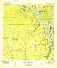
Other maps of this area

1948 · Palm City
USGS Topo · 1:24,000
1950 · Palm City
USGS Topo · 1:24,000
1953 · Okeechobee 4 SE
USGS Topo · 1:24,000
1953 · Okeechobee 4 NE
USGS Topo · 1:24,000
1953 · Indian Town SE
USGS Topo · 1:24,000

1953 · Indian Town NW
USGS Topo · 1:24,000

1956 · West Palm Beach
USGS Topo · 1:250,000

1956 · Fort Pierce
USGS Topo · 1:250,000

1957 · West Palm Beach
USGS Topo · 1:250,000

1958 · Fort Pierce
USGS Topo · 1:250,000